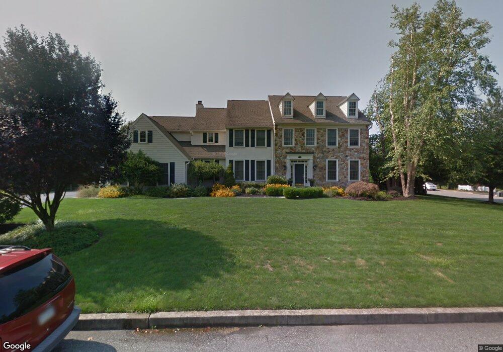
1310 Woodspring Ln Huntingdon Valley, PA 19006
Upper Moreland NeighborhoodEstimated Value: $1,000,000 - $1,583,000
4
Beds
5
Baths
3,666
Sq Ft
$358/Sq Ft
Est. Value
About This Home
This home is located at 1310 Woodspring Ln, Huntingdon Valley, PA 19006 and is currently estimated at $1,310,936, approximately $357 per square foot. 1310 Woodspring Ln is a home located in Montgomery County with nearby schools including Pine Road Elementary School, Murray Avenue School, and Lower Moreland High School.
Ownership History
Date
Name
Owned For
Owner Type
Purchase Details
Closed on
Mar 2, 2010
Sold by
Pinto Christopher J
Bought by
Pinto Christopher J and Pinto Kristen A
Current Estimated Value
Home Financials for this Owner
Home Financials are based on the most recent Mortgage that was taken out on this home.
Original Mortgage
$635,000
Outstanding Balance
$422,334
Interest Rate
5.05%
Estimated Equity
$888,602
Purchase Details
Closed on
Jan 31, 2005
Sold by
Not Provided
Bought by
Not Provided
Home Financials for this Owner
Home Financials are based on the most recent Mortgage that was taken out on this home.
Original Mortgage
$675,000
Interest Rate
5.37%
Mortgage Type
New Conventional
Purchase Details
Closed on
Feb 9, 1999
Sold by
Stonegate Realty Associates Lp
Bought by
Smith Marc and Smith Karen
Create a Home Valuation Report for This Property
The Home Valuation Report is an in-depth analysis detailing your home's value as well as a comparison with similar homes in the area
Home Values in the Area
Average Home Value in this Area
Purchase History
| Date | Buyer | Sale Price | Title Company |
|---|---|---|---|
| Pinto Christopher J | -- | None Available | |
| Not Provided | $1,010,000 | -- | |
| Smith Marc | $501,139 | -- |
Source: Public Records
Mortgage History
| Date | Status | Borrower | Loan Amount |
|---|---|---|---|
| Open | Pinto Christopher J | $635,000 | |
| Closed | Not Provided | $675,000 |
Source: Public Records
Tax History Compared to Growth
Tax History
| Year | Tax Paid | Tax Assessment Tax Assessment Total Assessment is a certain percentage of the fair market value that is determined by local assessors to be the total taxable value of land and additions on the property. | Land | Improvement |
|---|---|---|---|---|
| 2025 | $23,790 | $471,200 | -- | -- |
| 2024 | $23,790 | $471,200 | -- | -- |
| 2023 | $22,736 | $471,200 | $0 | $0 |
| 2022 | $22,068 | $471,200 | $0 | $0 |
| 2021 | $21,615 | $471,200 | $0 | $0 |
| 2020 | $20,973 | $471,200 | $0 | $0 |
| 2019 | $20,659 | $471,200 | $0 | $0 |
| 2018 | $4,074 | $471,200 | $0 | $0 |
| 2017 | $19,484 | $471,200 | $0 | $0 |
| 2016 | $19,300 | $471,200 | $0 | $0 |
| 2015 | $18,132 | $471,200 | $0 | $0 |
| 2014 | $18,132 | $471,200 | $0 | $0 |
Source: Public Records
Map
Nearby Homes
- 3370 Paper Mill Rd
- 1427 Byberry Rd
- 1439 Byberry Rd
- 3505 Heaton Rd
- 1018 Corn Crib Dr
- 3617 Sipler Ln
- 3541 Reading Way
- 985 Milkweed Ln
- 1291 Mettler Rd
- 3843 Loop Rd
- 3750 Wheatsheaf Rd
- 1790 Cathedral Rd
- 1035 Wright Dr
- 3567 Oriole Dr
- 2560 Fetters Mill Rd
- 2015 Butternut Dr
- 1625 Terwood Rd
- 1715 Terwood Rd
- 2070 Huntingdon Rd
- 3945 Blue Bird Rd Unit 71
- 1300 Woodspring Ln
- 3257 Stonegate Dr
- 3248 Stonegate Dr
- 3264 Paper Mill Rd
- 3260 Stonegate Dr
- 3229 Paper Mill Rd
- 3237 Paper Mill Rd
- 3269 Stonegate Dr
- 3245 Paper Mill Rd
- 3272 Stonegate Dr
- 3280 Paper Mill Rd
- 3271 Paper Mill Rd
- 3312 Paper Mill Rd
- 3309 Paper Mill Rd
- 1338 Saddlebrook Ln
- 3199 Paper Mill Rd
- 3325 Paper Mill Rd
- 3328 Paper Mill Rd
- 3175 Paper Mill Rd
- 3332 Paper Mill Rd