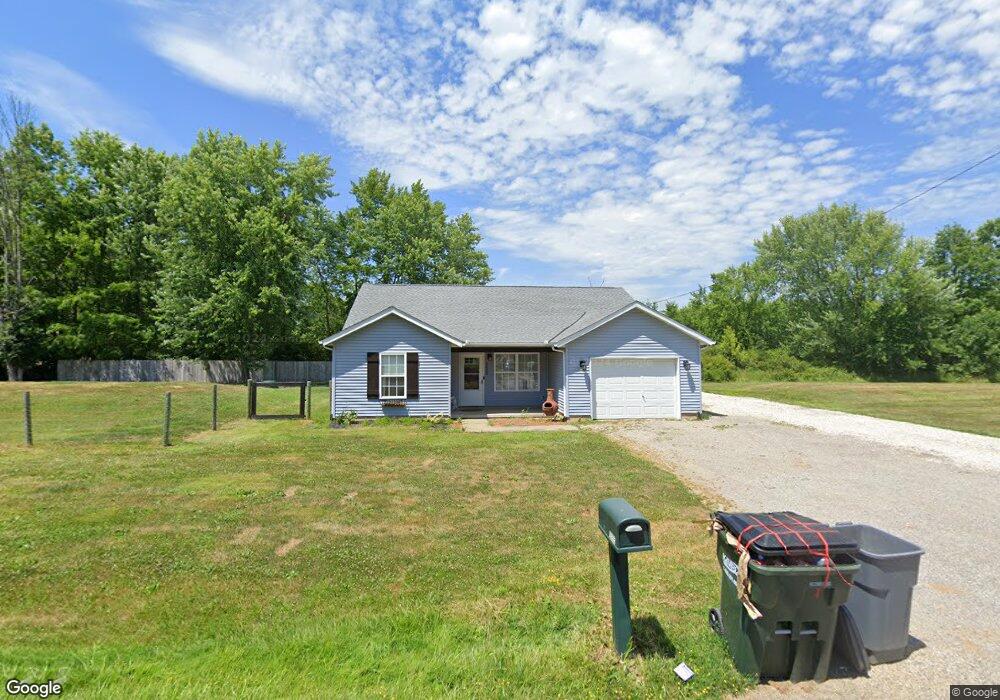
13100 Union Ave NE Alliance, OH 44601
Estimated Value: $68,000 - $247,000
3
Beds
1
Bath
872
Sq Ft
$151/Sq Ft
Est. Value
About This Home
This home is located at 13100 Union Ave NE, Alliance, OH 44601 and is currently estimated at $131,915, approximately $151 per square foot. 13100 Union Ave NE is a home located in Stark County with nearby schools including Marlington High School and Regina Coeli/St Joseph School.
Ownership History
Date
Name
Owned For
Owner Type
Purchase Details
Closed on
Aug 17, 1998
Sold by
Holsopple Kevin R
Bought by
Anderson Shawn D
Current Estimated Value
Home Financials for this Owner
Home Financials are based on the most recent Mortgage that was taken out on this home.
Original Mortgage
$43,200
Outstanding Balance
$9,130
Interest Rate
7.07%
Mortgage Type
New Conventional
Estimated Equity
$122,785
Purchase Details
Closed on
Mar 23, 1990
Create a Home Valuation Report for This Property
The Home Valuation Report is an in-depth analysis detailing your home's value as well as a comparison with similar homes in the area
Home Values in the Area
Average Home Value in this Area
Purchase History
| Date | Buyer | Sale Price | Title Company |
|---|---|---|---|
| Anderson Shawn D | $48,000 | -- | |
| -- | $40,900 | -- |
Source: Public Records
Mortgage History
| Date | Status | Borrower | Loan Amount |
|---|---|---|---|
| Open | Anderson Shawn D | $43,200 |
Source: Public Records
Tax History Compared to Growth
Tax History
| Year | Tax Paid | Tax Assessment Tax Assessment Total Assessment is a certain percentage of the fair market value that is determined by local assessors to be the total taxable value of land and additions on the property. | Land | Improvement |
|---|---|---|---|---|
| 2025 | -- | $33,010 | $14,980 | $18,030 |
| 2024 | -- | $33,010 | $14,980 | $18,030 |
| 2023 | $979 | $26,390 | $11,620 | $14,770 |
| 2022 | $935 | $26,390 | $11,620 | $14,770 |
| 2021 | $938 | $26,390 | $11,620 | $14,770 |
| 2020 | $908 | $22,750 | $10,010 | $12,740 |
| 2019 | $901 | $22,770 | $10,020 | $12,750 |
| 2018 | $904 | $22,770 | $10,020 | $12,750 |
| 2017 | $784 | $18,490 | $7,180 | $11,310 |
| 2016 | $784 | $18,490 | $7,180 | $11,310 |
| 2015 | $746 | $18,490 | $7,180 | $11,310 |
| 2014 | $771 | $17,440 | $6,970 | $10,470 |
| 2013 | $383 | $17,440 | $6,970 | $10,470 |
Source: Public Records
Map
Nearby Homes
- 0 Knoll St NE
- 15520 Coalbank St NE
- 15789 Coalbank St NE
- 14723 Bolton St NE
- 15995 Elbrook St NE
- 14422 Sturbridge Rd NE
- 11344 Walnut Ave NE
- 15832 Waverly St NE
- 0 Johnson Ave NE Unit 5142926
- 0 Homestead Ave NE
- 11310 Webb Ave NE
- 0 Klinger Ave NE
- 0 Meadowbrook Ave
- 124 E Wayne St
- 652 N Webb Ave
- 710 N Freedom Ave
- 505 N Union Ave
- 608 N Freedom Ave
- 000 Klinger Ave
- 11480 Aebi Ave NE
- 15355 Knoll St NE
- 15394 Knoll St NE
- 13090 Union Ave NE
- 13180 Lexington Ave NE
- 15407 Knoll St NE
- 15432 Knoll St NE
- 13222 Lexington Ave NE
- 13058 Union Ave NE
- 13220 Lexington Ave NE
- 13220 Lexington Ave NE
- 15232 Greenbower St NE
- 13221 Lexington Ave NE
- 15470 Knoll St NE
- 15211 Greenbower St NE
- 13053 Union Ave NE
- 13020 Union Ave NE
- 13131 Lexington Ave NE
- 12990 Union Ave NE
- 13051 Union Ave NE
- 15056 Greenbower St NE