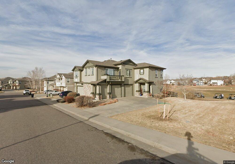
13102 Grant Cir N Unit A Thornton, CO 80241
Estimated Value: $405,000 - $439,000
2
Beds
3
Baths
1,328
Sq Ft
$319/Sq Ft
Est. Value
About This Home
This home is located at 13102 Grant Cir N Unit A, Thornton, CO 80241 and is currently estimated at $423,472, approximately $318 per square foot. 13102 Grant Cir N Unit A is a home located in Adams County with nearby schools including Hunters Glen Elementary School, Century Middle School, and Mountain Range High School.
Ownership History
Date
Name
Owned For
Owner Type
Purchase Details
Closed on
Jul 23, 2019
Sold by
Jackson Larry D
Bought by
Harmon Catherine
Current Estimated Value
Purchase Details
Closed on
Sep 16, 2013
Sold by
Nelson Stephen C
Bought by
Jackson Larry D
Home Financials for this Owner
Home Financials are based on the most recent Mortgage that was taken out on this home.
Original Mortgage
$129,500
Interest Rate
4.41%
Mortgage Type
New Conventional
Purchase Details
Closed on
Jun 26, 2013
Sold by
Kornbau J Ryan
Bought by
Nelson Stephen C
Purchase Details
Closed on
Mar 31, 2006
Sold by
D R Horton Inc
Bought by
Kornbau J Ryan
Home Financials for this Owner
Home Financials are based on the most recent Mortgage that was taken out on this home.
Original Mortgage
$163,462
Interest Rate
6.37%
Mortgage Type
New Conventional
Create a Home Valuation Report for This Property
The Home Valuation Report is an in-depth analysis detailing your home's value as well as a comparison with similar homes in the area
Home Values in the Area
Average Home Value in this Area
Purchase History
| Date | Buyer | Sale Price | Title Company |
|---|---|---|---|
| Harmon Catherine | $320,000 | Wfg National Title | |
| Jackson Larry D | $185,000 | None Available | |
| Nelson Stephen C | -- | None Available | |
| Kornbau J Ryan | $204,328 | Land Title Guarantee Company |
Source: Public Records
Mortgage History
| Date | Status | Borrower | Loan Amount |
|---|---|---|---|
| Previous Owner | Jackson Larry D | $129,500 | |
| Previous Owner | Kornbau J Ryan | $163,462 |
Source: Public Records
Tax History Compared to Growth
Tax History
| Year | Tax Paid | Tax Assessment Tax Assessment Total Assessment is a certain percentage of the fair market value that is determined by local assessors to be the total taxable value of land and additions on the property. | Land | Improvement |
|---|---|---|---|---|
| 2024 | $2,885 | $28,940 | $6,500 | $22,440 |
| 2023 | $2,855 | $31,600 | $5,720 | $25,880 |
| 2022 | $2,524 | $22,910 | $5,510 | $17,400 |
| 2021 | $2,608 | $22,910 | $5,510 | $17,400 |
| 2020 | $2,422 | $21,710 | $5,670 | $16,040 |
| 2019 | $2,427 | $21,710 | $5,670 | $16,040 |
| 2018 | $2,094 | $18,200 | $1,510 | $16,690 |
| 2017 | $1,904 | $18,200 | $1,510 | $16,690 |
| 2016 | $1,489 | $13,860 | $1,670 | $12,190 |
| 2015 | $1,487 | $13,860 | $1,670 | $12,190 |
| 2014 | -- | $12,970 | $1,670 | $11,300 |
Source: Public Records
Map
Nearby Homes
- 13141 Grant Cir N Unit B
- 13151 Grant Cir N Unit B
- 13151 Grant Cir N Unit C
- 13043 Grant Cir E Unit C
- 12962 Grant Cir E Unit C
- 12921 Grant Cir W Unit B
- 12910 Grant Cir W Unit C
- 12901 Grant Cir W Unit C
- 634 E 130th Way
- 609 W 130th Ave
- 13283 Clarkson St
- 0 128th & Washington St
- 943 E 130th Dr
- 12901 Galapago St
- 1089 E 131st Dr
- 1124 E 130th Ave Unit C
- 811 W 128th Place
- 860 W 132nd Ave Unit 85
- 860 W 132nd Ave Unit 44
- 860 W 132nd Ave Unit 105
- 13102 Grant Cir N Unit C
- 13102 Grant Cir N Unit B
- 13102 Grant Cir N
- 13102 Grant Cir N Unit 20A
- 13102 Grant Cir N Unit 20C
- 13112 Grant Cir N Unit C
- 13112 Grant Cir N Unit B
- 13112 Grant Cir N Unit A
- 13112 Grant Cir N
- 13112 Grant Cir N Unit 21A
- 13092 Grant Cir N
- 13092 Grant Cir N Unit 87B
- 13092 Grant Cir N Unit B
- 13101 Grant Cir N Unit C
- 13101 Grant Cir N Unit B
- 13101 Grant Cir N Unit A
- 13101 Grant Cir N
- 13101 Grant Cir N Unit C
- 13121 Grant Cir N Unit C
- 13121 Grant Cir N Unit B