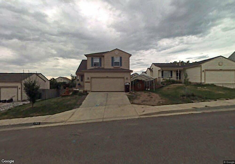
1311 Ancestra Dr Fountain, CO 80817
North Fountain Valley NeighborhoodEstimated Value: $386,000 - $418,000
4
Beds
4
Baths
1,398
Sq Ft
$284/Sq Ft
Est. Value
About This Home
This home is located at 1311 Ancestra Dr, Fountain, CO 80817 and is currently estimated at $397,606, approximately $284 per square foot. 1311 Ancestra Dr is a home located in El Paso County with nearby schools including Mesa Elementary School, Fountain Middle School, and Fountain-Fort Carson High School.
Ownership History
Date
Name
Owned For
Owner Type
Purchase Details
Closed on
May 1, 2020
Sold by
Rough Dale M and Rough Marina M
Bought by
Rough Dale M and Rough Marina M
Current Estimated Value
Home Financials for this Owner
Home Financials are based on the most recent Mortgage that was taken out on this home.
Original Mortgage
$269,175
Outstanding Balance
$239,415
Interest Rate
3.5%
Mortgage Type
VA
Estimated Equity
$158,191
Purchase Details
Closed on
Apr 9, 2003
Sold by
Harmony Homes Inc
Bought by
Rough Dale M and Rough Marina M
Home Financials for this Owner
Home Financials are based on the most recent Mortgage that was taken out on this home.
Original Mortgage
$179,769
Interest Rate
5.71%
Mortgage Type
VA
Create a Home Valuation Report for This Property
The Home Valuation Report is an in-depth analysis detailing your home's value as well as a comparison with similar homes in the area
Home Values in the Area
Average Home Value in this Area
Purchase History
| Date | Buyer | Sale Price | Title Company |
|---|---|---|---|
| Rough Dale M | -- | None Available | |
| Rough Dale M | $176,245 | Security Title |
Source: Public Records
Mortgage History
| Date | Status | Borrower | Loan Amount |
|---|---|---|---|
| Open | Rough Dale M | $269,175 | |
| Closed | Rough Dale M | $179,769 |
Source: Public Records
Tax History Compared to Growth
Tax History
| Year | Tax Paid | Tax Assessment Tax Assessment Total Assessment is a certain percentage of the fair market value that is determined by local assessors to be the total taxable value of land and additions on the property. | Land | Improvement |
|---|---|---|---|---|
| 2025 | $1,148 | $29,570 | -- | -- |
| 2024 | $1,042 | $21,970 | $4,340 | $17,630 |
| 2022 | $1,286 | $20,330 | $3,430 | $16,900 |
| 2021 | $1,205 | $20,910 | $3,530 | $17,380 |
| 2020 | $971 | $16,530 | $3,090 | $13,440 |
| 2019 | $954 | $16,530 | $3,090 | $13,440 |
| 2018 | $827 | $13,870 | $3,110 | $10,760 |
| 2017 | $818 | $13,870 | $3,110 | $10,760 |
| 2016 | $805 | $13,640 | $3,220 | $10,420 |
| 2015 | $806 | $13,640 | $3,220 | $10,420 |
| 2014 | $741 | $12,600 | $3,220 | $9,380 |
Source: Public Records
Map
Nearby Homes
- 960 Lords Hill Dr
- 1255 Ancestra Dr
- 1153 Cailin Way
- 7275 Josh Byers Way
- 2124 Bent Tree Ln
- 739 Memory Ln
- 2031 Hibbard Ln
- 830 Winebrook Way
- 7307 Glenburn Dr
- 803 Ridgebury Place
- 7275 Bentwater Dr
- 654 High Tea Ct
- 7015 Reunion Cir
- 7081 Ancestra Dr
- 7069 Reunion Cir
- 8342 Silver Glen Dr
- 9223 Waters Edge Dr
- 8170 Snow Bowl Heights
- 6969 Ancestra Dr
- 2023 Calle Corona
- 1303 Ancestra Dr
- 1319 Ancestra Dr
- 1295 Ancestra Dr
- 1327 Ancestra Dr
- 1287 Ancestra Dr
- 1335 Ancestra Dr
- 984 White Stone Way
- 996 White Stone Way
- 972 White Stone Way
- 1320 Ancestra Dr
- 1008 White Stone Way
- 1328 Ancestra Dr
- 1312 Ancestra Dr
- 960 White Stone Way
- 1279 Ancestra Dr
- 1020 White Stone Way
- 1336 Ancestra Dr
- 1343 Ancestra Dr
- 948 White Stone Way
- 1032 White Stone Way