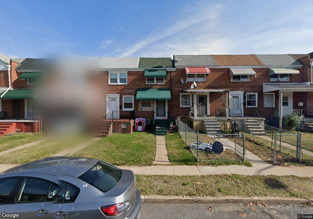
1311 Broening Hwy Baltimore, MD 21224
O'Donnell Heights NeighborhoodEstimated Value: $122,000 - $152,717
--
Bed
1
Bath
840
Sq Ft
$164/Sq Ft
Est. Value
About This Home
This home is located at 1311 Broening Hwy, Baltimore, MD 21224 and is currently estimated at $137,359, approximately $163 per square foot. 1311 Broening Hwy is a home located in Baltimore City with nearby schools including Graceland Park-O'Donnell Heights Elementary/Middle School, Booker T. Washington Middle School, and Patterson High School.
Ownership History
Date
Name
Owned For
Owner Type
Purchase Details
Closed on
Jun 9, 2006
Sold by
Secretary Of Housing & Urban
Bought by
Portillo Santos Moises
Current Estimated Value
Home Financials for this Owner
Home Financials are based on the most recent Mortgage that was taken out on this home.
Original Mortgage
$85,302
Outstanding Balance
$50,291
Interest Rate
6.62%
Mortgage Type
Purchase Money Mortgage
Estimated Equity
$87,068
Purchase Details
Closed on
Feb 8, 2006
Sold by
Yokum James J
Bought by
Secretary Of Housing & Urban and Development
Purchase Details
Closed on
Sep 29, 1999
Sold by
Gunpowder Manor Properties Llc
Bought by
Yokum James J
Purchase Details
Closed on
Jul 16, 1999
Sold by
Schiaffino George
Bought by
Gunpowder Manor Properties Llc
Purchase Details
Closed on
Jun 1, 1999
Sold by
Martin August Wf
Bought by
Schiaffino George
Create a Home Valuation Report for This Property
The Home Valuation Report is an in-depth analysis detailing your home's value as well as a comparison with similar homes in the area
Home Values in the Area
Average Home Value in this Area
Purchase History
| Date | Buyer | Sale Price | Title Company |
|---|---|---|---|
| Portillo Santos Moises | $81,000 | -- | |
| Secretary Of Housing & Urban | $63,753 | -- | |
| Yokum James J | $52,000 | -- | |
| Gunpowder Manor Properties Llc | $35,000 | -- | |
| Schiaffino George | $31,000 | -- |
Source: Public Records
Mortgage History
| Date | Status | Borrower | Loan Amount |
|---|---|---|---|
| Open | Portillo Santos Moises | $85,302 |
Source: Public Records
Tax History Compared to Growth
Tax History
| Year | Tax Paid | Tax Assessment Tax Assessment Total Assessment is a certain percentage of the fair market value that is determined by local assessors to be the total taxable value of land and additions on the property. | Land | Improvement |
|---|---|---|---|---|
| 2025 | $2,308 | $104,400 | $15,000 | $89,400 |
| 2024 | $2,308 | $98,267 | $0 | $0 |
| 2023 | $2,174 | $92,133 | $0 | $0 |
| 2022 | $2,030 | $86,000 | $15,000 | $71,000 |
| 2021 | $1,935 | $82,000 | $0 | $0 |
| 2020 | $1,640 | $78,000 | $0 | $0 |
| 2019 | $1,571 | $74,000 | $15,000 | $59,000 |
| 2018 | $1,599 | $74,000 | $15,000 | $59,000 |
| 2017 | $1,618 | $74,000 | $0 | $0 |
| 2016 | $1,429 | $82,700 | $0 | $0 |
| 2015 | $1,429 | $81,700 | $0 | $0 |
| 2014 | $1,429 | $80,700 | $0 | $0 |
Source: Public Records
Map
Nearby Homes
- 6109 Bessemer Ave
- 1600 Charlotte Ave
- 6424 Bushey St
- 6302 Brown Ave
- 6321 Brown Ave
- 6609 Bushey St
- 6705 Gary Ave
- 724 Umbra St
- 6707 1/2 Gary Ave
- 6714 Boston Ave
- 6620 Bushey St
- 6700 Hudson St
- 5905 O Donnell St
- 705 Tolna St
- 6728 Boston Ave
- 6628 Hartwait St
- 466 Hornel St
- 464 Hornel St
- 625 Savage St
- 714 Rappolla St
- 1313 Broening Hwy
- 1309 Broening Hwy
- 1315 Broening Hwy
- 1307 Broening Hwy
- 1305 Broening Hwy
- 1317 Broening Hwy
- 1303 Broening Hwy
- 1319 Broening Hwy
- 1301 Broening Hwy
- 1321 Broening Hwy
- 1251 Broening Hwy
- 1323 Broening Hwy
- 1249 Broening Hwy
- 1325 Broening Hwy
- 1247 Broening Hwy
- 1327 Broening Hwy
- 1245 Broening Hwy
- 1329 Broening Hwy
- 1312 Broening Hwy
- 1314 Broening Hwy