Estimated Value: $121,994 - $155,000
3
Beds
2
Baths
1,200
Sq Ft
$116/Sq Ft
Est. Value
About This Home
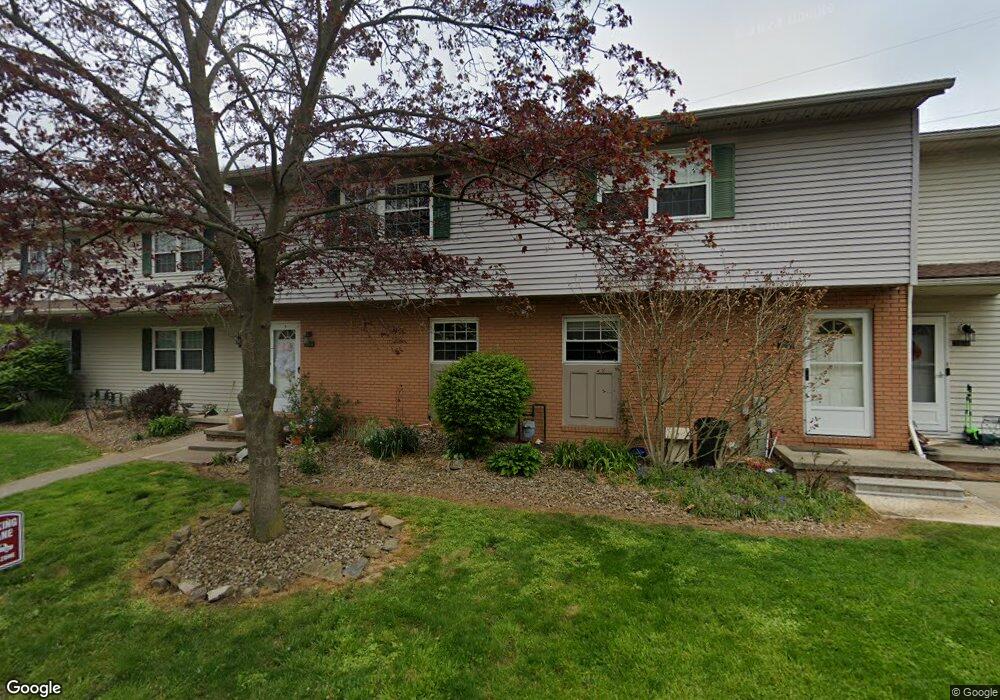
This home is located at 1311 Cedarwood Dr Unit 53D, Kent, OH 44240 and is currently estimated at $139,499, approximately $116 per square foot. 1311 Cedarwood Dr Unit 53D is a home located in Portage County with nearby schools including Brimfield Elementary School, Field Middle School, and Field High School.
Ownership History
Date
Name
Owned For
Owner Type
Purchase Details
Closed on
Oct 6, 2005
Sold by
Kimmell Daniel O
Bought by
Floyd Anthony D
Current Estimated Value
Home Financials for this Owner
Home Financials are based on the most recent Mortgage that was taken out on this home.
Original Mortgage
$81,700
Outstanding Balance
$44,060
Interest Rate
5.88%
Mortgage Type
Fannie Mae Freddie Mac
Estimated Equity
$95,439
Purchase Details
Closed on
Dec 26, 1996
Sold by
Smith Lorene M
Bought by
Kimmell Daniel O
Home Financials for this Owner
Home Financials are based on the most recent Mortgage that was taken out on this home.
Original Mortgage
$55,700
Interest Rate
7.64%
Mortgage Type
FHA
Create a Home Valuation Report for This Property
The Home Valuation Report is an in-depth analysis detailing your home's value as well as a comparison with similar homes in the area
Home Values in the Area
Average Home Value in this Area
Purchase History
| Date | Buyer | Sale Price | Title Company |
|---|---|---|---|
| Floyd Anthony D | $86,000 | Bond & Associates Title Agen | |
| Kimmell Daniel O | $57,000 | -- |
Source: Public Records
Mortgage History
| Date | Status | Borrower | Loan Amount |
|---|---|---|---|
| Open | Floyd Anthony D | $81,700 | |
| Previous Owner | Kimmell Daniel O | $55,700 |
Source: Public Records
Tax History Compared to Growth
Tax History
| Year | Tax Paid | Tax Assessment Tax Assessment Total Assessment is a certain percentage of the fair market value that is determined by local assessors to be the total taxable value of land and additions on the property. | Land | Improvement |
|---|---|---|---|---|
| 2024 | $2,341 | $36,020 | $3,500 | $32,520 |
| 2023 | $2,073 | $24,650 | $2,630 | $22,020 |
| 2022 | $1,936 | $24,650 | $2,630 | $22,020 |
| 2021 | $1,464 | $24,650 | $2,630 | $22,020 |
| 2020 | $1,872 | $20,520 | $2,630 | $17,890 |
| 2019 | $1,465 | $20,520 | $2,630 | $17,890 |
| 2018 | $978 | $18,060 | $3,500 | $14,560 |
| 2017 | $978 | $18,060 | $3,500 | $14,560 |
| 2016 | $1,250 | $18,060 | $3,500 | $14,560 |
| 2015 | $1,105 | $18,060 | $3,500 | $14,560 |
| 2014 | $1,676 | $22,160 | $3,500 | $18,660 |
| 2013 | $1,384 | $22,160 | $3,500 | $18,660 |
Source: Public Records
Map
Nearby Homes
- 1354 Brimfield Dr
- 4682 State Route 43
- 847 Lakeview Ct
- Poplar Plan at Woodland Reserve
- Nassau Cove Plan at Woodland Reserve
- V/L Sherman Rd
- 4891 Edson Rd
- 4649 Creekside Dr Unit 4649
- 1755 Honeychuck Ln
- 3946 Mctaggart Blvd
- 1088 Irish Rd
- 4088 Lynwood Dr
- 0 Meloy Rd Unit 5162435
- 1523 Queenstown Rd
- 1224 Cedar Ridge Rd
- 1236 Cedar Ridge Rd
- 1418 Arcadia Rd
- 2092 Sugar Maple Dr
- 3793 Ranfield Rd
- 3868 Willow Way
- 1313 Cedarwood Dr Unit 52E
- 1315 Cedarwood Dr Unit 51E
- 1317 Cedarwood Dr
- 1309 Cedarwood Dr Unit 54D
- 1307 Cedarwood Dr
- 1319 Cedarwood Dr
- 1321 Cedarwood Dr Unit 48E
- 1316 Cedarwood Dr Unit 62E
- 1318 Cedarwood Dr Unit 61E
- 1320 Cedarwood Dr Unit 60D
- 1327 Cedarwood Dr
- 1327 Cedarwood Dr Unit 46D
- 1322 Cedarwood Dr
- 1322 Cedarwood Dr Unit 59-D
- 1324 Cedarwood Dr
- 1303 Cedarwood Dr
- 1329 Cedarwood Dr
- 1329 Cedarwood Dr Unit 45D
- 1326 Cedarwood Dr Unit 57E
- 1335 Cedarwood Dr Unit 42E