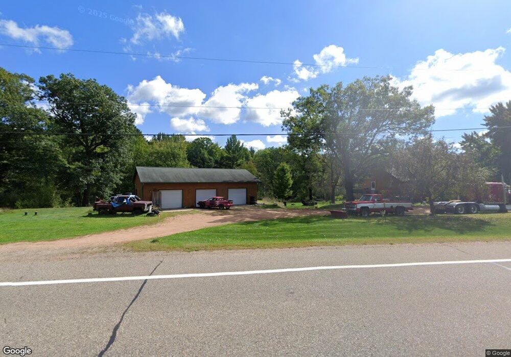
1311 Highway 66 W Stevens Point, WI 54481
Estimated Value: $310,465 - $389,000
--
Bed
--
Bath
--
Sq Ft
2.21
Acres
About This Home
This home is located at 1311 Highway 66 W, Stevens Point, WI 54481 and is currently estimated at $345,866. 1311 Highway 66 W is a home located in Portage County with nearby schools including McKinley Center, Benjamin Franklin Junior High School, and Stevens Point Area Senior High School.
Ownership History
Date
Name
Owned For
Owner Type
Purchase Details
Closed on
May 26, 2023
Sold by
Reedy Jenny A and Reedy Ryan L
Bought by
Kvatek Anthony J
Current Estimated Value
Home Financials for this Owner
Home Financials are based on the most recent Mortgage that was taken out on this home.
Original Mortgage
$198,000
Outstanding Balance
$192,373
Interest Rate
6.27%
Mortgage Type
New Conventional
Estimated Equity
$153,493
Purchase Details
Closed on
Feb 4, 2022
Sold by
Reedy Jenny A and Chojnacki Jenny A
Bought by
Reedy Jenny A and Reedy Ryan L
Create a Home Valuation Report for This Property
The Home Valuation Report is an in-depth analysis detailing your home's value as well as a comparison with similar homes in the area
Home Values in the Area
Average Home Value in this Area
Purchase History
| Date | Buyer | Sale Price | Title Company |
|---|---|---|---|
| Kvatek Anthony J | $220,000 | Portage County Title | |
| Reedy Jenny A | -- | None Listed On Document |
Source: Public Records
Mortgage History
| Date | Status | Borrower | Loan Amount |
|---|---|---|---|
| Open | Kvatek Anthony J | $198,000 |
Source: Public Records
Tax History Compared to Growth
Tax History
| Year | Tax Paid | Tax Assessment Tax Assessment Total Assessment is a certain percentage of the fair market value that is determined by local assessors to be the total taxable value of land and additions on the property. | Land | Improvement |
|---|---|---|---|---|
| 2024 | $3,127 | $207,000 | $47,300 | $159,700 |
| 2023 | $2,992 | $207,000 | $47,300 | $159,700 |
| 2022 | $3,035 | $207,000 | $47,300 | $159,700 |
| 2021 | $2,873 | $207,000 | $47,300 | $159,700 |
| 2020 | $2,999 | $207,000 | $47,300 | $159,700 |
| 2019 | $3,070 | $207,000 | $47,300 | $159,700 |
| 2018 | $2,724 | $165,200 | $33,800 | $131,400 |
| 2017 | $2,603 | $165,200 | $33,800 | $131,400 |
| 2016 | $2,562 | $165,200 | $33,800 | $131,400 |
| 2015 | $2,687 | $165,200 | $33,800 | $131,400 |
| 2014 | $2,492 | $165,200 | $33,800 | $131,400 |
Source: Public Records
Map
Nearby Homes
- 2701 Blue Jay Ln
- 901 W Gates Dr
- 481 W Harding Ave
- 3340 Whiting Ave
- 1309 W Pearl St
- 2916 Blue Heron Ln
- 403 W River Dr Unit 409 West River Drive
- 3248 Whiting Ave
- 2500 Water St
- 2812 Water St
- 2101 Strongs Ave
- 1791 Strongs Ave
- 16 acres mol Ole River Rd
- 2316 Wyatt Ave
- 1941 Church St
- 2117 Wyatt Ave
- 1016 3rd St
- 5581 Forest St
- 1417 Rogers St
- 1532 Clark St
- 1327 Highway 66 W
- 1312 Highway 66 W
- 1319 Highway 66 W
- 1332 Highway 66 W
- 1336 Birchwood Ln
- 1346 Birchwood Ln
- 1330 Birchwood Ln
- 1347 Birchwood Ln
- Lot 2 Birchwood Ln
- 1323 Highway 66 W
- Lot 1 Birchwood Ln
- 1341 Highway 66 W
- 1295 Highway 66 W
- 1295 Highway 66 W
- 1287 Highway 66 W
- 1279 Highway 66 W
- 1279 Robin Ln
- 1306 Birchwood Ln
- 1195 Rocky Run Rd
- 1271 Highway 66 W