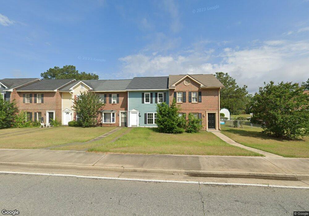
1311 Newton Rd Albany, GA 31701
Estimated Value: $80,000 - $98,867
3
Beds
2
Baths
1,240
Sq Ft
$70/Sq Ft
Est. Value
About This Home
This home is located at 1311 Newton Rd, Albany, GA 31701 and is currently estimated at $86,467, approximately $69 per square foot. 1311 Newton Rd is a home located in Dougherty County with nearby schools including Alice Coachman Elementary School, Southside Middle School, and Monroe High School.
Ownership History
Date
Name
Owned For
Owner Type
Purchase Details
Closed on
Mar 23, 2010
Sold by
Odom Michael D
Bought by
M I Properties Llc
Current Estimated Value
Purchase Details
Closed on
Dec 1, 2009
Sold by
Green Tracey M
Bought by
Citifinancial Services Inc
Purchase Details
Closed on
Sep 25, 2000
Sold by
City Of Albany
Bought by
Green Tracey M
Purchase Details
Closed on
Nov 16, 1993
Sold by
City Of Albany
Bought by
Green Tracey M
Purchase Details
Closed on
Jan 1, 1991
Bought by
City Of Albany
Create a Home Valuation Report for This Property
The Home Valuation Report is an in-depth analysis detailing your home's value as well as a comparison with similar homes in the area
Home Values in the Area
Average Home Value in this Area
Purchase History
| Date | Buyer | Sale Price | Title Company |
|---|---|---|---|
| M I Properties Llc | -- | -- | |
| Odom Michael D | $32,000 | -- | |
| Citifinancial Services Inc | $53,400 | -- | |
| Citifinancial Services Inc | $53,423 | -- | |
| Green Tracey M | -- | -- | |
| Green Tracey M | $42,200 | -- | |
| City Of Albany | -- | -- |
Source: Public Records
Tax History Compared to Growth
Tax History
| Year | Tax Paid | Tax Assessment Tax Assessment Total Assessment is a certain percentage of the fair market value that is determined by local assessors to be the total taxable value of land and additions on the property. | Land | Improvement |
|---|---|---|---|---|
| 2024 | $1,115 | $23,380 | $60 | $23,320 |
| 2023 | $1,089 | $23,380 | $60 | $23,320 |
| 2022 | $1,093 | $23,380 | $60 | $23,320 |
| 2021 | $1,014 | $23,380 | $60 | $23,320 |
| 2020 | $1,016 | $23,380 | $60 | $23,320 |
| 2019 | $1,020 | $23,380 | $60 | $23,320 |
| 2018 | $1,024 | $23,380 | $60 | $23,320 |
| 2017 | $954 | $23,380 | $60 | $23,320 |
| 2016 | $955 | $23,380 | $60 | $23,320 |
| 2015 | $957 | $23,380 | $60 | $23,320 |
| 2014 | $983 | $24,320 | $1,000 | $23,320 |
Source: Public Records
Map
Nearby Homes
- 404 Cedar Ave
- 604 Jefferies Ave
- 1505 Mcarthur St
- 512 Cherry Ave
- 612 Louis Ave
- 1627 Mcarthur St
- 807 Corn Ave
- 611 Albert Ct
- 903 Dorsett Ave
- 906 Holloway Ave
- 420 Cotton Ave
- 418 Cotton Ave
- 704 W Lincoln Ave
- 600 W Lincoln Ave
- 2504 S Madison St
- 1207 S Cleveland St
- 1407 S Cleveland St
- 417 Cotton Ave
- 635 Harmon Ave
- 415 Cotton Ave
- 1313 Newton Rd
- 1315 Newton Rd
- 1317 Newton Rd
- 1319 Newton Rd
- 1305 Newton Rd
- 1303 Newton Rd
- 625 Cedar Ave
- 1323 Hampton Ct
- 1325 Hampton Ct
- 1319 Hampton Ct
- 1317 Hampton Ct
- 1321 Hampton Ct
- 627 Cedar Ave
- 1315 Hampton Ct
- 1227 Newton Rd
- 1311 Hampton Ct
- 1225 Newton Rd
- 1307 Hampton Ct
- 1309 Hampton Ct
- 628 Cedar Ave