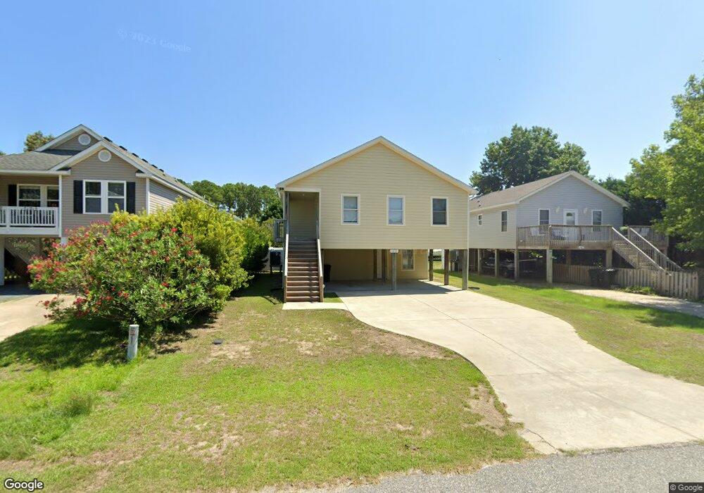
1311 Percy St Unit 10 Kill Devil Hills, NC 27948
Estimated Value: $520,000 - $570,000
3
Beds
2
Baths
1,787
Sq Ft
$305/Sq Ft
Est. Value
About This Home
This home is located at 1311 Percy St Unit 10, Kill Devil Hills, NC 27948 and is currently estimated at $545,176, approximately $305 per square foot. 1311 Percy St Unit 10 is a home located in Dare County with nearby schools including Nags Head Elementary School, Manteo Middle School, and Manteo High School.
Ownership History
Date
Name
Owned For
Owner Type
Purchase Details
Closed on
Apr 30, 2021
Sold by
Morrison Zachary L and Morrison Mary K
Bought by
Shaw David Franklin and Shaw Jessica Elaine
Current Estimated Value
Home Financials for this Owner
Home Financials are based on the most recent Mortgage that was taken out on this home.
Original Mortgage
$306,000
Outstanding Balance
$276,281
Interest Rate
3%
Mortgage Type
New Conventional
Estimated Equity
$268,895
Create a Home Valuation Report for This Property
The Home Valuation Report is an in-depth analysis detailing your home's value as well as a comparison with similar homes in the area
Home Values in the Area
Average Home Value in this Area
Purchase History
| Date | Buyer | Sale Price | Title Company |
|---|---|---|---|
| Shaw David Franklin | $340,000 | None Available |
Source: Public Records
Mortgage History
| Date | Status | Borrower | Loan Amount |
|---|---|---|---|
| Open | Shaw David Franklin | $306,000 |
Source: Public Records
Tax History
| Year | Tax Paid | Tax Assessment Tax Assessment Total Assessment is a certain percentage of the fair market value that is determined by local assessors to be the total taxable value of land and additions on the property. | Land | Improvement |
|---|---|---|---|---|
| 2025 | $3,104 | $571,500 | $140,700 | $430,800 |
| 2024 | $2,011 | $266,200 | $71,300 | $194,900 |
| 2023 | $2,011 | $266,200 | $71,300 | $194,900 |
| 2022 | $1,918 | $266,200 | $71,300 | $194,900 |
| 2021 | $1,918 | $266,200 | $71,300 | $194,900 |
| 2020 | $1,918 | $266,200 | $71,300 | $194,900 |
| 2019 | $1,695 | $194,800 | $57,800 | $137,000 |
| 2018 | $1,658 | $194,800 | $57,800 | $137,000 |
| 2017 | $1,658 | $194,800 | $57,800 | $137,000 |
| 2016 | $1,580 | $194,800 | $57,800 | $137,000 |
| 2014 | $1,521 | $194,800 | $57,800 | $137,000 |
Source: Public Records
Map
Nearby Homes
- 1308 Theodore St Unit 5
- 1306 Theodore St Unit Lot 4
- 1208 Swan St Unit 4
- 1208 Swan St Unit 2
- 1208 Swan St Unit 5
- 1208 Swan St Unit 1
- 1208 -2 Swan St Unit 2
- 1208 -1 Swan St Unit 1
- 0 W Martin St
- 205 W Atlantic St Unit Lot 3
- 0 10th Ave Unit Lot 2R 130569
- 809 9th Ave Unit 809-B
- 0 W Boundary St Unit Lot 1-R 130568
- 311 Gunas Dr Unit 17
- 311 Gunas Dr
- 302 W Clark St Unit Lot 6
- 1511 Wrightsville Blvd Unit Lot 64
- 900 Fox St
- 1209 Wrightsville Blvd Unit Lot 26
- 704 Swan St Unit 2
- 1311 Percy St
- 1313 Percy St
- 1309 Percy St
- 1307 Percy St
- 1310 Elizabeth St Unit 5
- 1310 Elizabeth St
- 1312 Elizabeth St Unit 6
- 1312 Elizabeth St
- 1312 Percy St
- 1306 Elizabeth St Unit 3
- 1306 Elizabeth St
- 1308 Elizabeth St
- 1305 Percy St Unit 7
- 1305 Percy St
- 1310 Percy St Unit 4
- 1310 Percy St
- 1308 Percy St Unit 3
- 1308 Percy St
- 707 Holly St
- 1304 Elizabeth St
Your Personal Tour Guide
Ask me questions while you tour the home.