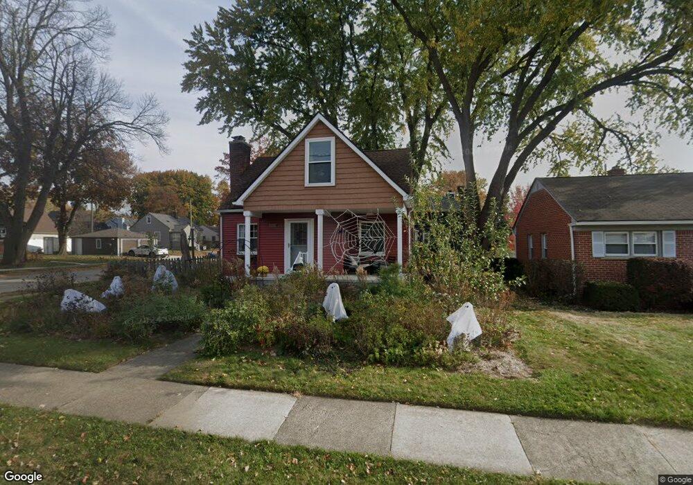
1311 S Harvey St Plymouth, MI 48170
Estimated Value: $427,000 - $553,000
3
Beds
2
Baths
1,090
Sq Ft
$425/Sq Ft
Est. Value
About This Home
This home is located at 1311 S Harvey St, Plymouth, MI 48170 and is currently estimated at $463,361, approximately $425 per square foot. 1311 S Harvey St is a home located in Wayne County with nearby schools including Canton High School, Smith Elementary School, and West Middle School.
Ownership History
Date
Name
Owned For
Owner Type
Purchase Details
Closed on
Sep 1, 2011
Sold by
Kuhns Matthew E and Kuhns Dianne J
Bought by
Guideau Nathan and Guideau Kate
Current Estimated Value
Purchase Details
Closed on
Aug 30, 2005
Sold by
Kuhns Matthew E and Kuhns Matthew
Bought by
Kuhns Matthew E and Kuhns Dianne J
Home Financials for this Owner
Home Financials are based on the most recent Mortgage that was taken out on this home.
Original Mortgage
$164,000
Interest Rate
6.01%
Mortgage Type
Fannie Mae Freddie Mac
Purchase Details
Closed on
Feb 8, 2002
Sold by
Hornbeck Veneta M
Bought by
Kuhns Mathew E
Create a Home Valuation Report for This Property
The Home Valuation Report is an in-depth analysis detailing your home's value as well as a comparison with similar homes in the area
Home Values in the Area
Average Home Value in this Area
Purchase History
| Date | Buyer | Sale Price | Title Company |
|---|---|---|---|
| Guideau Nathan | $182,000 | None Available | |
| Kuhns Matthew E | -- | First American Title Ins Co | |
| Kuhns Mathew E | $157,000 | -- |
Source: Public Records
Mortgage History
| Date | Status | Borrower | Loan Amount |
|---|---|---|---|
| Previous Owner | Kuhns Matthew E | $164,000 |
Source: Public Records
Tax History Compared to Growth
Tax History
| Year | Tax Paid | Tax Assessment Tax Assessment Total Assessment is a certain percentage of the fair market value that is determined by local assessors to be the total taxable value of land and additions on the property. | Land | Improvement |
|---|---|---|---|---|
| 2025 | $4,303 | $186,600 | $0 | $0 |
| 2024 | $4,303 | $172,000 | $0 | $0 |
| 2023 | $4,191 | $154,500 | $0 | $0 |
| 2022 | $4,015 | $143,700 | $0 | $0 |
| 2021 | $4,264 | $142,300 | $0 | $0 |
| 2020 | $4,294 | $138,700 | $0 | $0 |
| 2019 | $3,512 | $126,200 | $0 | $0 |
| 2018 | $3,411 | $122,500 | $0 | $0 |
| 2017 | $723 | $123,000 | $0 | $0 |
| 2016 | $3,716 | $117,800 | $0 | $0 |
| 2015 | $8,512 | $103,100 | $0 | $0 |
| 2013 | $8,246 | $87,150 | $0 | $0 |
| 2011 | -- | $79,120 | $0 | $0 |
Source: Public Records
Map
Nearby Homes
- 1338 S Harvey St
- 1078 Simpson St
- 844 Ross St
- 1125 Sutherland St
- 9405 Northern Ave
- 1199 S Sheldon Rd
- 9453 Brookline Ave
- 775 Deer Ct Unit 104
- 770 Deer St Unit 204
- 9264 Brookline Ave
- 9205 Rocker Ave
- 638 S Harvey St
- 44571 Clare Blvd
- 44736 Lynn Dr
- 44703 Erin Dr
- 44750 Erin Dr Unit 40
- 543 Deer St
- 9060 N Sheldon Rd
- 44872 Lynn Dr
- 44877 Erin Dr Unit 2
- 1337 S Harvey St
- 1293 S Harvey St
- 1273 S Harvey St
- 1312 S Harvey St
- 956 Simpson St
- 1294 S Harvey St
- 935 Simpson St
- 917 Simpson St
- 1364 S Harvey St
- 1257 S Harvey St
- 936 Simpson St
- 1282 S Harvey St
- 1386 S Harvey St
- 989 Ross St
- 1055 Simpson St
- 899 Simpson St
- 918 Simpson St
- 1258 S Harvey St
- 1056 Simpson St
- 912 Simpson St