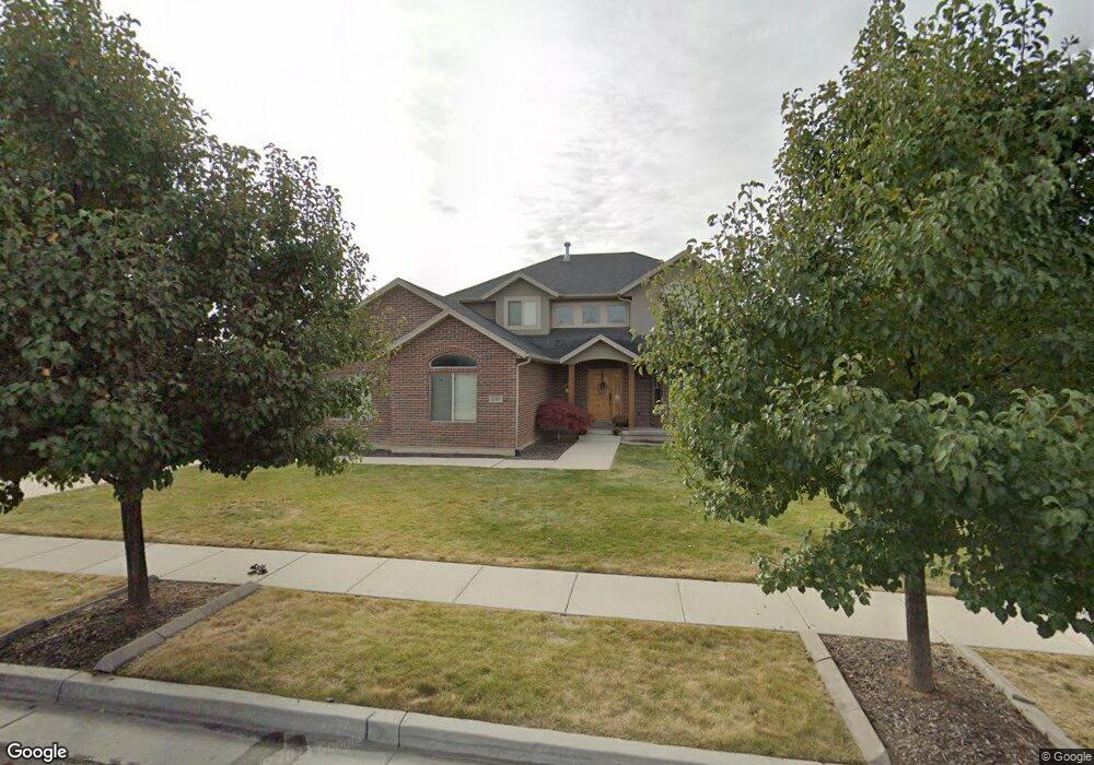
1311 W 1875 S Syracuse, UT 84075
Estimated Value: $595,000 - $683,000
4
Beds
3
Baths
2,252
Sq Ft
$278/Sq Ft
Est. Value
About This Home
This home is located at 1311 W 1875 S, Syracuse, UT 84075 and is currently estimated at $626,556, approximately $278 per square foot. 1311 W 1875 S is a home located in Davis County with nearby schools including Cook School, Legacy Junior High School, and Clearfield High School.
Ownership History
Date
Name
Owned For
Owner Type
Purchase Details
Closed on
May 28, 2008
Sold by
Miller Clint and Miller Amanda
Bought by
Miller Clinton G and Miller Amanda E
Current Estimated Value
Home Financials for this Owner
Home Financials are based on the most recent Mortgage that was taken out on this home.
Original Mortgage
$190,800
Outstanding Balance
$121,589
Interest Rate
6%
Mortgage Type
New Conventional
Estimated Equity
$504,967
Purchase Details
Closed on
Sep 7, 2005
Sold by
Boyer Antelope Run Lc
Bought by
Miller Clint and Miller Amanda
Create a Home Valuation Report for This Property
The Home Valuation Report is an in-depth analysis detailing your home's value as well as a comparison with similar homes in the area
Home Values in the Area
Average Home Value in this Area
Purchase History
| Date | Buyer | Sale Price | Title Company |
|---|---|---|---|
| Miller Clinton G | -- | Security Title | |
| Miller Clint | -- | Bonneville Title Company |
Source: Public Records
Mortgage History
| Date | Status | Borrower | Loan Amount |
|---|---|---|---|
| Open | Miller Clinton G | $190,800 |
Source: Public Records
Tax History Compared to Growth
Tax History
| Year | Tax Paid | Tax Assessment Tax Assessment Total Assessment is a certain percentage of the fair market value that is determined by local assessors to be the total taxable value of land and additions on the property. | Land | Improvement |
|---|---|---|---|---|
| 2025 | $3,369 | $325,050 | $122,286 | $202,764 |
| 2024 | $3,199 | $310,750 | $98,648 | $212,102 |
| 2023 | $3,091 | $547,000 | $137,595 | $409,405 |
| 2022 | $3,310 | $321,200 | $79,544 | $241,656 |
| 2021 | $2,856 | $429,000 | $117,268 | $311,732 |
| 2020 | $2,537 | $369,000 | $103,399 | $265,601 |
| 2019 | $2,480 | $356,000 | $99,547 | $256,453 |
| 2018 | $2,323 | $331,000 | $96,955 | $234,045 |
| 2016 | $2,038 | $152,295 | $37,270 | $115,025 |
| 2015 | $2,117 | $150,700 | $37,270 | $113,430 |
| 2014 | $1,902 | $137,911 | $37,270 | $100,641 |
| 2013 | -- | $117,893 | $38,775 | $79,118 |
Source: Public Records
Map
Nearby Homes
- 1876 S 1230 W
- 1153 W 1875 S
- 1154 W 1700 S
- 1142 W 2050 S
- 1148 W 2050 S
- 992 W 1910 S
- 1062 W 2050 S
- 1079 W 2050 S
- 1622 S 1000 W
- 929 W 1920 S Unit A
- 1481 S Melanie Ln
- 891 W 1840 S Unit A
- 891 W 1920 S Unit C
- Stetson Plan at Wilcox Farms
- Caldwell Plan at Wilcox Farms
- 877 W 1920 S Unit C
- 1384 S Melanie Ln
- Everglade Plan at Wilcox Farms
- Echo Plan at Wilcox Farms
- Granite Plan at Wilcox Farms