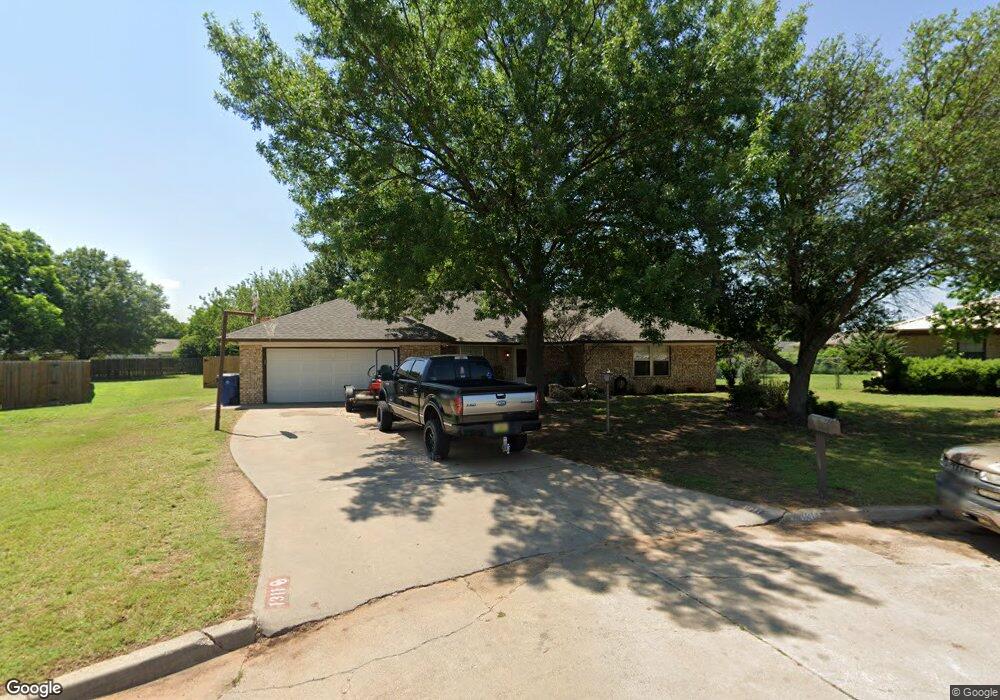
1311 Whisenant Ct Duncan, OK 73533
Estimated Value: $152,000 - $200,000
3
Beds
2
Baths
1,898
Sq Ft
$96/Sq Ft
Est. Value
About This Home
This home is located at 1311 Whisenant Ct, Duncan, OK 73533 and is currently estimated at $182,221, approximately $96 per square foot. 1311 Whisenant Ct is a home located in Stephens County with nearby schools including Horace Mann Elementary School, Duncan Middle School, and Duncan High School.
Ownership History
Date
Name
Owned For
Owner Type
Purchase Details
Closed on
Sep 9, 2016
Sold by
Geohagan Gordon and Geohagan Melissa C
Bought by
Hall Amy S
Current Estimated Value
Home Financials for this Owner
Home Financials are based on the most recent Mortgage that was taken out on this home.
Original Mortgage
$108,007
Outstanding Balance
$86,920
Interest Rate
3.75%
Mortgage Type
FHA
Estimated Equity
$95,301
Purchase Details
Closed on
Apr 1, 2003
Sold by
King Thomas A and King Kathy
Bought by
Geohagan Gordon and Geohagan Elissa C
Purchase Details
Closed on
Feb 23, 1994
Sold by
Edgmon Philip D
Purchase Details
Closed on
Jun 1, 1993
Sold by
Nelson Lonnette E
Create a Home Valuation Report for This Property
The Home Valuation Report is an in-depth analysis detailing your home's value as well as a comparison with similar homes in the area
Home Values in the Area
Average Home Value in this Area
Purchase History
| Date | Buyer | Sale Price | Title Company |
|---|---|---|---|
| Hall Amy S | $110,000 | None Available | |
| Geohagan Gordon | $88,000 | -- | |
| -- | $70,500 | -- | |
| -- | $70,000 | -- |
Source: Public Records
Mortgage History
| Date | Status | Borrower | Loan Amount |
|---|---|---|---|
| Open | Hall Amy S | $108,007 |
Source: Public Records
Tax History Compared to Growth
Tax History
| Year | Tax Paid | Tax Assessment Tax Assessment Total Assessment is a certain percentage of the fair market value that is determined by local assessors to be the total taxable value of land and additions on the property. | Land | Improvement |
|---|---|---|---|---|
| 2025 | $950 | $12,511 | $1,432 | $11,079 |
| 2024 | $950 | $12,147 | $1,432 | $10,715 |
| 2023 | $950 | $12,147 | $1,432 | $10,715 |
| 2022 | $888 | $11,793 | $1,432 | $10,361 |
| 2021 | $879 | $11,327 | $1,432 | $9,895 |
| 2020 | $846 | $10,792 | $1,432 | $9,360 |
| 2019 | $881 | $11,186 | $1,432 | $9,754 |
| 2018 | $980 | $11,999 | $1,432 | $10,567 |
| 2017 | $968 | $12,268 | $1,432 | $10,836 |
| 2016 | $1,116 | $13,130 | $1,432 | $11,698 |
| 2015 | $1,134 | $13,130 | $1,432 | $11,698 |
| 2014 | $1,134 | $13,130 | $1,432 | $11,698 |
Source: Public Records
Map
Nearby Homes
- 1311 1311 N 20 St
- 1302 N 21st St
- 1212 1212 N 21st
- 2110 W Amhurst Ave
- 1929 W Chisholm Dr
- 1902 W Randall Ave
- 2202 W Canary Ave
- 2120 2120 Flamingo Ln
- 1807 W Chisholm Dr
- 1099 N 19th St
- 2204 W Parkview Ave
- 2206 2206 W Spruce
- 2230 W Spruce St
- 2360 Rockwell Dr
- 2321 Rockwell Dr
- 1405 Evergreen Dr
- 1402 1402 W Elk Ave
- 1404 1404 Ne Aspen
- 1829 1829 Terrace Dr
- 2210 Western Dr
- 179381 N 3000 Rd
- 289298 E 1790 Rd
- 296161 E 1790 Rd
- 1313 Whisenant Ct
- 1309 Whisenant Ct
- 2105 W Scott Ln
- 2107 W Scott Ln
- 2103 W Scott Ln
- 1307 N 21st St
- 1309 N 21st St
- 168733 8 Mile Rd
- 167613 8 Mile Rd
- 168712 8 Mile Rd
- 168668 8 Mile Rd
- 168733 8 Mile Rd
- 168625 8 Mile Rd
- 168577 8 Mile Rd
- 168505 8 Mile Rd
- 168780 4 Mile Rd
- 168470 4 Mile Rd