Estimated Value: $341,000 - $518,000
--
Bed
--
Bath
1,080
Sq Ft
$414/Sq Ft
Est. Value
About This Home
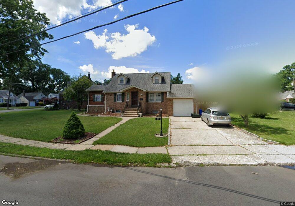
This home is located at 1311 Wilshire Dr, Union, NJ 07083 and is currently estimated at $446,660, approximately $413 per square foot. 1311 Wilshire Dr is a home located in Union County with nearby schools including Hannah Caldwell Elementary School, Burnet Middle School, and Union High School.
Ownership History
Date
Name
Owned For
Owner Type
Purchase Details
Closed on
Apr 12, 2021
Sold by
Bautista Roberto and Bautista Jerosa
Bought by
Castro Norman and Castro Jocez
Current Estimated Value
Home Financials for this Owner
Home Financials are based on the most recent Mortgage that was taken out on this home.
Original Mortgage
$288,000
Outstanding Balance
$260,029
Interest Rate
3%
Mortgage Type
New Conventional
Estimated Equity
$186,631
Purchase Details
Closed on
Jun 1, 1999
Sold by
Nunes Telmo G and Nunes Maria S
Bought by
Bautista Roberto and Bautista Jerosa
Home Financials for this Owner
Home Financials are based on the most recent Mortgage that was taken out on this home.
Original Mortgage
$130,000
Interest Rate
6.85%
Mortgage Type
Stand Alone First
Create a Home Valuation Report for This Property
The Home Valuation Report is an in-depth analysis detailing your home's value as well as a comparison with similar homes in the area
Home Values in the Area
Average Home Value in this Area
Purchase History
| Date | Buyer | Sale Price | Title Company |
|---|---|---|---|
| Castro Norman | $320,000 | Altor Abstract Company Inc | |
| Baustista Roberto | $320,000 | Chicago Title | |
| Bautista Roberto | $166,000 | Transnation Title Insurance |
Source: Public Records
Mortgage History
| Date | Status | Borrower | Loan Amount |
|---|---|---|---|
| Open | Baustista Roberto | $288,000 | |
| Closed | Baustista Roberto | $288,000 | |
| Previous Owner | Bautista Roberto | $130,000 |
Source: Public Records
Tax History Compared to Growth
Tax History
| Year | Tax Paid | Tax Assessment Tax Assessment Total Assessment is a certain percentage of the fair market value that is determined by local assessors to be the total taxable value of land and additions on the property. | Land | Improvement |
|---|---|---|---|---|
| 2025 | $8,963 | $40,100 | $20,500 | $19,600 |
| 2024 | $8,689 | $40,100 | $20,500 | $19,600 |
| 2023 | $8,689 | $40,100 | $20,500 | $19,600 |
| 2022 | $8,387 | $40,100 | $20,500 | $19,600 |
| 2021 | $8,184 | $40,100 | $20,500 | $19,600 |
| 2020 | $8,021 | $40,100 | $20,500 | $19,600 |
| 2019 | $7,913 | $40,100 | $20,500 | $19,600 |
| 2018 | $7,778 | $40,100 | $20,500 | $19,600 |
| 2017 | $7,663 | $40,100 | $20,500 | $19,600 |
| 2016 | $7,476 | $40,100 | $20,500 | $19,600 |
| 2015 | $7,352 | $40,100 | $20,500 | $19,600 |
| 2014 | $7,188 | $40,100 | $20,500 | $19,600 |
Source: Public Records
Map
Nearby Homes
- 1265 Shetland Dr
- 2144 Tyler St
- 2112 Gless Ave
- 1231 Glenn Ave
- 2225 Stecher Ave
- 2217 Vauxhall Rd
- 2220 Morrison Ave
- 1396 Orange Ave
- 2253 Vauxhall Rd
- 2021 Tyler St
- 1249 Plane St
- 2010 Gless Ave
- 1084 Pine Ave
- 1208 Francyne Way
- 1120 Weber St
- 1164 Commerce Ave
- 2159 Berwyn St
- 4 Sadie Cir Unit 4103
- 4 Sadie Cir Unit 4205
- 1244 Grandview Ave
- 1305 Wilshire Dr
- 1305 Shetland Dr
- 1295 Shetland Dr
- 1299 Wilshire Dr
- 1293 Shetland Dr
- 1295 Wilshire Dr
- 2181 Kay Ave
- 2176 Kay Ave
- 1304 Wilshire Dr
- 1314 Shetland Dr
- 1291 Wilshire Dr
- 1289 Shetland Dr
- 1302 Wilshire Dr
- 1306 Shetland Dr
- 2173 Kay Ave
- 1302 Shetland Dr
- 1296 Wilshire Dr
- 1296 Shetland Dr
- 1320 Shetland Dr
- 1287 Wilshire Dr