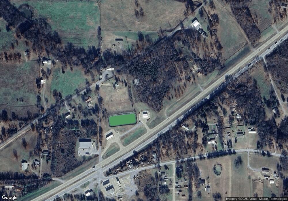
13112 Highway 62 Tahlequah, OK 74464
Estimated Value: $262,804
--
Bed
--
Bath
1,600
Sq Ft
$164/Sq Ft
Est. Value
About This Home
This home is located at 13112 Highway 62, Tahlequah, OK 74464 and is currently estimated at $262,804, approximately $164 per square foot. 13112 Highway 62 is a home located in Cherokee County.
Ownership History
Date
Name
Owned For
Owner Type
Purchase Details
Closed on
May 31, 2023
Sold by
Purget William Cole and Purget Rachel
Bought by
Maldonado Hernandez Jose E
Current Estimated Value
Purchase Details
Closed on
Feb 1, 2017
Sold by
Gibson Barbara Jean and Barbara Jean Gibson Revocable
Bought by
Purget Rachel and Purget William Cole
Home Financials for this Owner
Home Financials are based on the most recent Mortgage that was taken out on this home.
Original Mortgage
$130,000
Interest Rate
4.3%
Mortgage Type
Future Advance Clause Open End Mortgage
Purchase Details
Closed on
Dec 16, 2004
Sold by
Gibson Fam Joint Rev Tr
Bought by
Barbara Gibson Rev Trust
Create a Home Valuation Report for This Property
The Home Valuation Report is an in-depth analysis detailing your home's value as well as a comparison with similar homes in the area
Home Values in the Area
Average Home Value in this Area
Purchase History
| Date | Buyer | Sale Price | Title Company |
|---|---|---|---|
| Maldonado Hernandez Jose E | $120,000 | None Listed On Document | |
| Purget Rachel | $153,000 | None Available | |
| Barbara Gibson Rev Trust | $28,000 | -- |
Source: Public Records
Mortgage History
| Date | Status | Borrower | Loan Amount |
|---|---|---|---|
| Previous Owner | Purget Rachel | $130,000 |
Source: Public Records
Tax History Compared to Growth
Tax History
| Year | Tax Paid | Tax Assessment Tax Assessment Total Assessment is a certain percentage of the fair market value that is determined by local assessors to be the total taxable value of land and additions on the property. | Land | Improvement |
|---|---|---|---|---|
| 2025 | $1,165 | $15,824 | $1,952 | $13,872 |
| 2024 | $1,165 | $14,657 | $1,859 | $12,798 |
| 2023 | $1,165 | $14,657 | $1,859 | $12,798 |
| 2022 | $1,188 | $14,657 | $1,859 | $12,798 |
| 2021 | $1,195 | $14,657 | $1,859 | $12,798 |
| 2020 | $1,401 | $16,830 | $2,200 | $14,630 |
| 2019 | $1,393 | $16,830 | $2,200 | $14,630 |
| 2018 | $1,411 | $16,830 | $2,200 | $14,630 |
| 2017 | $874 | $10,313 | $1,480 | $8,833 |
| 2016 | $964 | $11,411 | $3,385 | $8,026 |
| 2015 | $862 | $10,867 | $3,319 | $7,548 |
| 2014 | $862 | $10,350 | $3,203 | $7,147 |
Source: Public Records
Map
Nearby Homes
- 0 Hwy 62 Hwy Unit 2532149
- 0 Hwy 62 Hwy Unit 2532139
- 0 Hwy 62 Hwy Unit 2532141
- 0 Hwy 62 Hwy Unit 2532145
- 13670 W 834 Rd
- 12910 W Southern Oaks St
- 12890 W Southern Oaks St
- 12219 U S 62
- 14650 W 835 Rd
- 11396 W Joyce Ln
- 24481 S Manard Rd
- 27254 S 490 Rd
- 0 S Qualls Rd Unit 2543872
- 2 S 490 Rd
- 1956 E Moffett Ln
- 0 S 490 Rd
- 22781 S 490 Rd
- 16920 W 828 Rd
- 16981 W 828 Rd
- 16289 W 810 Rd
- 13100 U S 62
- 13112 W 834 Rd
- 13066 W 834 Rd
- 13139 Highway 62
- 13004 W 835 Rd
- 25327 S Stanley Ln
- 25429 S Woodall Dr
- 25418 S Woodall Dr
- 13276 W 834 Rd
- 25441 S Woodall Dr
- 25436 S Woodall Dr
- 13078 W 835 Rd
- 13037 W 834 Rd
- 25446 S Woodall Dr
- 12979 Highway 62
- 0 Hwy 62 Hwy Unit 2543791
- 0 Hwy 62 Hwy Unit 2517481
- 0 Hwy 62 Hwy Unit 2443573
- 0 Hwy 62 Hwy Unit 2443577
- 0 Hwy 62 Hwy Unit 2443579
