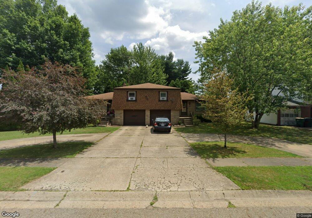
1312 Baier Ave Louisville, OH 44641
Estimated Value: $229,000 - $242,000
4
Beds
2
Baths
1,964
Sq Ft
$119/Sq Ft
Est. Value
About This Home
This home is located at 1312 Baier Ave, Louisville, OH 44641 and is currently estimated at $233,279, approximately $118 per square foot. 1312 Baier Ave is a home located in Stark County with nearby schools including Louisville High School and St. Thomas Aquinas High School & Middle School.
Ownership History
Date
Name
Owned For
Owner Type
Purchase Details
Closed on
Apr 8, 1998
Sold by
Myers Bud
Bought by
Ferrall Patrick R
Current Estimated Value
Home Financials for this Owner
Home Financials are based on the most recent Mortgage that was taken out on this home.
Original Mortgage
$114,750
Outstanding Balance
$21,955
Interest Rate
7.19%
Mortgage Type
New Conventional
Estimated Equity
$211,324
Purchase Details
Closed on
Jul 19, 1996
Sold by
Myers Terri L
Bought by
Myers Bud
Purchase Details
Closed on
Aug 5, 1988
Create a Home Valuation Report for This Property
The Home Valuation Report is an in-depth analysis detailing your home's value as well as a comparison with similar homes in the area
Home Values in the Area
Average Home Value in this Area
Purchase History
| Date | Buyer | Sale Price | Title Company |
|---|---|---|---|
| Ferrall Patrick R | $127,500 | -- | |
| Myers Bud | $10,000 | -- | |
| -- | $81,000 | -- |
Source: Public Records
Mortgage History
| Date | Status | Borrower | Loan Amount |
|---|---|---|---|
| Open | Ferrall Patrick R | $114,750 |
Source: Public Records
Tax History Compared to Growth
Tax History
| Year | Tax Paid | Tax Assessment Tax Assessment Total Assessment is a certain percentage of the fair market value that is determined by local assessors to be the total taxable value of land and additions on the property. | Land | Improvement |
|---|---|---|---|---|
| 2025 | -- | $68,530 | $15,470 | $53,060 |
| 2024 | -- | $68,530 | $15,470 | $53,060 |
| 2023 | $2,293 | $52,090 | $12,780 | $39,310 |
| 2022 | $2,298 | $52,090 | $12,780 | $39,310 |
| 2021 | $2,305 | $52,090 | $12,780 | $39,310 |
| 2020 | $1,893 | $46,310 | $11,520 | $34,790 |
| 2019 | $1,903 | $47,960 | $11,520 | $36,440 |
| 2018 | $1,963 | $47,960 | $11,520 | $36,440 |
| 2017 | $1,856 | $43,760 | $9,630 | $34,130 |
| 2016 | $1,894 | $43,760 | $9,630 | $34,130 |
| 2015 | $1,900 | $43,760 | $9,630 | $34,130 |
| 2014 | $1,811 | $38,780 | $8,540 | $30,240 |
| 2013 | $909 | $38,780 | $8,540 | $30,240 |
Source: Public Records
Map
Nearby Homes
- 0 Brookridge Ave
- 0 Glenbar St
- 614 Reno Dr
- 524 Glenbar St
- 3580 Brookridge Ave Lot 15
- 1175 Sturbridge Dr
- 1149 Sturbridge Dr
- 300 Kennedy St
- 428 Honeycrisp Dr NE
- 3047 Mcintosh Dr NE
- 432 Honeycrisp Dr NE
- 2962 Mcintosh Dr NE
- 2963 Mcintosh Dr NE
- 430 Honeycrisp Dr NE
- 2957 Mcintosh Dr NE
- 5474 Ravenna Ave
- 316 E Reno Dr
- 910 Crosswyck Cir
- 325 Lincoln Ave
- 1170 Winding Ridge Ave
- 1304 Baier Ave
- 906 Reno Dr
- 0 W Reno Dr
- 1268 Baier Ave
- 1313 Baier Ave
- 1303 Baier Ave
- 1000 Reno Dr
- 1267 Baier Ave
- 1258 Baier Ave
- 1426 Brookridge Ave
- 1446 Brookridge Ave
- 1259 Baier Ave
- 3578 Brookridge Ave Lot 13 NW
- 1250 Baier Ave
- 813 Reno Dr
- 803 Reno Dr
- 7027 Reno Dr
- 1249 Baier Ave
- 7028 Reno Dr
- 1453 Brookridge Ave