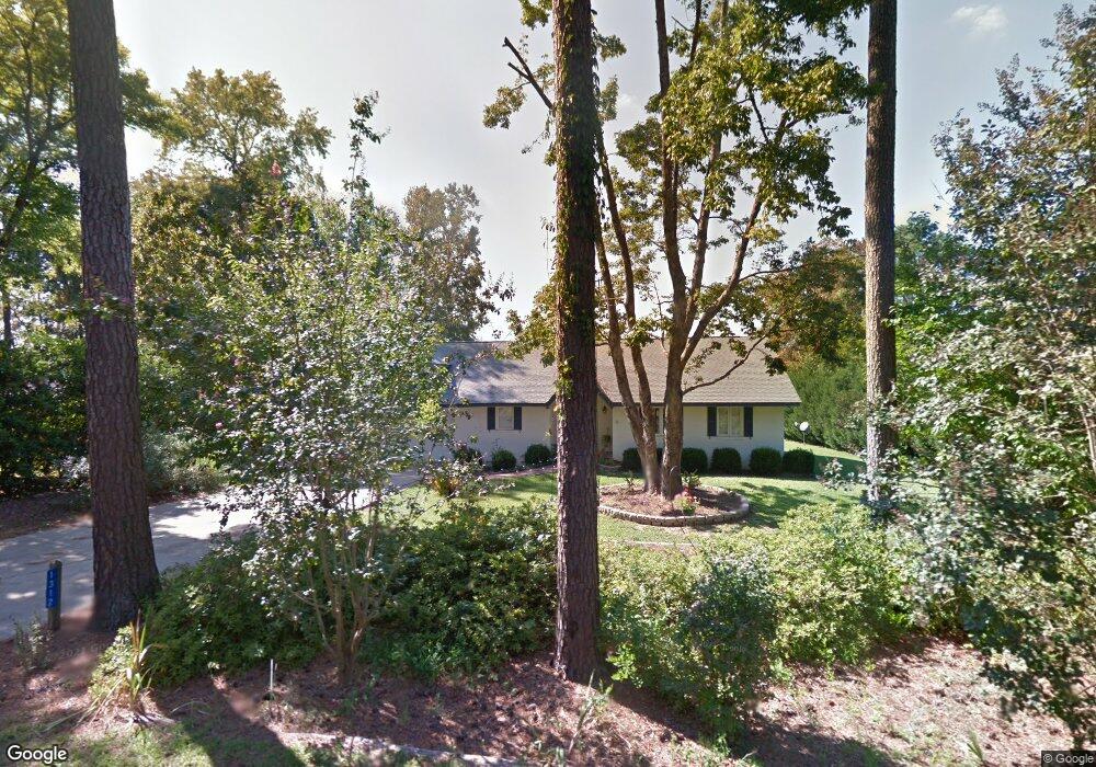
1312 Bordeaux Point Rd Leesville, SC 29070
Estimated Value: $544,000 - $667,000
3
Beds
2
Baths
2,016
Sq Ft
$302/Sq Ft
Est. Value
About This Home
This home is located at 1312 Bordeaux Point Rd, Leesville, SC 29070 and is currently estimated at $608,489, approximately $301 per square foot. 1312 Bordeaux Point Rd is a home located in Lexington County with nearby schools including Batesburg-Leesville Primary School, Batesburg-Leesville Elementary School, and Batesburg-Leesville Middle School.
Ownership History
Date
Name
Owned For
Owner Type
Purchase Details
Closed on
Aug 1, 2018
Sold by
Hammond Hammond A and Hammond Shannon K
Bought by
Hammond Shannon K and Hammond A
Current Estimated Value
Purchase Details
Closed on
Jun 25, 2010
Sold by
Jones Jon M and Jones Ashley A
Bought by
Hammond A E and Hammond Sharon K
Home Financials for this Owner
Home Financials are based on the most recent Mortgage that was taken out on this home.
Original Mortgage
$276,000
Interest Rate
4.77%
Mortgage Type
Future Advance Clause Open End Mortgage
Purchase Details
Closed on
Jul 14, 2005
Sold by
Garrett Bennie E
Bought by
Jones Jon M and Jones Ashley A
Create a Home Valuation Report for This Property
The Home Valuation Report is an in-depth analysis detailing your home's value as well as a comparison with similar homes in the area
Home Values in the Area
Average Home Value in this Area
Purchase History
| Date | Buyer | Sale Price | Title Company |
|---|---|---|---|
| Hammond Shannon K | -- | None Available | |
| Hammond A E | $345,000 | -- | |
| Jones Jon M | $285,000 | -- |
Source: Public Records
Mortgage History
| Date | Status | Borrower | Loan Amount |
|---|---|---|---|
| Previous Owner | Hammond A E | $276,000 |
Source: Public Records
Tax History Compared to Growth
Tax History
| Year | Tax Paid | Tax Assessment Tax Assessment Total Assessment is a certain percentage of the fair market value that is determined by local assessors to be the total taxable value of land and additions on the property. | Land | Improvement |
|---|---|---|---|---|
| 2024 | $1,872 | $12,264 | $6,811 | $5,453 |
| 2023 | $1,872 | $12,264 | $6,811 | $5,453 |
| 2022 | $1,873 | $12,264 | $6,811 | $5,453 |
| 2020 | $1,562 | $12,264 | $6,811 | $5,453 |
| 2019 | $1,475 | $10,664 | $4,800 | $5,864 |
| 2018 | $1,424 | $10,664 | $4,800 | $5,864 |
| 2017 | $1,311 | $10,664 | $4,800 | $5,864 |
| 2016 | $1,030 | $10,664 | $4,800 | $5,864 |
| 2014 | $1,101 | $10,812 | $5,220 | $5,592 |
| 2013 | -- | $10,810 | $5,220 | $5,590 |
Source: Public Records
Map
Nearby Homes
- 0 Wildwood Cir Unit 611605
- 1694 Wildwood Cove Rd
- 920 Wildwood Cir
- 1356 Peninsula Dr
- 1156 Langford Rd
- 895 Peninsula Dr
- 0 Langford Rd Unit 612505
- 701 Peninsula Dr
- Lot 202 Peninsula Dr
- 10 Newberry Dr
- 110 Rd
- 42 Sommerset Place
- 0 Rock N Creek Rd Unit Lot 3 590102
- 0 Rock N Creek Rd
- 406 State Road S-32-1427
- 412 State Road S-32-1427
- 400 Disher Dr
- 758 Caughman Point
- 507 Chalet Rd
- 0 Sturkie Ln
- 1401 Bordeaux Point Rd
- 1320 Bordeaux Point Rd
- 1313 Bordeaux Point Rd
- 1311 Bordeaux Point Rd
- 1319 Bordeaux Point Rd
- 1324 Bordeaux Point Rd
- 1307 Bordeaux Point Rd
- 1326 Bordeaux Point Rd
- 1323 Bordeaux Point Rd
- 1415 Bordeaux Point Rd
- 1300 Bordeaux Point Rd
- 1301 Bordeaux Point Rd
- 1328 Wildwood Cir
- 725 Wildwood Rd
- 715 Wildwood Rd
- 1332 Wildwood Cir
- 721 Wildwood Rd
- 1424 Bordeaux Point Rd
- 729 Wildwood Rd
- 1336 Wildwood Cir