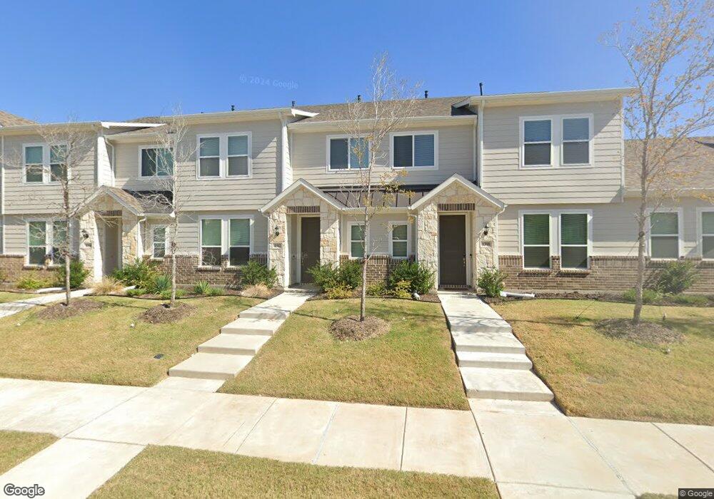
1312 Creekbank Dr Unit D McKinney, TX 75071
Slaughter NeighborhoodEstimated Value: $366,000 - $402,000
4
Beds
3
Baths
1,900
Sq Ft
$200/Sq Ft
Est. Value
About This Home
This home is located at 1312 Creekbank Dr Unit D, McKinney, TX 75071 and is currently estimated at $380,239, approximately $200 per square foot. 1312 Creekbank Dr Unit D is a home located in Collin County with nearby schools including Slaughter Elementary School, Dr Jack Cockrill Middle School, and McKinney Boyd High School.
Ownership History
Date
Name
Owned For
Owner Type
Purchase Details
Closed on
Apr 1, 2024
Sold by
Jeans Creek Th Lp
Bought by
Ronald Hays Family Revocable Trust and Hays
Current Estimated Value
Home Financials for this Owner
Home Financials are based on the most recent Mortgage that was taken out on this home.
Original Mortgage
$200,000
Outstanding Balance
$196,760
Interest Rate
6.77%
Mortgage Type
New Conventional
Estimated Equity
$183,479
Purchase Details
Closed on
Jun 16, 2022
Sold by
Forney 56 Llc
Bought by
Jeans Creek Th Lp
Home Financials for this Owner
Home Financials are based on the most recent Mortgage that was taken out on this home.
Original Mortgage
$7,500,000
Interest Rate
5.27%
Mortgage Type
Credit Line Revolving
Create a Home Valuation Report for This Property
The Home Valuation Report is an in-depth analysis detailing your home's value as well as a comparison with similar homes in the area
Home Values in the Area
Average Home Value in this Area
Purchase History
| Date | Buyer | Sale Price | Title Company |
|---|---|---|---|
| Ronald Hays Family Revocable Trust | -- | None Listed On Document | |
| Jeans Creek Th Lp | -- | Chicago Title |
Source: Public Records
Mortgage History
| Date | Status | Borrower | Loan Amount |
|---|---|---|---|
| Open | Ronald Hays Family Revocable Trust | $200,000 | |
| Previous Owner | Jeans Creek Th Lp | $7,500,000 |
Source: Public Records
Tax History Compared to Growth
Tax History
| Year | Tax Paid | Tax Assessment Tax Assessment Total Assessment is a certain percentage of the fair market value that is determined by local assessors to be the total taxable value of land and additions on the property. | Land | Improvement |
|---|---|---|---|---|
| 2025 | $6,971 | $391,146 | $90,000 | $301,146 |
| 2024 | $6,971 | $393,586 | $90,000 | $303,586 |
| 2023 | $6,971 | $180,367 | $62,000 | $118,367 |
| 2022 | $1,643 | $81,980 | $53,900 | $28,080 |
| 2021 | $1,044 | $49,140 | $49,140 | $0 |
| 2019 | $1,078 | $45,360 | $45,360 | $0 |
Source: Public Records
Map
Nearby Homes
- 2304 Glenhaven Dr
- 2421 Jeans Mill Dr
- 912 Margaret Dr
- 2208 Stoneleigh Place
- 2608 Glenhaven Dr
- 2228 Stonepark Place
- 2429 Emerald Ln
- 808 Stags Leap Dr
- 2313 Gabriel Dr
- 2409 Marshbrook Dr
- 2421 Gabriel Dr
- 2404 Marshbrook Dr
- 141 Camellia Ln
- 309 Gwendola Dr
- 314 Northwood Dr
- 2708 Gabriel Dr
- 310 Westpark Dr N
- 309 Westpark Dr N
- 223 Mccarley Place
- 219 Mccarley Place
- 1312 Creekbank Dr
- 1316 Creekbank Dr
- 1320 Creekbank Dr
- 1304 Creekbank Dr
- 1324 Creekbank Dr
- 1328 Creekbank Dr
- 1300 Creekbank Dr
- 1332 Creekbank Dr
- 1240 Creekbank Dr
- 1336 Creekbank Dr
- 1236 Creekbank Dr
- 1317 Creekbank Dr
- 1321 Creekbank Dr
- 1313 Creekbank Dr
- 1309 Creekbank Dr
- 1305 Creekbank Dr
- 1325 Creekbank Dr
- 1301 Creekbank Dr
- 1329 Creekbank Dr
- 1232 Creekbank Dr