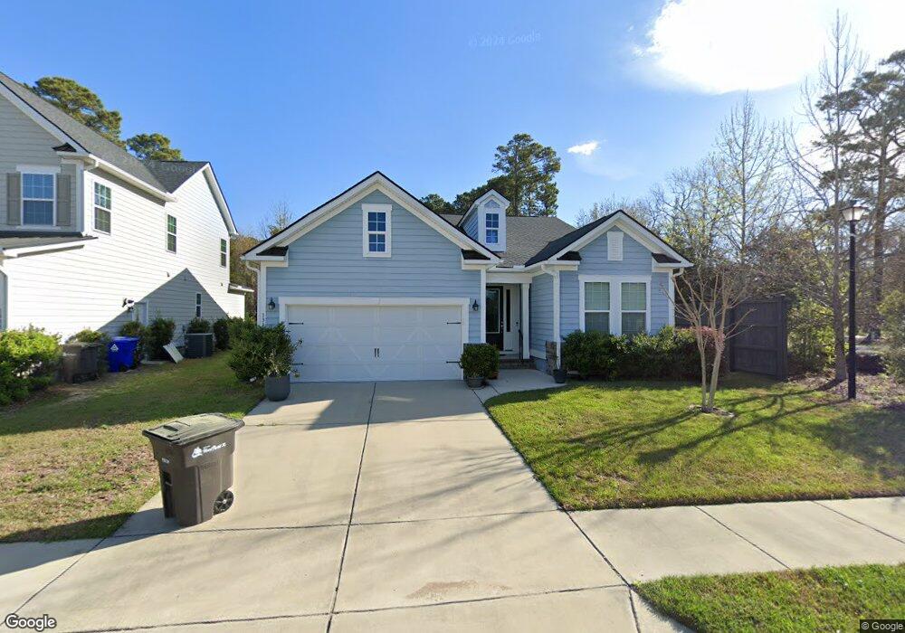
1312 Enfield Ln Mount Pleasant, SC 29466
Six Mile NeighborhoodEstimated Value: $810,000 - $900,000
3
Beds
3
Baths
2,004
Sq Ft
$428/Sq Ft
Est. Value
About This Home
This home is located at 1312 Enfield Ln, Mount Pleasant, SC 29466 and is currently estimated at $858,075, approximately $428 per square foot. 1312 Enfield Ln is a home located in Charleston County with nearby schools including Jennie Moore Elementary School, Laing Middle School, and Wando High School.
Ownership History
Date
Name
Owned For
Owner Type
Purchase Details
Closed on
Jun 25, 2020
Sold by
Bostwick William M and Bostwick Elizabeth J
Bought by
Groves Cheryl B
Current Estimated Value
Home Financials for this Owner
Home Financials are based on the most recent Mortgage that was taken out on this home.
Original Mortgage
$185,000
Outstanding Balance
$164,350
Interest Rate
3.2%
Mortgage Type
New Conventional
Estimated Equity
$693,725
Purchase Details
Closed on
Sep 1, 2017
Sold by
Beazer Homes Llc
Bought by
Bostwick William M and Bostwick Elizabeth J
Create a Home Valuation Report for This Property
The Home Valuation Report is an in-depth analysis detailing your home's value as well as a comparison with similar homes in the area
Home Values in the Area
Average Home Value in this Area
Purchase History
| Date | Buyer | Sale Price | Title Company |
|---|---|---|---|
| Groves Cheryl B | $435,000 | None Available | |
| Bostwick William M | $400,000 | None Available |
Source: Public Records
Mortgage History
| Date | Status | Borrower | Loan Amount |
|---|---|---|---|
| Open | Groves Cheryl B | $185,000 |
Source: Public Records
Tax History Compared to Growth
Tax History
| Year | Tax Paid | Tax Assessment Tax Assessment Total Assessment is a certain percentage of the fair market value that is determined by local assessors to be the total taxable value of land and additions on the property. | Land | Improvement |
|---|---|---|---|---|
| 2024 | $1,783 | $17,400 | $0 | $0 |
| 2023 | $1,783 | $17,400 | $0 | $0 |
| 2022 | $1,629 | $17,400 | $0 | $0 |
| 2021 | $1,789 | $17,400 | $0 | $0 |
| 2020 | $1,733 | $16,200 | $0 | $0 |
| 2019 | $1,507 | $14,000 | $0 | $0 |
| 2017 | $1,699 | $7,200 | $0 | $0 |
Source: Public Records
Map
Nearby Homes
- 0 Rifle Range Rd Unit (Lot 2)
- 0 Rifle Range Rd Unit (Lot 1)
- 2336 Minifarm Way Unit 507
- 2284 Minifarm Way
- 2336 Minifarm Way
- 2276 Minifarm Way
- 3104 Sandy Pearl Way
- 0 N Rifle Range Rd Unit (Lot 1 & 2)
- 0 N Rifle Range Rd Unit 24028206
- 3116 Sandy Pearl Way
- Bridgeside Plan at Norwood Oaks
- 1509 W Palmetto Fort Dr
- 2242 Dewees Creek Dr
- 2182 Gulf Dr
- Wando Plan at Liberty Hill Farm
- Hamlin Plan at Liberty Hill Farm
- Capers Plan at Liberty Hill Farm
- Copahee Plan at Liberty Hill Farm
- Kiawah Plan at Liberty Hill Farm
- Stono Plan at Liberty Hill Farm
- 1308 Enfield Ln
- 1304 Enfield Ln
- 1300 Enfield Ln
- 1313 Enfield Ln
- 1309 Enfield Ln
- 2243 Rifle Range Rd
- 1303 Enfield Ln
- 1301 Enfield Ln
- 0 Rifle Range Rd Unit 2518194
- 0 Rifle Range Rd Unit 2705354
- 0 Rifle Range Rd Unit 2800866
- 0 Rifle Range Rd Unit 2800871
- 0 Rifle Range Rd Unit 2821378
- 0 Rifle Range Rd Unit 2901774
- 0 Rifle Range Rd Unit 2917137
- 0 Rifle Range Rd Unit 1002449
- 0 Rifle Range Rd Unit 1002450
- 0 Rifle Range Rd Unit 1012087
- 0 Rifle Range Rd Unit 1109594
- 0 Rifle Range Rd Unit 1217640