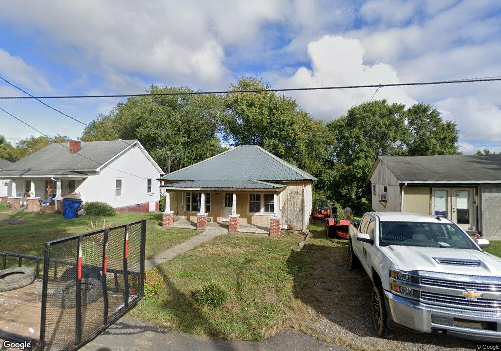
1312 Grove Ln Mount Airy, NC 27030
Estimated Value: $90,000 - $166,000
2
Beds
1
Bath
756
Sq Ft
$158/Sq Ft
Est. Value
About This Home
This home is located at 1312 Grove Ln, Mount Airy, NC 27030 and is currently estimated at $119,411, approximately $157 per square foot. 1312 Grove Ln is a home located in Surry County with nearby schools including Franklin Elementary School, Meadowview Magnet Middle School, and North Surry High School.
Ownership History
Date
Name
Owned For
Owner Type
Purchase Details
Closed on
Dec 13, 2007
Sold by
Utt Eva France Cochran and Utt Glenn D
Bought by
Brock Joseph D and Brock Jennifer T
Current Estimated Value
Home Financials for this Owner
Home Financials are based on the most recent Mortgage that was taken out on this home.
Original Mortgage
$17,465
Outstanding Balance
$10,953
Interest Rate
6.21%
Mortgage Type
Purchase Money Mortgage
Estimated Equity
$108,458
Purchase Details
Closed on
Aug 1, 1972
Create a Home Valuation Report for This Property
The Home Valuation Report is an in-depth analysis detailing your home's value as well as a comparison with similar homes in the area
Home Values in the Area
Average Home Value in this Area
Purchase History
| Date | Buyer | Sale Price | Title Company |
|---|---|---|---|
| Brock Joseph D | $16,500 | None Available | |
| -- | -- | -- |
Source: Public Records
Mortgage History
| Date | Status | Borrower | Loan Amount |
|---|---|---|---|
| Open | Brock Joseph D | $17,465 |
Source: Public Records
Tax History Compared to Growth
Tax History
| Year | Tax Paid | Tax Assessment Tax Assessment Total Assessment is a certain percentage of the fair market value that is determined by local assessors to be the total taxable value of land and additions on the property. | Land | Improvement |
|---|---|---|---|---|
| 2025 | $273 | $41,790 | $6,000 | $35,790 |
| 2024 | $237 | $33,830 | $6,000 | $27,830 |
| 2023 | $233 | $33,830 | $6,000 | $27,830 |
| 2022 | $233 | $33,830 | $6,000 | $27,830 |
| 2021 | $237 | $33,830 | $6,000 | $27,830 |
| 2020 | $240 | $33,440 | $6,000 | $27,440 |
| 2019 | $237 | $33,440 | $0 | $0 |
| 2018 | $233 | $33,440 | $0 | $0 |
| 2017 | $234 | $33,440 | $0 | $0 |
| 2016 | $234 | $33,440 | $0 | $0 |
| 2013 | -- | $34,070 | $0 | $0 |
Source: Public Records
Map
Nearby Homes
- 1520 Edgewood Dr
- 00 Hillcrest Dr
- 1122 Viewland Ave
- .58 Newsome St
- 130 Williamson Ave
- 123 Greystone Ln
- 125 Greystone Ln
- 2019 Woodland Dr
- 0 Caudle Dr
- 00 Farmbrook Rd
- 02 Farmbrook Rd
- 000000 Farmbrook Rd
- 01 Farmbrook Rd
- 00000 Farmbrook Rd
- 1023 Spring St
- 802 Spring St
- 220 Broad St
- 1610 E Wensley Dr
- 212 Bluemont Rd
- 216 E Devon Dr