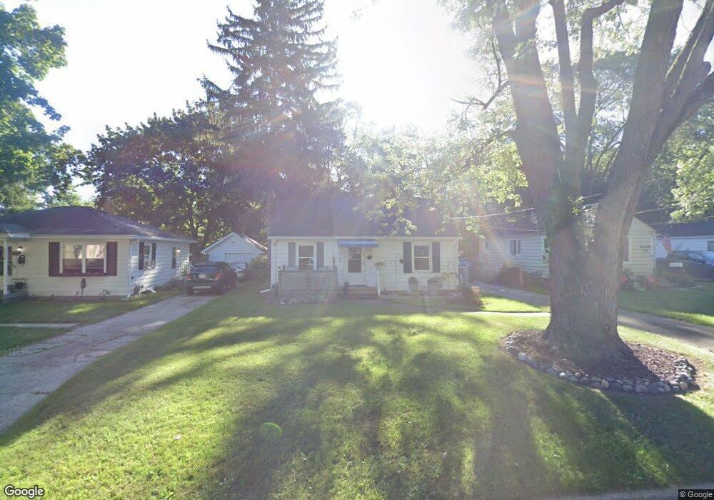
1312 Mayfield Ave NE Grand Rapids, MI 49505
North East Citizens Action NeighborhoodEstimated Value: $206,177 - $254,000
--
Bed
--
Bath
760
Sq Ft
$309/Sq Ft
Est. Value
About This Home
This home is located at 1312 Mayfield Ave NE, Grand Rapids, MI 49505 and is currently estimated at $234,544, approximately $308 per square foot. 1312 Mayfield Ave NE is a home located in Kent County with nearby schools including Kent Hills School, Riverside Middle School, and Union High School.
Ownership History
Date
Name
Owned For
Owner Type
Purchase Details
Closed on
Jan 25, 2023
Sold by
Mclaughlin Mary
Bought by
Harig Marsha
Current Estimated Value
Purchase Details
Closed on
May 15, 2007
Sold by
Mclaughlin Mary C and Kadwell Mary C
Bought by
Mclaughlin Mary C
Home Financials for this Owner
Home Financials are based on the most recent Mortgage that was taken out on this home.
Original Mortgage
$90,000
Interest Rate
6.27%
Mortgage Type
New Conventional
Purchase Details
Closed on
Aug 8, 1988
Purchase Details
Closed on
Oct 20, 1982
Create a Home Valuation Report for This Property
The Home Valuation Report is an in-depth analysis detailing your home's value as well as a comparison with similar homes in the area
Home Values in the Area
Average Home Value in this Area
Purchase History
| Date | Buyer | Sale Price | Title Company |
|---|---|---|---|
| Harig Marsha | -- | -- | |
| Mclaughlin Mary C | -- | None Available | |
| -- | $45,000 | -- | |
| -- | $38,800 | -- |
Source: Public Records
Mortgage History
| Date | Status | Borrower | Loan Amount |
|---|---|---|---|
| Previous Owner | Mclaughlin Mary C | $90,000 |
Source: Public Records
Tax History Compared to Growth
Tax History
| Year | Tax Paid | Tax Assessment Tax Assessment Total Assessment is a certain percentage of the fair market value that is determined by local assessors to be the total taxable value of land and additions on the property. | Land | Improvement |
|---|---|---|---|---|
| 2025 | $1,149 | $83,500 | $0 | $0 |
| 2024 | $1,149 | $75,400 | $0 | $0 |
| 2023 | $1,166 | $64,300 | $0 | $0 |
| 2022 | $1,107 | $55,400 | $0 | $0 |
| 2021 | $1,082 | $51,200 | $0 | $0 |
| 2020 | $1,035 | $47,000 | $0 | $0 |
| 2019 | $1,084 | $42,000 | $0 | $0 |
| 2018 | $1,046 | $37,500 | $0 | $0 |
| 2017 | $1,019 | $32,400 | $0 | $0 |
| 2016 | $1,031 | $30,300 | $0 | $0 |
| 2015 | $959 | $30,300 | $0 | $0 |
| 2013 | -- | $28,200 | $0 | $0 |
Source: Public Records
Map
Nearby Homes
- 1250 Mayfield Ave NE
- 1238 Carlton Ave NE
- 1455 Ball Ave NE
- 1452 Carlton Ave NE
- 1518 Mayfield Ave NE
- 1332 Leonard St NE
- 1524 Sweet St NE
- 1444 Sweet St NE
- 1339 Fuller Ave NE
- 1119 Spencer St NE
- 1666 Carlton Ave NE
- 1237 Dale Ct NE
- 1060 Leonard St NE
- 1228 Spring Ave NE
- 1535 Mason St NE
- 1539 Mason St NE
- 1100 Coldbrook St NE
- 1659 Mason St NE
- 1256 Diamond Ave NE
- 1150 Diamond Ave NE
- 1318 Mayfield Ave NE
- 1306 Mayfield Ave NE
- 1300 Mayfield Ave NE
- 1324 Mayfield Ave NE
- 1317 Edith Ave NE
- 1311 Edith Ave NE
- 1330 Mayfield Ave NE
- 1301 Edith Ave NE
- 1325 Edith Ave NE
- 1313 Mayfield Ave NE
- 1336 Mayfield Ave NE
- 1319 Mayfield Ave NE
- 1329 Edith Ave NE
- 1307 Mayfield Ave NE
- 1258 Mayfield Ave NE
- 1325 Mayfield Ave NE
- 1335 Edith Ave NE
- 1331 Mayfield Ave NE
- 1259 Edith Ave NE
- 1340 Mayfield Ave NE