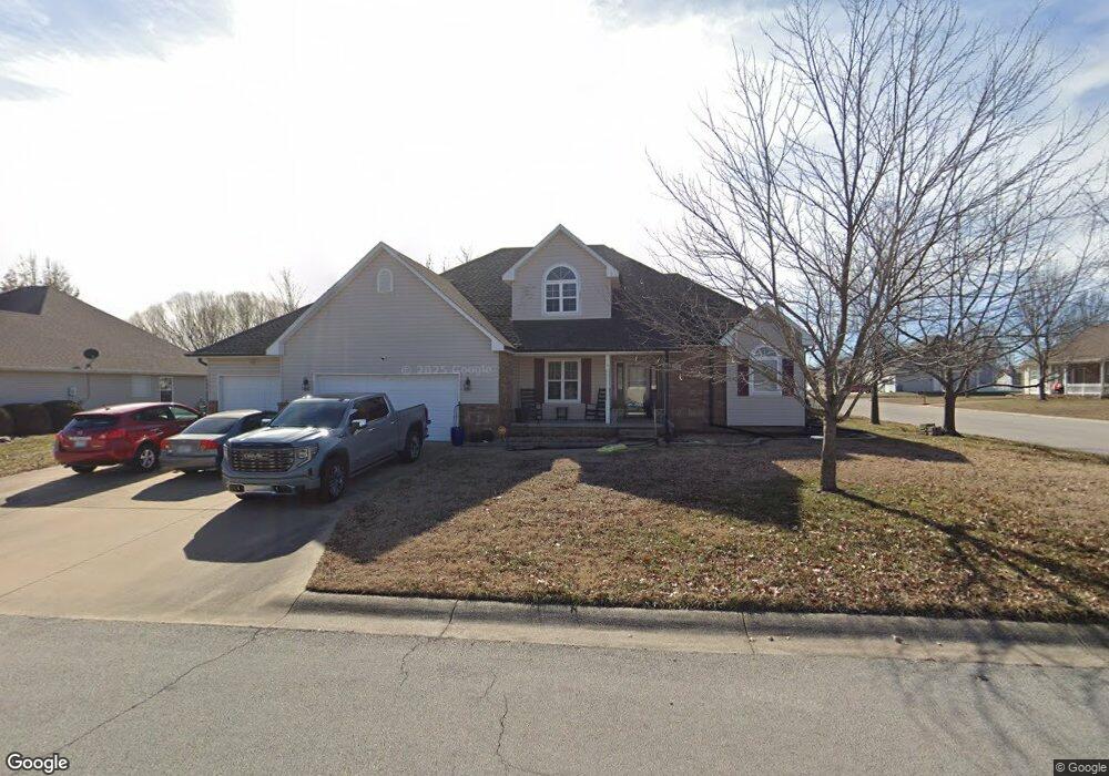
1312 Michael Ct Carthage, MO 64836
Estimated Value: $377,470 - $436,000
5
Beds
3
Baths
2,989
Sq Ft
$134/Sq Ft
Est. Value
About This Home
This home is located at 1312 Michael Ct, Carthage, MO 64836 and is currently estimated at $399,118, approximately $133 per square foot. 1312 Michael Ct is a home located in Jasper County with nearby schools including Carthage High School, St. Ann's Catholic School, and Victory Academy.
Ownership History
Date
Name
Owned For
Owner Type
Purchase Details
Closed on
Mar 25, 2022
Sold by
Virginia Howard Revocable Trust
Bought by
Hanks David T
Current Estimated Value
Home Financials for this Owner
Home Financials are based on the most recent Mortgage that was taken out on this home.
Original Mortgage
$266,000
Outstanding Balance
$249,474
Interest Rate
4.42%
Mortgage Type
New Conventional
Estimated Equity
$149,644
Create a Home Valuation Report for This Property
The Home Valuation Report is an in-depth analysis detailing your home's value as well as a comparison with similar homes in the area
Home Values in the Area
Average Home Value in this Area
Purchase History
| Date | Buyer | Sale Price | Title Company |
|---|---|---|---|
| Hanks David T | -- | None Listed On Document |
Source: Public Records
Mortgage History
| Date | Status | Borrower | Loan Amount |
|---|---|---|---|
| Open | Hanks David T | $266,000 |
Source: Public Records
Tax History
| Year | Tax Paid | Tax Assessment Tax Assessment Total Assessment is a certain percentage of the fair market value that is determined by local assessors to be the total taxable value of land and additions on the property. | Land | Improvement |
|---|---|---|---|---|
| 2025 | $2,228 | $47,350 | $3,920 | $43,430 |
| 2024 | $2,228 | $43,280 | $3,920 | $39,360 |
| 2023 | $2,228 | $43,280 | $3,920 | $39,360 |
| 2022 | $2,172 | $42,330 | $3,920 | $38,410 |
| 2021 | $2,191 | $43,170 | $3,920 | $39,250 |
| 2020 | $2,107 | $39,800 | $3,920 | $35,880 |
| 2019 | $2,111 | $39,800 | $3,920 | $35,880 |
| 2018 | $2,013 | $38,050 | $0 | $0 |
| 2017 | $2,018 | $38,050 | $0 | $0 |
| 2016 | $2,121 | $40,110 | $0 | $0 |
Source: Public Records
Map
Nearby Homes
- 1328 Hafner Ct
- 2110 Pearl St
- 2032 Alison St
- 905 Durward Hall Dr
- 909 Durward Hall Dr
- 1910 Buena Vista Ave
- 2515 S River St
- 1814 Buena Vista Ave
- 1431 Quail Place
- TBD Lexie Ln
- 1922 Southwood Ln
- 2166 Noah's Ark Ln
- 1910 Wynwood Dr
- 1726 Buena Vista Ave
- 2206 Benjamin Dr
- 1131 Belle Air Place
- 1647 Glenwood Place
- TBD George E Phelps Blvd
- 1012 Euclid Blvd
- XXXX Clinton
- 1320 Michael Ct
- 1309 Hafner Ct
- 2259 Laura St
- 1319 Hafner Ct
- 1311 Michael Ct
- 2265 Laura St
- 1328 Michael Ct
- 1319 Michael Ct
- 2251 Laura St
- 1325 Michael Ct
- 2241 Laura St
- 1336 Michael Ct
- 2327 Laura St
- 2334 Laura St
- 1333 Hafner Ct
- 1320 Hafner Ct
- 2260 Alison St
- 2266 Alison St
- 1320 Patrick Place
- 2250 Alison St
Your Personal Tour Guide
Ask me questions while you tour the home.