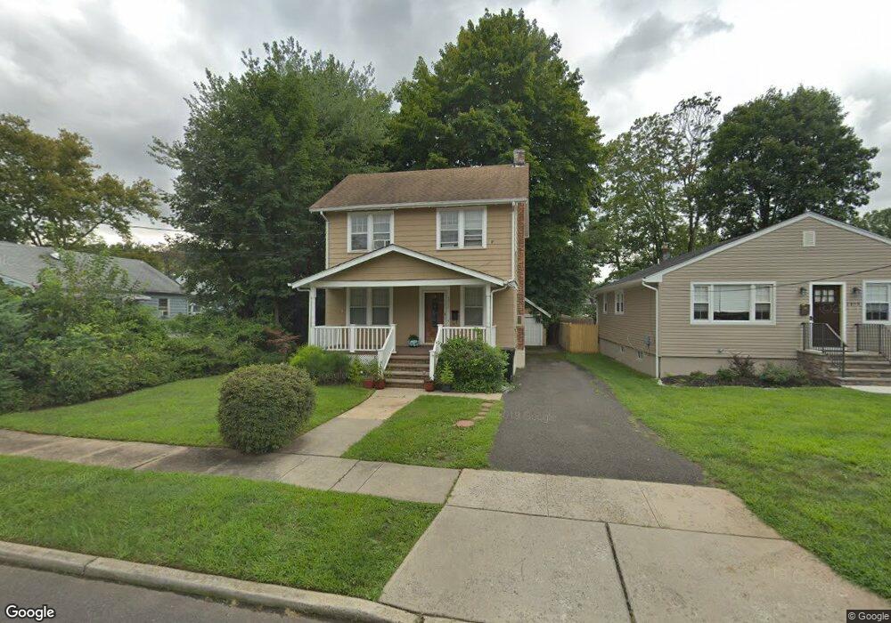
1312 Moffett Ave Unit 14 Plainfield, NJ 07060
Estimated Value: $433,471 - $527,000
--
Bed
--
Bath
1,128
Sq Ft
$423/Sq Ft
Est. Value
About This Home
This home is located at 1312 Moffett Ave Unit 14, Plainfield, NJ 07060 and is currently estimated at $476,618, approximately $422 per square foot. 1312 Moffett Ave Unit 14 is a home located in Union County with nearby schools including Evergreen Elementary School, Maxson Middle School, and Plainfield High School.
Ownership History
Date
Name
Owned For
Owner Type
Purchase Details
Closed on
Dec 23, 2004
Sold by
Muhlenberg Regional Medical Ct
Bought by
Pemberton Max and Pemberton Karen
Current Estimated Value
Home Financials for this Owner
Home Financials are based on the most recent Mortgage that was taken out on this home.
Original Mortgage
$155,824
Outstanding Balance
$78,452
Interest Rate
5.81%
Estimated Equity
$398,166
Create a Home Valuation Report for This Property
The Home Valuation Report is an in-depth analysis detailing your home's value as well as a comparison with similar homes in the area
Home Values in the Area
Average Home Value in this Area
Purchase History
| Date | Buyer | Sale Price | Title Company |
|---|---|---|---|
| Pemberton Max | $194,780 | -- |
Source: Public Records
Mortgage History
| Date | Status | Borrower | Loan Amount |
|---|---|---|---|
| Open | Pemberton Max | $155,824 |
Source: Public Records
Tax History Compared to Growth
Tax History
| Year | Tax Paid | Tax Assessment Tax Assessment Total Assessment is a certain percentage of the fair market value that is determined by local assessors to be the total taxable value of land and additions on the property. | Land | Improvement |
|---|---|---|---|---|
| 2025 | $8,653 | $99,100 | $39,600 | $59,500 |
| 2024 | $8,568 | $99,100 | $39,600 | $59,500 |
| 2023 | $8,568 | $99,100 | $39,600 | $59,500 |
| 2022 | $8,383 | $99,100 | $39,600 | $59,500 |
| 2021 | $8,310 | $99,100 | $39,600 | $59,500 |
| 2020 | $8,286 | $99,100 | $39,600 | $59,500 |
| 2019 | $8,286 | $99,100 | $39,600 | $59,500 |
| 2018 | $8,112 | $99,100 | $39,600 | $59,500 |
| 2017 | $7,914 | $99,100 | $39,600 | $59,500 |
| 2016 | $7,753 | $99,100 | $39,600 | $59,500 |
| 2015 | $7,524 | $99,100 | $39,600 | $59,500 |
| 2014 | -- | $99,100 | $39,600 | $59,500 |
Source: Public Records
Map
Nearby Homes
- 1208 Moffett Ave Unit 12
- 1339 Park Ave Unit 41
- 1349 Park Ave Unit 53
- 1143 Stilford Ave Unit 45
- 1143-45 Stilford Ave
- 1454 S End Pkwy Unit 56
- 1360 Belleview Ave Unit 64
- 1388 Belleview Ave Unit 90
- 1358 Marlborough Ave Unit 60
- 1354 Chetwynd Ave Unit 58
- 115 Ellsworth Ct Unit 17
- 117 Golf Ave E
- 77 Parkside Rd Unit 89
- 221 Golf Ave E
- 132 Parkside Rd
- 125 Redding Ave
- 19 Ravenswood Ln
- 1066 Allenwood Dr
- 1358 Prospect Ave Unit 64
- 14 Jenna Ct
- 1310 Moffett Ave
- 1308 Moffett Ave Unit 10
- 1256 Florence Ave Unit 60
- 1262 Florence Ave Unit 68
- 1270 Florence Ave Unit 72
- 1263 Marion Ave Unit 69
- 1257-61 Marion Ave
- 1279 Marion Ave Unit 81
- 1274 Florence Ave Unit 78
- 1255 Florence Ave Unit 57
- 1259 Florence Ave Unit 61
- 1275 Marion Ave
- 1271 Marion Ave Unit 77
- 1263 Florence Ave Unit 65
- 1280 Florence Ave Unit 84
- 1251-53 Florence Ave
- 1283 Marion Ave Unit 85
- 1246 Moffett Ave
- 1244 Moffett Ave Unit 48
- 1283-85 Marion Ave