Estimated Value: $202,152 - $300,000
3
Beds
2
Baths
2,236
Sq Ft
$108/Sq Ft
Est. Value
About This Home
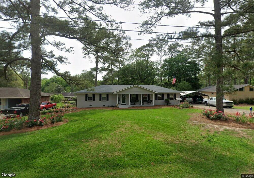
This home is located at 1312 Platt Ave, Cairo, GA 39828 and is currently estimated at $240,788, approximately $107 per square foot. 1312 Platt Ave is a home with nearby schools including Cairo High School.
Ownership History
Date
Name
Owned For
Owner Type
Purchase Details
Closed on
Aug 19, 2005
Sold by
Singletary Mike L
Bought by
Singletary Mike L and Singletary Judy Ann
Current Estimated Value
Purchase Details
Closed on
Mar 30, 1995
Sold by
Drew Phillip E
Bought by
Singletary Mike L
Purchase Details
Closed on
Sep 7, 1990
Bought by
Drew Phillip E
Create a Home Valuation Report for This Property
The Home Valuation Report is an in-depth analysis detailing your home's value as well as a comparison with similar homes in the area
Purchase History
| Date | Buyer | Sale Price | Title Company |
|---|---|---|---|
| Singletary Mike L | -- | -- | |
| Singletary Mike L | $72,500 | -- | |
| Drew Phillip E | $55,000 | -- |
Source: Public Records
Tax History
| Year | Tax Paid | Tax Assessment Tax Assessment Total Assessment is a certain percentage of the fair market value that is determined by local assessors to be the total taxable value of land and additions on the property. | Land | Improvement |
|---|---|---|---|---|
| 2025 | $2,668 | $99,616 | $4,100 | $95,516 |
| 2024 | $2,668 | $90,256 | $4,100 | $86,156 |
| 2023 | $1,669 | $45,098 | $5,520 | $39,578 |
| 2022 | $1,736 | $45,098 | $5,520 | $39,578 |
| 2021 | $1,741 | $45,098 | $5,520 | $39,578 |
| 2020 | $1,746 | $45,098 | $5,520 | $39,578 |
| 2019 | $1,745 | $45,098 | $5,520 | $39,578 |
| 2018 | $1,659 | $45,098 | $5,520 | $39,578 |
| 2017 | $1,596 | $45,098 | $5,520 | $39,578 |
| 2016 | $1,390 | $38,414 | $5,520 | $32,894 |
| 2015 | $1,376 | $38,414 | $5,520 | $32,894 |
| 2014 | $1,376 | $38,414 | $5,520 | $32,894 |
| 2013 | -- | $35,088 | $5,520 | $29,568 |
Source: Public Records
Map
Nearby Homes
- 1406 Platt Ave
- 1405 Platt Ave
- 306 Midland Place
- 198 Oakdale Rd SE
- 530 6th St
- 130 17th Ave SE
- 1193 S Broad St
- 112 Cakebread Dr
- 530 6th Ave SE
- 117 SW Pine Cirlce
- 580 5th St SE
- 1870 Oakdale Rd SE
- 112 Pine Cir SW
- 1891 Lakewood Dr SE
- 460 2nd St SW
- 592 20th St SE
- 309 3rd St SE
- 0 111 Hwy Unit 396477
- 140 Elderberry Ln
- X 1st St
- 1310 Platt Ave
- 1314 Platt Ave
- 1279 Emerson Ave SE
- 1305 Platt Ave
- 00 Emerson Ave
- 1404 Platt Ave
- 00 Emerson Ave
- 1259 Emerson Ave SE
- 1299 Emerson Ave SE
- 1303 Emerson Ave SE
- 00 Maxwell Dr
- 310 Grady St SE
- 1358 Stone Ave
- 1339 Emerson Ave SE
- 1401 Platt Ave
- 1284 Emerson Ave SE
- 1312 Emerson Ave SE
- 1264 Emerson Ave SE
- 413 Ridgecrest Dr SE
- 351 Grady St SE
Your Personal Tour Guide
Ask me questions while you tour the home.