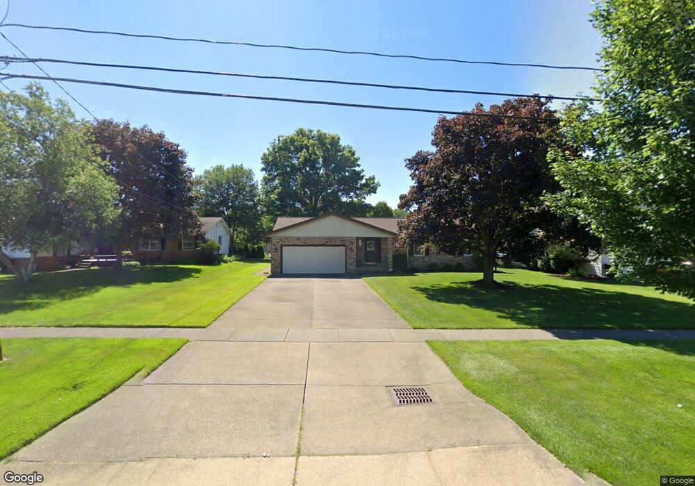
1312 State Rd Wadsworth, OH 44281
Estimated Value: $293,681 - $304,000
3
Beds
2
Baths
1,492
Sq Ft
$200/Sq Ft
Est. Value
About This Home
This home is located at 1312 State Rd, Wadsworth, OH 44281 and is currently estimated at $298,170, approximately $199 per square foot. 1312 State Rd is a home located in Medina County with nearby schools including Valley View Elementary School, Central Intermediate School, and Wadsworth Middle School.
Ownership History
Date
Name
Owned For
Owner Type
Purchase Details
Closed on
Jul 18, 2024
Sold by
Joyce Thomas P and Joyce Elizabeth H
Bought by
Joyce Family Irrevocable Trust and Joyce
Current Estimated Value
Purchase Details
Closed on
Oct 15, 2003
Sold by
Schur Bernard M and Schur Carol M
Bought by
Joyce Thomas P and Joyce Elizabeth H
Home Financials for this Owner
Home Financials are based on the most recent Mortgage that was taken out on this home.
Original Mortgage
$148,400
Interest Rate
6.23%
Mortgage Type
Purchase Money Mortgage
Create a Home Valuation Report for This Property
The Home Valuation Report is an in-depth analysis detailing your home's value as well as a comparison with similar homes in the area
Home Values in the Area
Average Home Value in this Area
Purchase History
| Date | Buyer | Sale Price | Title Company |
|---|---|---|---|
| Joyce Family Irrevocable Trust | -- | None Listed On Document | |
| Joyce Thomas P | $165,000 | Guardian Title |
Source: Public Records
Mortgage History
| Date | Status | Borrower | Loan Amount |
|---|---|---|---|
| Previous Owner | Joyce Thomas P | $148,400 |
Source: Public Records
Tax History Compared to Growth
Tax History
| Year | Tax Paid | Tax Assessment Tax Assessment Total Assessment is a certain percentage of the fair market value that is determined by local assessors to be the total taxable value of land and additions on the property. | Land | Improvement |
|---|---|---|---|---|
| 2024 | $2,573 | $68,400 | $21,880 | $46,520 |
| 2023 | $2,573 | $68,400 | $21,880 | $46,520 |
| 2022 | $2,628 | $68,400 | $21,880 | $46,520 |
| 2021 | $2,392 | $54,720 | $17,500 | $37,220 |
| 2020 | $2,106 | $54,720 | $17,500 | $37,220 |
| 2019 | $2,109 | $54,720 | $17,500 | $37,220 |
| 2018 | $2,108 | $51,840 | $19,760 | $32,080 |
| 2017 | $2,109 | $51,840 | $19,760 | $32,080 |
| 2016 | $2,143 | $51,840 | $19,760 | $32,080 |
| 2015 | $2,036 | $47,560 | $18,130 | $29,430 |
| 2014 | $2,070 | $47,560 | $18,130 | $29,430 |
| 2013 | $2,072 | $47,560 | $18,130 | $29,430 |
Source: Public Records
Map
Nearby Homes
- 1397 Harmony Dr
- 1400 Harmony Dr
- 4896 Ridge Rd
- 354 Edenmore St
- 1384 Tullamore Trail
- 1031 Ledgestone Dr
- Riverton Plan at Highlands of Sharon
- Hilltop Plan at Highlands of Sharon
- Greenfield Plan at Highlands of Sharon
- Westchester Plan at Highlands of Sharon
- Amberwood Plan at Highlands of Sharon
- 1396 Tullamore Trail
- 1414 Tullamore Trail
- 1250 Reserve Blvd
- 1199 Reserve Blvd
- 1166 Reserve Blvd
- 1570 Reimer Rd
- 1796 Cobham Ln
- 563 Rockglen Dr
- 944 Reedy Dr
- 1304 State Rd
- 1320 State Rd
- 1309 Harmony Dr
- 1328 State Rd
- 1296 State Rd
- 1303 Harmony Dr
- 1317 Harmony Dr
- 1295 Harmony Dr
- 1323 Harmony Dr
- 1336 State Rd
- 1288 State Rd
- 1287 Harmony Dr
- 123 Britestone Ave
- 1331 Harmony Dr
- 121 Britestone Ave
- 1280 State Rd
- 119 Britestone Ave
- 1318 Harmony Dr
- 1279 Harmony Dr
- 117 Britestone Ave