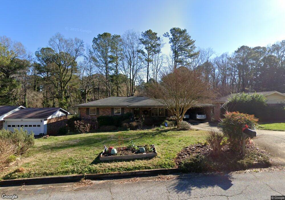
1312 Weston Dr Decatur, GA 30032
Estimated Value: $305,095 - $387,000
4
Beds
3
Baths
1,398
Sq Ft
$243/Sq Ft
Est. Value
About This Home
This home is located at 1312 Weston Dr, Decatur, GA 30032 and is currently estimated at $340,024, approximately $243 per square foot. 1312 Weston Dr is a home located in DeKalb County with nearby schools including Peachcrest Elementary School, Mary McLeod Bethune Middle School, and Towers High School.
Ownership History
Date
Name
Owned For
Owner Type
Purchase Details
Closed on
Oct 21, 2005
Sold by
Brock Todd M and Brock Deborah A
Bought by
Teague Thomas C and Dekoker Katherine
Current Estimated Value
Home Financials for this Owner
Home Financials are based on the most recent Mortgage that was taken out on this home.
Original Mortgage
$146,320
Outstanding Balance
$78,317
Interest Rate
5.76%
Mortgage Type
New Conventional
Estimated Equity
$261,707
Purchase Details
Closed on
May 2, 1996
Sold by
Pittman Delilah J
Bought by
Brock Todd M Deborah
Create a Home Valuation Report for This Property
The Home Valuation Report is an in-depth analysis detailing your home's value as well as a comparison with similar homes in the area
Home Values in the Area
Average Home Value in this Area
Purchase History
| Date | Buyer | Sale Price | Title Company |
|---|---|---|---|
| Teague Thomas C | $182,900 | -- | |
| Brock Todd M Deborah | $105,000 | -- |
Source: Public Records
Mortgage History
| Date | Status | Borrower | Loan Amount |
|---|---|---|---|
| Open | Teague Thomas C | $146,320 | |
| Closed | Brock Todd M Deborah | $0 |
Source: Public Records
Tax History Compared to Growth
Tax History
| Year | Tax Paid | Tax Assessment Tax Assessment Total Assessment is a certain percentage of the fair market value that is determined by local assessors to be the total taxable value of land and additions on the property. | Land | Improvement |
|---|---|---|---|---|
| 2025 | $3,772 | $131,200 | $38,240 | $92,960 |
| 2024 | $4,004 | $136,800 | $38,240 | $98,560 |
| 2023 | $4,004 | $121,520 | $35,000 | $86,520 |
| 2022 | $2,845 | $88,800 | $16,000 | $72,800 |
| 2021 | $2,814 | $87,480 | $16,000 | $71,480 |
| 2020 | $2,612 | $78,480 | $16,000 | $62,480 |
| 2019 | $2,234 | $66,160 | $16,000 | $50,160 |
| 2018 | $1,411 | $56,760 | $6,120 | $50,640 |
| 2017 | $1,596 | $45,960 | $6,120 | $39,840 |
| 2016 | $1,226 | $36,320 | $6,120 | $30,200 |
| 2014 | $913 | $27,160 | $6,120 | $21,040 |
Source: Public Records
Map
Nearby Homes
- 1309 Weston Dr
- 1350 Weston Dr
- 3581 Turner Heights Dr
- 3571 Turner Heights Dr
- 3558 Turner Heights Dr
- 1244 Weston Dr Unit 1
- 1401 Richard Rd
- 1376 Cornwall Rd
- 1407 Richard Rd
- 3589 Orchard Cir
- 3465 Glen Rd
- 3601 Orchard Cir
- 1255 Glen Forest Way
- 1425 Cobb Branch Dr
- 1395 Dennis Dr
- 3444 Orchard Cir
- 4250 Timber Valley Ct
- 3462 Maryvale Dr
- 4242 Timber Valley Ct
- 3645 Aldea Dr
- 1318 Weston Dr
- 1306 Weston Dr
- 3588 Farnham Ct
- 1326 Weston Dr
- 1298 Weston Dr
- 3594 Farnham Ct Unit 2
- 3595 Farnham Ct
- 1323 Weston Dr
- 1332 Weston Dr Unit I
- 1292 Weston Dr
- 1301 Weston Dr Unit 1
- 3602 Farnham Ct
- 1329 Weston Dr
- 3601 Farnham Ct Unit 2
- 1338 Weston Dr
- 1293 Weston Dr
- 1284 Weston Dr
- 1335 Weston Dr
- 3555 Wicklow Way
- 3602 Turner Heights Dr