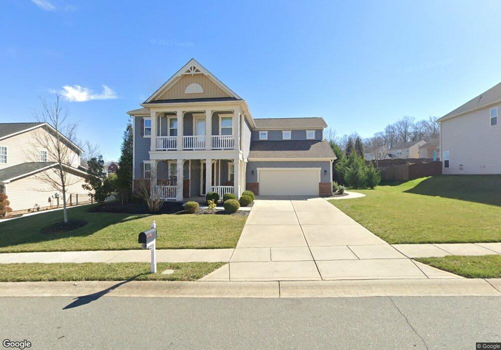
13120 Red Vulcan Ct Charlotte, NC 28213
Back Creek Church Road NeighborhoodEstimated Value: $472,844 - $547,000
5
Beds
4
Baths
2,913
Sq Ft
$176/Sq Ft
Est. Value
About This Home
This home is located at 13120 Red Vulcan Ct, Charlotte, NC 28213 and is currently estimated at $513,461, approximately $176 per square foot. 13120 Red Vulcan Ct is a home located in Mecklenburg County with nearby schools including University Meadows Elementary, James Martin Middle, and Julius L. Chambers High School.
Ownership History
Date
Name
Owned For
Owner Type
Purchase Details
Closed on
Dec 30, 2014
Sold by
A V H Carolinsa Llc
Bought by
Nolasco Jose D and Nolasco Maria E
Current Estimated Value
Home Financials for this Owner
Home Financials are based on the most recent Mortgage that was taken out on this home.
Original Mortgage
$232,750
Outstanding Balance
$179,518
Interest Rate
4.03%
Mortgage Type
New Conventional
Estimated Equity
$333,943
Purchase Details
Closed on
Mar 25, 2014
Sold by
K Hovnanian Homes Of North Carolina Inc
Bought by
Avh Carolinas Llc
Purchase Details
Closed on
Dec 15, 2006
Sold by
Fc Caldwell Llc
Bought by
K Hovnanian Homes Of North Carolina Inc
Create a Home Valuation Report for This Property
The Home Valuation Report is an in-depth analysis detailing your home's value as well as a comparison with similar homes in the area
Home Values in the Area
Average Home Value in this Area
Purchase History
| Date | Buyer | Sale Price | Title Company |
|---|---|---|---|
| Nolasco Jose D | $245,000 | Investors | |
| Avh Carolinas Llc | $308,000 | None Available | |
| K Hovnanian Homes Of North Carolina Inc | $531,500 | None Available |
Source: Public Records
Mortgage History
| Date | Status | Borrower | Loan Amount |
|---|---|---|---|
| Open | Nolasco Jose D | $232,750 |
Source: Public Records
Tax History Compared to Growth
Tax History
| Year | Tax Paid | Tax Assessment Tax Assessment Total Assessment is a certain percentage of the fair market value that is determined by local assessors to be the total taxable value of land and additions on the property. | Land | Improvement |
|---|---|---|---|---|
| 2025 | -- | $422,100 | $105,000 | $317,100 |
| 2024 | -- | $422,100 | $105,000 | $317,100 |
| 2023 | $2,765 | $422,100 | $105,000 | $317,100 |
| 2022 | $2,765 | $286,500 | $50,000 | $236,500 |
| 2021 | $2,879 | $286,500 | $50,000 | $236,500 |
| 2020 | $2,872 | $286,500 | $50,000 | $236,500 |
| 2019 | $2,856 | $286,500 | $50,000 | $236,500 |
| 2018 | $3,070 | $228,400 | $56,000 | $172,400 |
| 2017 | $3,019 | $228,400 | $56,000 | $172,400 |
| 2016 | $3,010 | $228,400 | $56,000 | $172,400 |
| 2015 | $2,998 | $56,000 | $56,000 | $0 |
| 2014 | $719 | $56,000 | $56,000 | $0 |
Source: Public Records
Map
Nearby Homes
- 16615 Crimson Sargent Dr
- 4036 Sawmill Trace Dr
- 12822 Plumleaf Dr
- 13108 Purple Dawn Dr
- 12705 Caldwell Rd
- 10048 Greystar Ln
- 20004 Faithwood Ct
- 20005 Faithwood Ct
- 10032 Greystar Ln
- Magnolia Plan at River Ridge Townes
- Chestnut Plan at River Ridge Townes
- 20008 Faithwood Ct
- 10044 Greystar Ln
- 10040 Greystar Ln
- 10036 Greystar Ln
- 4501 Brookwood Rd
- 11012 N Commons Dr
- 13812 Connell Green Dr
- 4328 Woodwind St
- 2024 Embassy Ct
- TBD Red Vulcan Ct Unit 26
- 13112 Red Vulcan Ct
- 13126 Red Vulcan Ct
- 1311 Red Vulcan Ct
- 13119 Red Vulcan Ct
- 16627 Silversword Dr
- 13111 Red Vulcan Ct
- 13125 Red Vulcan Ct
- 13104 Red Vulcan Ct
- 13105 Red Vulcan Ct
- 16632 Crimson Sargent Dr
- 13045 Red Vulcan Ct
- 16634 Silversword Dr
- 16642 Silversword Dr
- 16638 Crimson Sargent Dr
- 16621 Silversword Dr
- 16624 Crimson Sargent Dr
- 16702 Silversword Dr
- 16628 Crimson Sargent Dr
- 13039 Red Vulcan Ct