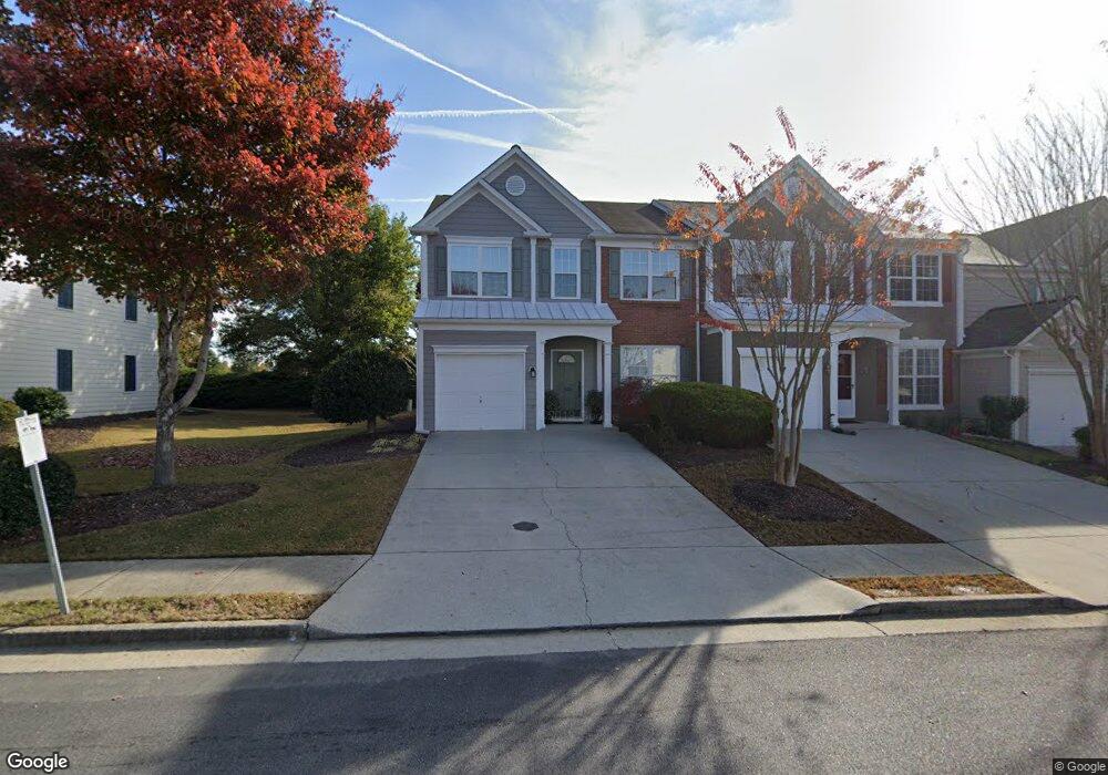
13121 Commonwealth Point Unit I Alpharetta, GA 30004
Estimated Value: $430,438 - $459,000
3
Beds
3
Baths
1,616
Sq Ft
$276/Sq Ft
Est. Value
About This Home
This home is located at 13121 Commonwealth Point Unit I, Alpharetta, GA 30004 and is currently estimated at $446,110, approximately $276 per square foot. 13121 Commonwealth Point Unit I is a home located in Fulton County with nearby schools including Hopewell Middle School, Cambridge High School, and Guidepost Montessori at Deerfield.
Ownership History
Date
Name
Owned For
Owner Type
Purchase Details
Closed on
Sep 17, 2001
Sold by
Pulte Home Corp
Bought by
Kleitz Jeffrey D
Current Estimated Value
Home Financials for this Owner
Home Financials are based on the most recent Mortgage that was taken out on this home.
Original Mortgage
$151,029
Outstanding Balance
$58,464
Interest Rate
6.89%
Mortgage Type
FHA
Estimated Equity
$387,646
Create a Home Valuation Report for This Property
The Home Valuation Report is an in-depth analysis detailing your home's value as well as a comparison with similar homes in the area
Home Values in the Area
Average Home Value in this Area
Purchase History
| Date | Buyer | Sale Price | Title Company |
|---|---|---|---|
| Kleitz Jeffrey D | $153,700 | -- | |
| Walsh Josephine W | $153,400 | -- |
Source: Public Records
Mortgage History
| Date | Status | Borrower | Loan Amount |
|---|---|---|---|
| Open | Walsh Josephine W | $151,029 | |
| Closed | Walsh Josephine W | $151,246 |
Source: Public Records
Tax History Compared to Growth
Tax History
| Year | Tax Paid | Tax Assessment Tax Assessment Total Assessment is a certain percentage of the fair market value that is determined by local assessors to be the total taxable value of land and additions on the property. | Land | Improvement |
|---|---|---|---|---|
| 2025 | $344 | $169,640 | $26,160 | $143,480 |
| 2023 | $4,441 | $157,320 | $29,480 | $127,840 |
| 2022 | $1,767 | $115,680 | $23,120 | $92,560 |
| 2021 | $1,756 | $105,840 | $16,000 | $89,840 |
| 2020 | $1,769 | $101,760 | $15,280 | $86,480 |
| 2019 | $324 | $99,960 | $15,000 | $84,960 |
| 2018 | $2,097 | $91,480 | $24,760 | $66,720 |
| 2017 | $1,639 | $68,120 | $9,560 | $58,560 |
| 2016 | $1,637 | $68,120 | $9,560 | $58,560 |
| 2015 | $1,895 | $68,120 | $9,560 | $58,560 |
| 2014 | $1,593 | $64,720 | $7,840 | $56,880 |
Source: Public Records
Map
Nearby Homes
- 834 Sandringham Dr
- 232 Edinburgh Ct
- 933 Sandringham Dr
- 916 Sandringham Dr
- 422 Pembrooke Cir Unit 422
- 3184 Buck Way
- 3301 Lathenview Ct
- 3313 Twinrose Place
- 840 Camelon Ct
- 13237 Aventide Ln
- 3070 Serenade Ct
- 650 Chantress Ct
- 3221 Serenade Ct
- 3533 Peacock Rd
- 13300 Morris Rd Unit 121
- 13300 Morris Rd Unit 4
- 13300 Morris Rd Unit 89
- 1095 S Bethany Creek Dr
- 3309 Bethany Bend
- 2215 Traywick Chase
- 13119 Commonwealth Point
- 13115 Commonwealth Point
- 13115 Commonwealth Point Unit 13115
- 13127 Commonwealth Point
- 13129 Commonwealth Point
- 13111 Commonwealth Point Unit VII
- 13131 Commonwealth Point
- 2999 Commonwealth Cir Unit I
- 13109 Commonwealth Point Unit 3
- 13109 Commonwealth Point Unit 13109
- 13133 Commonwealth Point Unit 13133
- 13133 Commonwealth Point
- 2997 Commonwealth Cir
- 3148 Commonwealth Way
- 3150 Commonwealth Way
- 13107 Commonwealth Point Unit 2
- 13107 Commonwealth Point Unit 13107
- 2995 Commonwealth Cir
- 2995 Commonwealth Cir Unit 1
- 2995 Commonwealth Cir Unit 2995