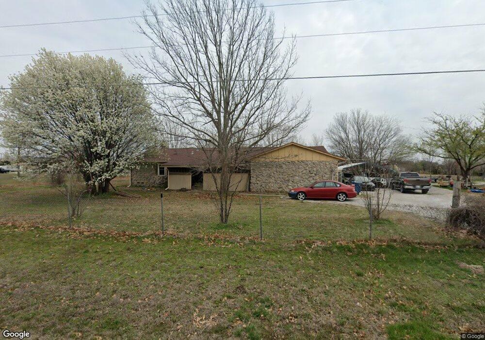
13121 N Memorial Dr Collinsville, OK 74021
Estimated Value: $206,000 - $393,000
--
Bed
1
Bath
2,007
Sq Ft
$157/Sq Ft
Est. Value
About This Home
This home is located at 13121 N Memorial Dr, Collinsville, OK 74021 and is currently estimated at $314,471, approximately $156 per square foot. 13121 N Memorial Dr is a home located in Tulsa County with nearby schools including Herald Elementary School, Collinsville Middle School, and Collinsville High School.
Ownership History
Date
Name
Owned For
Owner Type
Purchase Details
Closed on
Jul 15, 2015
Sold by
Vue Qhoua P and Vue Chao Y
Bought by
Vue James and Vue Luke
Current Estimated Value
Purchase Details
Closed on
May 24, 2006
Sold by
Federal National Mortgage Association
Bought by
Vue Qhoua P and Vue Chao Y
Home Financials for this Owner
Home Financials are based on the most recent Mortgage that was taken out on this home.
Original Mortgage
$86,330
Outstanding Balance
$50,284
Interest Rate
6.5%
Mortgage Type
Purchase Money Mortgage
Estimated Equity
$264,187
Create a Home Valuation Report for This Property
The Home Valuation Report is an in-depth analysis detailing your home's value as well as a comparison with similar homes in the area
Home Values in the Area
Average Home Value in this Area
Purchase History
| Date | Buyer | Sale Price | Title Company |
|---|---|---|---|
| Vue James | -- | Frisco Title Corp | |
| Vue Qhoua P | $89,000 | Frisco Title Corporation |
Source: Public Records
Mortgage History
| Date | Status | Borrower | Loan Amount |
|---|---|---|---|
| Open | Vue Qhoua P | $86,330 |
Source: Public Records
Tax History Compared to Growth
Tax History
| Year | Tax Paid | Tax Assessment Tax Assessment Total Assessment is a certain percentage of the fair market value that is determined by local assessors to be the total taxable value of land and additions on the property. | Land | Improvement |
|---|---|---|---|---|
| 2024 | $3,190 | $14,355 | $2,607 | $11,748 |
| 2023 | $1,595 | $14,007 | $2,544 | $11,463 |
| 2022 | $133 | $13,340 | $2,423 | $10,917 |
| 2021 | $127 | $12,704 | $2,607 | $10,097 |
| 2020 | $1,469 | $12,704 | $2,607 | $10,097 |
| 2019 | $1,447 | $12,704 | $2,607 | $10,097 |
| 2018 | $1,434 | $12,462 | $2,557 | $9,905 |
| 2017 | $1,460 | $11,869 | $2,607 | $9,262 |
| 2016 | $1,431 | $11,869 | $2,607 | $9,262 |
| 2015 | $1,333 | $11,869 | $2,607 | $9,262 |
| 2014 | $1,301 | $11,869 | $2,607 | $9,262 |
Source: Public Records
Map
Nearby Homes
- 8730 E 136th St N
- 13908 N 86th East Ave
- 12415 N 75th East Ave
- 10908 N Memorial
- 7010 E 137th St N
- 13514 N 97th East Ave
- 14109 N 72nd East Ave
- 14129 N 70th East Ave
- 14233 N 73rd East Ave
- 14250 N 72nd East Ave
- 14206 N 70th East Ave
- 14215 N 69th East Ave
- 14306 N 73rd East Ave
- 14256 N 71st East Ave
- 7502 E 144th Place N
- 0 N Sheridan Rd Unit 2545258
- Leighton Plan at Stone Lake
- Luna Plan at Stone Lake
- Phoenix Plan at Stone Lake
- Harper Plan at Stone Lake
- 13110 N Memorial Dr
- 13201 N Memorial Dr
- 13134 N Memorial Dr
- 13210 N Memorial Dr
- 8301 E 132nd St N
- 13089 N 83rd East Ave
- 13030 N Memorial Dr
- 7825 E 131st St N
- 13310 N 83rd East Ave
- 13306 N Memorial Dr
- 13321 N Memorial Dr
- 13229 N 83rd East Ave
- 12911 N Memorial Dr
- 8423 E 132nd St N
- 12910 N 83rd East Ave
- 12910 N Memorial Dr
- 12911 N 83rd East Ave
- 12915 N 83rd East Ave
- 12901 N Memorial Dr
- 8380 E 132nd St N