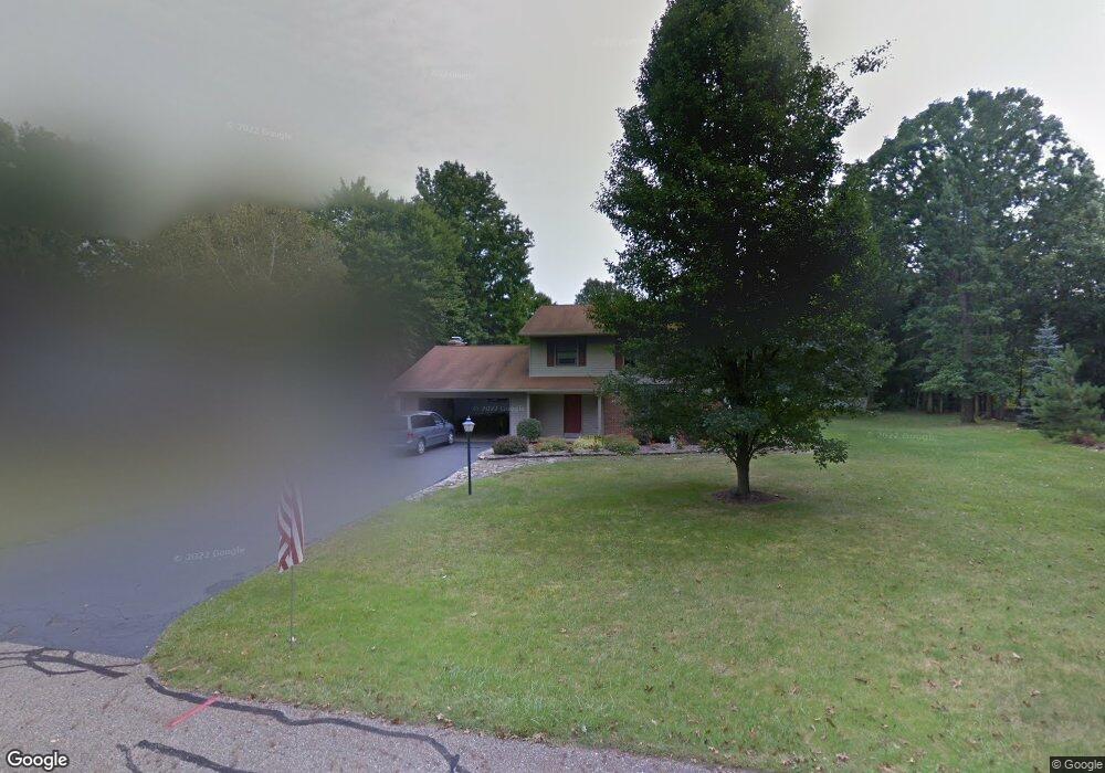
13122 Meadow St NE Alliance, OH 44601
Estimated Value: $285,000 - $297,000
4
Beds
3
Baths
1,868
Sq Ft
$155/Sq Ft
Est. Value
About This Home
This home is located at 13122 Meadow St NE, Alliance, OH 44601 and is currently estimated at $290,306, approximately $155 per square foot. 13122 Meadow St NE is a home located in Stark County with nearby schools including Marlington High School and Regina Coeli/St Joseph School.
Ownership History
Date
Name
Owned For
Owner Type
Purchase Details
Closed on
Apr 25, 2007
Sold by
Flint Tina L
Bought by
Flint Randall M
Current Estimated Value
Home Financials for this Owner
Home Financials are based on the most recent Mortgage that was taken out on this home.
Original Mortgage
$110,000
Outstanding Balance
$66,692
Interest Rate
6.2%
Mortgage Type
Purchase Money Mortgage
Estimated Equity
$223,614
Purchase Details
Closed on
Sep 21, 1993
Create a Home Valuation Report for This Property
The Home Valuation Report is an in-depth analysis detailing your home's value as well as a comparison with similar homes in the area
Home Values in the Area
Average Home Value in this Area
Purchase History
| Date | Buyer | Sale Price | Title Company |
|---|---|---|---|
| Flint Randall M | $38,500 | Attorney | |
| -- | $114,800 | -- |
Source: Public Records
Mortgage History
| Date | Status | Borrower | Loan Amount |
|---|---|---|---|
| Open | Flint Randall M | $110,000 |
Source: Public Records
Tax History Compared to Growth
Tax History
| Year | Tax Paid | Tax Assessment Tax Assessment Total Assessment is a certain percentage of the fair market value that is determined by local assessors to be the total taxable value of land and additions on the property. | Land | Improvement |
|---|---|---|---|---|
| 2025 | -- | $93,700 | $26,500 | $67,200 |
| 2024 | -- | $93,700 | $26,500 | $67,200 |
| 2023 | $2,328 | $66,120 | $14,070 | $52,050 |
| 2022 | $2,337 | $66,120 | $14,070 | $52,050 |
| 2021 | $2,344 | $66,120 | $14,070 | $52,050 |
| 2020 | $2,272 | $57,090 | $12,150 | $44,940 |
| 2019 | $2,256 | $57,090 | $12,150 | $44,940 |
| 2018 | $2,259 | $57,090 | $12,150 | $44,940 |
| 2017 | $2,133 | $50,450 | $11,560 | $38,890 |
| 2016 | $2,133 | $50,450 | $11,560 | $38,890 |
| 2015 | $2,031 | $50,450 | $11,560 | $38,890 |
| 2014 | $1,853 | $42,040 | $9,630 | $32,410 |
| 2013 | $921 | $42,040 | $9,630 | $32,410 |
Source: Public Records
Map
Nearby Homes
- 13334 Cindy St NE
- 0 Meadow St NE
- 13061 Beeson St NE
- 10666 Wilma Ave NE
- 11480 Aebi Ave NE
- 0 W Main St Unit 5090123
- 000 Klinger Ave
- 11940 Freshley Ave NE
- 11960 Freshley Ave NE
- 13109 Edison St NE
- 0 Klinger Ave NE
- 432 Johnson Ave
- 1430 Westwood Ave
- 12355 Edison St NE
- 2081 Marwood Cir
- 0 Johnson Ave NE Unit 5142926
- 14422 Sturbridge Rd NE
- 0 Meadowbrook Ave
- 0 Homestead Ave NE
- 565 W Broadway St
- 13130 Meadow St NE
- 10777 Julie St NE
- 10795 Julie St NE
- 13138 Meadow St NE
- 13123 Meadow St NE
- 10815 Julie St NE
- 13133 Meadow St NE
- 13146 Meadow St NE
- 13139 Meadow St NE
- 10837 Julie St NE
- 13147 Meadow St NE
- 13154 Meadow St NE
- 10796 Julie St NE
- 10855 Julie St NE
- 10814 Julie St NE
- 10728 Julie St NE
- 13155 Meadow St NE
- 13166 Meadow St NE
- 10836 Julie St NE
- 10877 Julie St NE