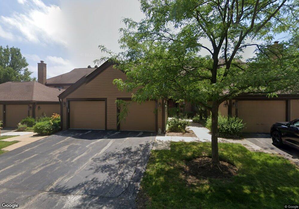
1313 Bristol Ln Unit N3 Buffalo Grove, IL 60089
Estimated Value: $330,700 - $366,000
--
Bed
2
Baths
1,477
Sq Ft
$239/Sq Ft
Est. Value
About This Home
This home is located at 1313 Bristol Ln Unit N3, Buffalo Grove, IL 60089 and is currently estimated at $353,675, approximately $239 per square foot. 1313 Bristol Ln Unit N3 is a home located in Lake County with nearby schools including Kildeer Countryside Elementary School, Woodlawn Middle School, and Adlai E Stevenson High School.
Ownership History
Date
Name
Owned For
Owner Type
Purchase Details
Closed on
Nov 1, 2017
Sold by
Mcguinn Stephen
Bought by
Mcguinn Kathleen
Current Estimated Value
Purchase Details
Closed on
Dec 8, 2000
Sold by
Dimaggio Mary Susan
Bought by
Mcguinn Stephen and Mcguinn Kathleen
Create a Home Valuation Report for This Property
The Home Valuation Report is an in-depth analysis detailing your home's value as well as a comparison with similar homes in the area
Home Values in the Area
Average Home Value in this Area
Purchase History
| Date | Buyer | Sale Price | Title Company |
|---|---|---|---|
| Mcguinn Kathleen | -- | None Available | |
| Mcguinn Stephen | $168,500 | -- |
Source: Public Records
Tax History Compared to Growth
Tax History
| Year | Tax Paid | Tax Assessment Tax Assessment Total Assessment is a certain percentage of the fair market value that is determined by local assessors to be the total taxable value of land and additions on the property. | Land | Improvement |
|---|---|---|---|---|
| 2024 | $8,939 | $92,355 | $24,156 | $68,199 |
| 2023 | $8,788 | $87,144 | $22,793 | $64,351 |
| 2022 | $8,788 | $84,277 | $22,043 | $62,234 |
| 2021 | $8,459 | $83,368 | $21,805 | $61,563 |
| 2020 | $8,258 | $83,652 | $21,879 | $61,773 |
| 2019 | $8,141 | $83,343 | $21,798 | $61,545 |
| 2018 | $5,907 | $62,324 | $23,694 | $38,630 |
| 2017 | $5,798 | $60,869 | $23,141 | $37,728 |
| 2016 | $5,659 | $58,287 | $22,159 | $36,128 |
| 2015 | $5,529 | $54,510 | $20,723 | $33,787 |
| 2014 | $6,050 | $58,790 | $22,256 | $36,534 |
| 2012 | $5,962 | $58,908 | $22,301 | $36,607 |
Source: Public Records
Map
Nearby Homes
- 1357 Bristol Ln Unit Q4
- 1324 Fairfax Ln Unit B32
- 1325 Fairfax Ln
- 5107 N Arlington Heights Rd
- 1032 Courtland Dr Unit 9
- 12 Cloverdale Ct
- 887 Saybrook Ln Unit 2
- 950 Belmar Ln
- 1514 Sumter Dr
- 890 Knollwood Dr
- 1141 Devonshire Rd
- 1265 Devonshire Rd
- 800 Clohesey Dr
- 1545 Chickamauga Ln
- 931 Shady Grove Ln
- 1242 Antietam Dr
- 327 Lasalle Ln
- 1728 Holly Ct
- 5255 Danbury Ct
- 614 Lyon Ct
- 1309 Bristol Ln Unit N4
- 1317 Bristol Ln Unit N2
- 1305 Bristol Ln Unit N5
- 1301 Bristol Ln Unit N6
- 1058 Fremont Ct W Unit E8
- 1064 Fremont Ct W Unit E5
- 1068 Fremont Ct W Unit E3
- 1070 Fremont Ct W Unit E2
- 1072 Fremont Ct W Unit E1
- 1064 Fremont Ct W
- 1291 Farnsworth Ln Unit O4
- 1295 Farnsworth Ln Unit O3
- 1295 Farnsworth Ln
- 1287 Farnsworth Ln Unit O5
- 1297 Bristol Ln Unit M1
- 1299 Farnsworth Ln Unit O2
- 1283 Farnsworth Ln Unit O6
- 1325 Bristol Ln Unit O1
- 1279 Farnsworth Ln Unit O7
- 1293 Bristol Ln Unit M2