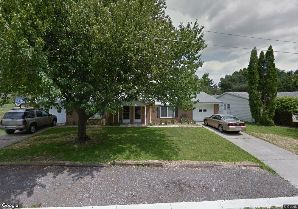
1313 Knapp Rd Mansfield, OH 44907
Estimated Value: $177,000 - $219,843
3
Beds
4
Baths
2,664
Sq Ft
$77/Sq Ft
Est. Value
About This Home
This home is located at 1313 Knapp Rd, Mansfield, OH 44907 and is currently estimated at $205,711, approximately $77 per square foot. 1313 Knapp Rd is a home located in Richland County with nearby schools including Lexington High School, Mansfield Christian School, and Discovery School.
Ownership History
Date
Name
Owned For
Owner Type
Purchase Details
Closed on
Apr 10, 2024
Sold by
Ward Irrevocable Heritage Trust and Balyeat Kelly D
Bought by
Partin Rentals Llc
Current Estimated Value
Home Financials for this Owner
Home Financials are based on the most recent Mortgage that was taken out on this home.
Original Mortgage
$152,700
Outstanding Balance
$149,881
Interest Rate
6.94%
Mortgage Type
Construction
Estimated Equity
$55,830
Purchase Details
Closed on
Dec 19, 2022
Sold by
Ward Wayne W
Bought by
Ward Irrevocable Heritage Trust
Purchase Details
Closed on
Jun 23, 2014
Sold by
Ward Charles D
Bought by
Balyeat Kelly D and Pinnow Melanie S
Create a Home Valuation Report for This Property
The Home Valuation Report is an in-depth analysis detailing your home's value as well as a comparison with similar homes in the area
Home Values in the Area
Average Home Value in this Area
Purchase History
| Date | Buyer | Sale Price | Title Company |
|---|---|---|---|
| Partin Rentals Llc | $160,000 | Southern Title | |
| Ward Irrevocable Heritage Trust | -- | -- | |
| Ward Irrevocable Heritage Trust | -- | None Listed On Document | |
| Balyeat Kelly D | -- | None Available |
Source: Public Records
Mortgage History
| Date | Status | Borrower | Loan Amount |
|---|---|---|---|
| Open | Partin Rentals Llc | $152,700 |
Source: Public Records
Tax History
| Year | Tax Paid | Tax Assessment Tax Assessment Total Assessment is a certain percentage of the fair market value that is determined by local assessors to be the total taxable value of land and additions on the property. | Land | Improvement |
|---|---|---|---|---|
| 2024 | $2,764 | $55,260 | $8,720 | $46,540 |
| 2023 | $2,764 | $55,260 | $8,720 | $46,540 |
| 2022 | $2,271 | $39,100 | $6,930 | $32,170 |
| 2021 | $2,279 | $39,100 | $6,930 | $32,170 |
| 2020 | $2,280 | $39,100 | $6,930 | $32,170 |
| 2019 | $2,095 | $33,130 | $5,870 | $27,260 |
| 2018 | $1,791 | $33,130 | $5,870 | $27,260 |
| 2017 | $1,772 | $33,130 | $5,870 | $27,260 |
| 2016 | $2,197 | $40,270 | $7,550 | $32,720 |
| 2015 | $2,195 | $40,270 | $7,550 | $32,720 |
| 2014 | $2,195 | $40,270 | $7,550 | $32,720 |
| 2012 | $1,090 | $42,390 | $7,950 | $34,440 |
Source: Public Records
Map
Nearby Homes
- 680 Weller Ave
- 1689 Middle Bellville Rd
- 1702 Middle Bellville Rd
- 0 Rippling Brook Dr
- 0 Lexington Ave Unit 224009661
- 489 Clifton Blvd
- 635 Karlson Dr
- 601 Karlson Dr
- 615 Bailey Dr
- 763 York St W
- 755 Locust Ln
- 1521 Cape Cod Dr
- 1179 Burkwood Rd
- 1510 Cape Cod Dr Unit 1504
- 986 Woodland Rd
- 594 Dirlam Ln
- 400 James Ave
- 1326 Rosedale Dr
- 1490 Hess Cir
- 810 Lexington Ave
Your Personal Tour Guide
Ask me questions while you tour the home.