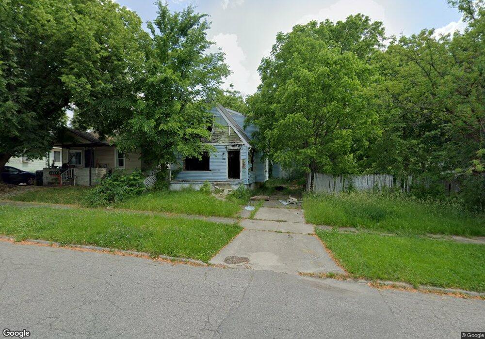
1313 Knight Ave Flint, MI 48503
Chevrolet NeighborhoodEstimated Value: $46,000 - $48,000
3
Beds
1
Bath
726
Sq Ft
$65/Sq Ft
Est. Value
About This Home
This home is located at 1313 Knight Ave, Flint, MI 48503 and is currently estimated at $47,000, approximately $64 per square foot. 1313 Knight Ave is a home located in Genesee County with nearby schools including Durant-Tuuri-Mott Elementary School, Flint Southwestern Classical Academy, and St. Paul Lutheran School.
Ownership History
Date
Name
Owned For
Owner Type
Purchase Details
Closed on
Dec 19, 2019
Sold by
Cherry Deborah L
Bought by
County Land Bank Authority
Current Estimated Value
Purchase Details
Closed on
Feb 22, 2016
Sold by
Robinson Dorothy M
Bought by
Quezada Leonel G
Home Financials for this Owner
Home Financials are based on the most recent Mortgage that was taken out on this home.
Original Mortgage
$35,800
Interest Rate
3.79%
Mortgage Type
Seller Take Back
Purchase Details
Closed on
May 15, 2009
Sold by
Bristol Albert L
Bought by
Robinson Dorothy
Create a Home Valuation Report for This Property
The Home Valuation Report is an in-depth analysis detailing your home's value as well as a comparison with similar homes in the area
Home Values in the Area
Average Home Value in this Area
Purchase History
| Date | Buyer | Sale Price | Title Company |
|---|---|---|---|
| County Land Bank Authority | -- | None Available | |
| Quezada Leonel G | $37,000 | None Available | |
| Robinson Dorothy | $14,000 | Sky Title Agency |
Source: Public Records
Mortgage History
| Date | Status | Borrower | Loan Amount |
|---|---|---|---|
| Previous Owner | Quezada Leonel G | $35,800 |
Source: Public Records
Tax History Compared to Growth
Tax History
| Year | Tax Paid | Tax Assessment Tax Assessment Total Assessment is a certain percentage of the fair market value that is determined by local assessors to be the total taxable value of land and additions on the property. | Land | Improvement |
|---|---|---|---|---|
| 2025 | -- | $0 | $0 | $0 |
| 2024 | -- | $0 | $0 | $0 |
| 2023 | -- | $0 | $0 | $0 |
| 2022 | $0 | $0 | $0 | $0 |
| 2021 | $0 | $0 | $0 | $0 |
| 2020 | $268 | $0 | $0 | $0 |
| 2019 | $2,013 | $7,200 | $0 | $0 |
| 2018 | $724 | $7,200 | $0 | $0 |
| 2017 | $1,009 | $0 | $0 | $0 |
| 2016 | $788 | $0 | $0 | $0 |
| 2015 | -- | $0 | $0 | $0 |
| 2014 | -- | $0 | $0 | $0 |
| 2012 | -- | $11,200 | $0 | $0 |
Source: Public Records
Map
Nearby Homes
- 1326 Hughes Ave
- 1126 Clancy Ave
- 1318 Knapp Ave
- 1114 Clancy Ave
- 1414 Knapp Ave
- 1202 Knapp Ave
- 1122 Stocker Ave
- 3217 Arlene Ave
- 2913 Gibson St
- 1017 Stocker Ave
- 1217 Barney Ave
- 1010 Hughes Ave
- 2710 Reynolds St
- 3214 Clairmont St
- 2926 Yale St
- 1308 Barney Ave
- 2618 Brown St
- 1006 Hammond Ave
- 2608 Cumings Ave
- 3413 Augusta St
- 1309 Knight Ave
- 1305 Knight Ave
- 1321 Knight Ave
- 1310 Clancy Ave
- 1301 Knight Ave
- 1325 Knight Ave
- 1306 Clancy Ave
- 1322 Clancy Ave
- 1302 Clancy Ave
- 1318 Knight Ave
- 1330 Clancy Ave
- 2901 Brown St
- 1322 Knight Ave
- 1401 Knight Ave
- 1314 Knight Ave
- 2816 Brown St
- 1402 Clancy Ave
- 1405 Knight Ave
- 1330 Knight Ave
- 1222 Clancy Ave