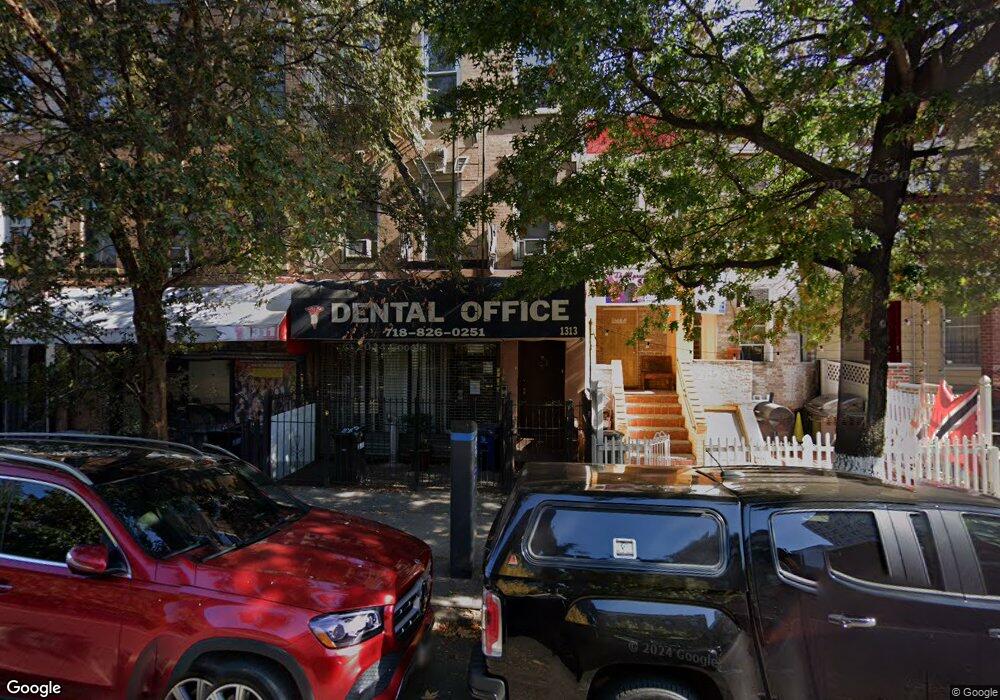
1313 Nostrand Ave Brooklyn, NY 11226
Flatbush Neighborhood
3
Beds
1
Bath
3,400
Sq Ft
1,623
Acres
About This Home
This home is located at 1313 Nostrand Ave, Brooklyn, NY 11226. 1313 Nostrand Ave is a home located in Kings County with nearby schools including P.S. 397 Foster Laurie, Parkside Preparatory Academy, and Explore Charter School.
Ownership History
Date
Name
Owned For
Owner Type
Purchase Details
Closed on
Mar 29, 2002
Sold by
Smith Doris D
Bought by
Milord Lesly
Home Financials for this Owner
Home Financials are based on the most recent Mortgage that was taken out on this home.
Original Mortgage
$282,765
Outstanding Balance
$117,554
Interest Rate
6.85%
Mortgage Type
Commercial
Purchase Details
Closed on
May 28, 1998
Sold by
New York City Housing Authority
Bought by
Smith Doris D
Home Financials for this Owner
Home Financials are based on the most recent Mortgage that was taken out on this home.
Original Mortgage
$167,100
Interest Rate
6.92%
Mortgage Type
FHA
Create a Home Valuation Report for This Property
The Home Valuation Report is an in-depth analysis detailing your home's value as well as a comparison with similar homes in the area
Home Values in the Area
Average Home Value in this Area
Purchase History
| Date | Buyer | Sale Price | Title Company |
|---|---|---|---|
| Milord Lesly | -- | -- | |
| Milord Lesly | -- | -- | |
| Smith Doris D | $67,500 | United General Title Ins Co | |
| Smith Doris D | $67,500 | United General Title Ins Co |
Source: Public Records
Mortgage History
| Date | Status | Borrower | Loan Amount |
|---|---|---|---|
| Open | Milord Lesly | $282,765 | |
| Closed | Milord Lesly | $282,765 | |
| Previous Owner | Smith Doris D | $167,100 |
Source: Public Records
Tax History Compared to Growth
Tax History
| Year | Tax Paid | Tax Assessment Tax Assessment Total Assessment is a certain percentage of the fair market value that is determined by local assessors to be the total taxable value of land and additions on the property. | Land | Improvement |
|---|---|---|---|---|
| 2025 | $4,271 | $72,660 | $20,040 | $52,620 |
| 2024 | $4,271 | $72,000 | $20,040 | $51,960 |
| 2023 | $4,074 | $63,660 | $20,040 | $43,620 |
| 2022 | $4,005 | $49,980 | $20,040 | $29,940 |
| 2021 | $4,151 | $45,060 | $20,040 | $25,020 |
| 2020 | $3,113 | $44,880 | $20,040 | $24,840 |
| 2019 | $3,707 | $44,880 | $20,040 | $24,840 |
| 2018 | $3,408 | $16,718 | $8,963 | $7,755 |
| 2017 | $3,408 | $16,718 | $9,611 | $7,107 |
| 2016 | $3,286 | $16,435 | $8,037 | $8,398 |
| 2015 | $1,902 | $15,653 | $8,557 | $7,096 |
| 2014 | $1,902 | $14,767 | $9,467 | $5,300 |
Source: Public Records
Map
Nearby Homes
- 310 Lenox Rd Unit 4J
- 310 Lenox Rd Unit 4-S
- 310 Lenox Rd Unit 3T
- 310 Lenox Rd Unit 4U
- 1363 Nostrand Ave
- 330 Lenox Rd Unit 4T
- 330 Lenox Rd Unit 6S
- 1281 Nostrand Ave
- 1406 Nostrand Ave
- 688 Rogers Ave
- 291 Martense St Unit 4M
- 258 Winthrop St Unit 4A
- 335 Martense St
- 355 Winthrop St
- 590 Parkside Ave Unit 2BE
- 590 Parkside Ave Unit 2CE
- 358 Linden Blvd
- 208 E 34th St
- 388 Fenimore St
- 220 E 34th St
- 1311 Nostrand Ave
- 1317 Nostrand Ave
- 1309 Nostrand Ave
- 1319 Nostrand Ave
- 1321 Nostrand Ave
- 1307 Nostrand Ave
- 1307 Nostrand Ave Unit 4
- 1307 Nostrand Ave Unit 3
- 1307 Nostrand Ave Unit 3
- 1307 Nostrand Ave Unit 2
- 1307 Nostrand Ave Unit 4
- 1323 Nostrand Ave
- 1323 Nostrand Ave Unit 1
- 1305 Nostrand Ave Unit 1
- 1305 Nostrand Ave
- 1303 Nostrand Ave
- 297 Lenox Rd
- 1337 Nostrand Ave Unit 4E
- 1337 Nostrand Ave Unit 2D
- 1337 Nostrand Ave Unit 4C