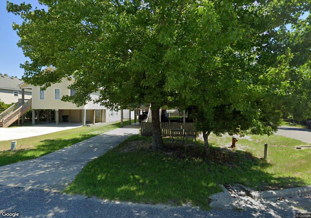
1313 Percy St Kill Devil Hills, NC 27948
Estimated Value: $417,711 - $503,000
3
Beds
2
Baths
1,144
Sq Ft
$406/Sq Ft
Est. Value
About This Home
This home is located at 1313 Percy St, Kill Devil Hills, NC 27948 and is currently estimated at $464,678, approximately $406 per square foot. 1313 Percy St is a home located in Dare County with nearby schools including Nags Head Elementary School, Manteo Middle School, and Manteo High School.
Ownership History
Date
Name
Owned For
Owner Type
Purchase Details
Closed on
Mar 23, 2015
Sold by
Conch Ii Llc
Bought by
Conch Llc
Current Estimated Value
Purchase Details
Closed on
Mar 18, 2005
Sold by
Stan Clough Renovation & Construction Ll
Bought by
Dickens Colleen A
Home Financials for this Owner
Home Financials are based on the most recent Mortgage that was taken out on this home.
Original Mortgage
$299,200
Interest Rate
5.79%
Mortgage Type
New Conventional
Create a Home Valuation Report for This Property
The Home Valuation Report is an in-depth analysis detailing your home's value as well as a comparison with similar homes in the area
Home Values in the Area
Average Home Value in this Area
Purchase History
| Date | Buyer | Sale Price | Title Company |
|---|---|---|---|
| Conch Llc | -- | None Available | |
| Dickens Colleen A | $249,000 | None Available |
Source: Public Records
Mortgage History
| Date | Status | Borrower | Loan Amount |
|---|---|---|---|
| Previous Owner | Dickens Colleen A | $299,200 |
Source: Public Records
Tax History Compared to Growth
Tax History
| Year | Tax Paid | Tax Assessment Tax Assessment Total Assessment is a certain percentage of the fair market value that is determined by local assessors to be the total taxable value of land and additions on the property. | Land | Improvement |
|---|---|---|---|---|
| 2025 | $2,058 | $370,300 | $140,700 | $229,600 |
| 2024 | $1,876 | $241,500 | $71,300 | $170,200 |
| 2023 | $1,876 | $248,308 | $71,300 | $177,008 |
| 2022 | $1,789 | $248,308 | $71,300 | $177,008 |
| 2021 | $1,789 | $248,308 | $71,300 | $177,008 |
| 2020 | $1,740 | $241,500 | $71,300 | $170,200 |
| 2019 | $1,565 | $179,900 | $57,800 | $122,100 |
| 2018 | $1,531 | $179,900 | $57,800 | $122,100 |
| 2017 | $1,531 | $179,900 | $57,800 | $122,100 |
| 2016 | $1,459 | $179,900 | $57,800 | $122,100 |
| 2014 | $1,405 | $179,900 | $57,800 | $122,100 |
Source: Public Records
Map
Nearby Homes
- 0 W Martin St
- 200 Quail Ln Unit Lot
- 301 W Ocean Acres Dr
- 205 W Atlantic St Unit Lot 3
- 0 10th Ave Unit Lot 2R 130569
- 311 Gunas Dr Unit 17
- 311 Gunas Dr
- 0 W Boundary St Unit Lot 1-R 130568
- 302 W Clark St Unit Lot 6
- 1511 Wrightsville Blvd Unit Lot 64
- 803 6th Ave Unit Lot 9
- 1209 Wrightsville Blvd Unit Lot 26
- 108 E Fresh Pond Dr Unit 24
- 209 E Fresh Pond Dr Unit Lot 10
- 305 E Martin St Unit Lot 25
- 1401 S Virginia Dare Trail Unit 10
- 1401 S Virginia Dare Trail Unit 12
- 2010 S Virginia Dare Trail Unit 104
- 2009 Wrightsville Blvd Unit 1-B
- 2009 Wrightsville Blvd Unit 4-B
- 1311 Percy St Unit 10
- 1311 Percy St
- 1309 Percy St
- 1312 Elizabeth St Unit 6
- 1312 Elizabeth St
- 1310 Elizabeth St Unit 5
- 1310 Elizabeth St
- 707 Holly St
- 1401 Percy St
- 1312 Percy St
- 1307 Percy St
- 705 Holly St
- 1310 Percy St Unit 4
- 1310 Percy St
- 703 Holly St
- 1308 Elizabeth St
- 1306 Elizabeth St Unit 3
- 1306 Elizabeth St
- 1308 Percy St Unit 3
- 1308 Percy St