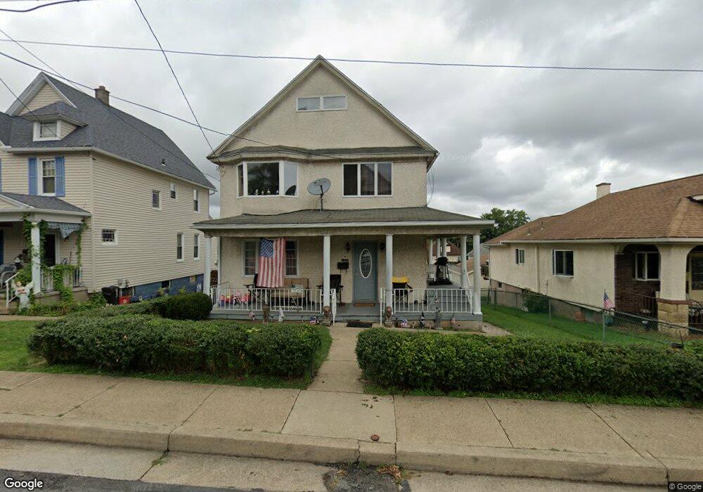
1314 Farr St Scranton, PA 18504
Hyde Park NeighborhoodEstimated Value: $113,000 - $204,000
4
Beds
2
Baths
1,600
Sq Ft
$108/Sq Ft
Est. Value
About This Home
This home is located at 1314 Farr St, Scranton, PA 18504 and is currently estimated at $173,333, approximately $108 per square foot. 1314 Farr St is a home located in Lackawanna County with nearby schools including Longan Elementary School, Adams Elementary School, and Isaac Tripp Elementary School.
Ownership History
Date
Name
Owned For
Owner Type
Purchase Details
Closed on
Feb 15, 2021
Sold by
Firestone Kathleen and Fox Kathleen Firestone
Bought by
Krah Robert C and Krah Tracylynn M
Current Estimated Value
Purchase Details
Closed on
Apr 25, 2005
Sold by
Kovach Mary Lou and Baldassari Louis
Bought by
Barros Orlando J and Rojas Nora C
Home Financials for this Owner
Home Financials are based on the most recent Mortgage that was taken out on this home.
Original Mortgage
$89,300
Interest Rate
5.95%
Mortgage Type
New Conventional
Create a Home Valuation Report for This Property
The Home Valuation Report is an in-depth analysis detailing your home's value as well as a comparison with similar homes in the area
Home Values in the Area
Average Home Value in this Area
Purchase History
| Date | Buyer | Sale Price | Title Company |
|---|---|---|---|
| Krah Robert C | $25,487 | None Available | |
| Barros Orlando J | $94,000 | None Available |
Source: Public Records
Mortgage History
| Date | Status | Borrower | Loan Amount |
|---|---|---|---|
| Previous Owner | Barros Orlando J | $89,300 |
Source: Public Records
Tax History Compared to Growth
Tax History
| Year | Tax Paid | Tax Assessment Tax Assessment Total Assessment is a certain percentage of the fair market value that is determined by local assessors to be the total taxable value of land and additions on the property. | Land | Improvement |
|---|---|---|---|---|
| 2025 | $2,114 | $6,500 | $1,150 | $5,350 |
| 2024 | $1,933 | $6,500 | $1,150 | $5,350 |
| 2023 | $1,933 | $6,500 | $1,150 | $5,350 |
| 2022 | $1,891 | $6,500 | $1,150 | $5,350 |
| 2021 | $1,891 | $6,500 | $1,150 | $5,350 |
| 2020 | $1,856 | $6,500 | $1,150 | $5,350 |
| 2019 | $1,746 | $6,500 | $1,150 | $5,350 |
| 2018 | $1,746 | $6,500 | $1,150 | $5,350 |
| 2017 | $1,716 | $6,500 | $1,150 | $5,350 |
| 2016 | $538 | $6,500 | $1,150 | $5,350 |
| 2015 | $1,291 | $6,500 | $1,150 | $5,350 |
| 2014 | -- | $6,500 | $1,150 | $5,350 |
Source: Public Records
Map
Nearby Homes
- 1126 W Gibson St
- 1431 Dorothy St
- 991 N Sumner Ave Unit 1/2 L 13
- 833 Powderly Ct
- 1425 Bulwer St
- 1327 Oram St
- 1008 Mount Vernon Ave
- 1501 Farr St
- 1727 Dorothy St
- 638 N Lincoln Ave
- 942 Providence Rd
- 938 Providence Rd
- 1123 Court St
- 1102 Pettibone St
- 602 604 N Lincoln Ave
- 607 N Main Ave Unit 607-09
- 535 N Hyde Park Ave
- 1235 N Sumner Ave
- 525 N Hyde Park Ave
- 1227 Providence Rd