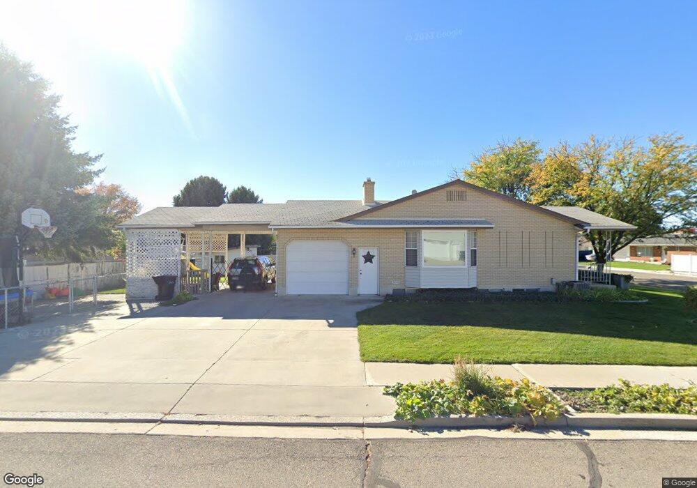
1314 Oquirrh Dr Provo, UT 84604
Grandview South NeighborhoodEstimated Value: $456,000 - $595,000
2
Beds
2
Baths
1,476
Sq Ft
$363/Sq Ft
Est. Value
About This Home
This home is located at 1314 Oquirrh Dr, Provo, UT 84604 and is currently estimated at $536,355, approximately $363 per square foot. 1314 Oquirrh Dr is a home located in Utah County with nearby schools including Westridge Elementary School, Dixon Middle School, and Provo High School.
Ownership History
Date
Name
Owned For
Owner Type
Purchase Details
Closed on
May 16, 2013
Sold by
Hale Janice Evelyn Blake and Blake John Thomas
Bought by
Andersen Troy J and Andersen Heidi M
Current Estimated Value
Home Financials for this Owner
Home Financials are based on the most recent Mortgage that was taken out on this home.
Original Mortgage
$175,750
Outstanding Balance
$124,650
Interest Rate
3.5%
Mortgage Type
New Conventional
Estimated Equity
$411,705
Purchase Details
Closed on
Mar 14, 2007
Sold by
Blake Joseph T
Bought by
Blake Joseph T and Joseph T & Grace E Blake Irrevocable Tr
Create a Home Valuation Report for This Property
The Home Valuation Report is an in-depth analysis detailing your home's value as well as a comparison with similar homes in the area
Home Values in the Area
Average Home Value in this Area
Purchase History
| Date | Buyer | Sale Price | Title Company |
|---|---|---|---|
| Andersen Troy J | -- | Security Title And Abstract | |
| Blake Joseph T | -- | Quality Title |
Source: Public Records
Mortgage History
| Date | Status | Borrower | Loan Amount |
|---|---|---|---|
| Open | Andersen Troy J | $175,750 |
Source: Public Records
Tax History Compared to Growth
Tax History
| Year | Tax Paid | Tax Assessment Tax Assessment Total Assessment is a certain percentage of the fair market value that is determined by local assessors to be the total taxable value of land and additions on the property. | Land | Improvement |
|---|---|---|---|---|
| 2025 | $2,479 | $266,915 | $174,800 | $310,500 |
| 2024 | $2,479 | $244,035 | $0 | $0 |
| 2023 | $2,502 | $242,770 | $0 | $0 |
| 2022 | $2,727 | $266,860 | $0 | $0 |
| 2021 | $2,104 | $359,100 | $110,900 | $248,200 |
| 2020 | $2,028 | $324,400 | $100,800 | $223,600 |
| 2019 | $1,927 | $320,600 | $100,800 | $219,800 |
| 2018 | $1,716 | $289,600 | $93,600 | $196,000 |
| 2017 | $1,524 | $141,295 | $0 | $0 |
| 2016 | $1,387 | $119,845 | $0 | $0 |
| 2015 | $1,242 | $108,460 | $0 | $0 |
| 2014 | $1,035 | $94,215 | $0 | $0 |
Source: Public Records
Map
Nearby Homes
- 1503 N 1980 W
- 1127 Independence Ave
- 2043 W 1100 N
- 932 N 1760 W
- 1620 W 1000 N
- 2075 W 1080 N
- 1471 W 1460 N
- 927 Independence Ave
- 1616 N 2100 W
- 1375 W 1460 N
- 1662 N 2250 W
- 1682 N 2250 W
- 1679 N 2250 W
- 2397 W 1160 N
- 1525 N 1250 W
- 2056 S 160 E
- 1188 W 1380 N
- 1451 Arthur Dr
- 1516 W 1970 N
- 1454 Lancelot Dr Unit 6F
- 1292 Oquirrh Dr
- 1847 Teton Dr
- 1291 Wasatch Dr
- 1339 N 1850 W
- 1901 Teton Dr
- 1295 Oquirrh Dr
- 1266 Oquirrh Dr
- 1344 N 1850 W
- 1267 Wasatch Dr
- 1904 Teton Dr
- 1265 Oquirrh Dr
- 985 N 1880 W Unit 8
- 1011 N 1880 W Unit 2
- 1062 N 1880 W
- 1054 N 1880 W Unit 41
- 1048 N 1880 W Unit 40
- 931 N 1880 W
- 1913 Teton Dr
- 1875 W 1380 N
- 1822 Teton Dr