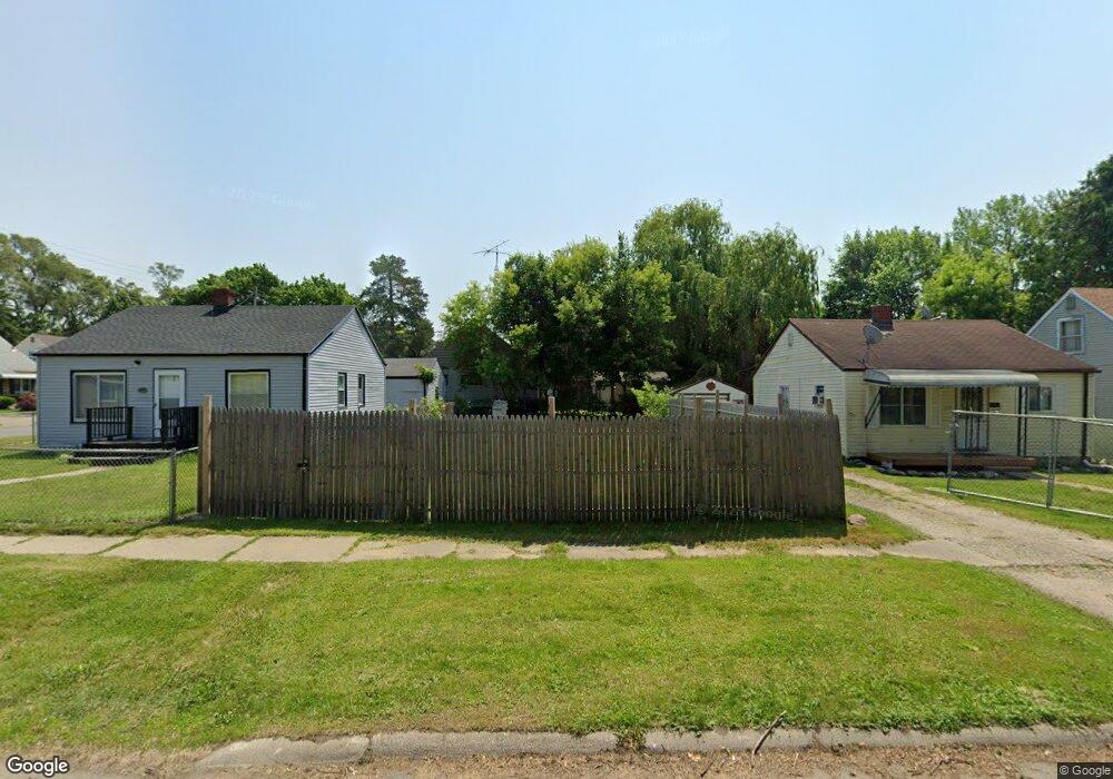
1314 Sutton Ave Flint, MI 48504
Ballenger Highway NeighborhoodEstimated Value: $49,000 - $174,000
2
Beds
1
Bath
808
Sq Ft
$112/Sq Ft
Est. Value
About This Home
This home is located at 1314 Sutton Ave, Flint, MI 48504 and is currently estimated at $90,621, approximately $112 per square foot. 1314 Sutton Ave is a home located in Genesee County with nearby schools including Durant-Tuuri-Mott Elementary School, Greater Heights Academy, and St. Paul Lutheran School.
Ownership History
Date
Name
Owned For
Owner Type
Purchase Details
Closed on
Jan 4, 2021
Sold by
Genesee County Land Bank Authority
Bought by
Willie-Mae Mildred
Current Estimated Value
Purchase Details
Closed on
Nov 14, 2013
Sold by
Genesee County Land Bank Authority
Bought by
State Of Michigan
Purchase Details
Closed on
Nov 13, 2013
Sold by
State Of Michigan
Bought by
Genesee County Land Bank Authority
Purchase Details
Closed on
Dec 22, 2010
Sold by
Genesee County Treasurer
Bought by
Genesee County Land Bank
Purchase Details
Closed on
Jan 29, 1999
Sold by
Hensley Traci E
Bought by
Faber Kenneth L
Create a Home Valuation Report for This Property
The Home Valuation Report is an in-depth analysis detailing your home's value as well as a comparison with similar homes in the area
Home Values in the Area
Average Home Value in this Area
Purchase History
| Date | Buyer | Sale Price | Title Company |
|---|---|---|---|
| Willie-Mae Mildred | $225 | None Listed On Document | |
| State Of Michigan | -- | None Available | |
| Genesee County Land Bank Authority | -- | None Available | |
| Genesee County Land Bank | -- | None Available | |
| Faber Kenneth L | $24,900 | Sargents Abstract & Title Co | |
| Hensley Traci E | $18,500 | Sargents Abstract & Title Co |
Source: Public Records
Tax History
| Year | Tax Paid | Tax Assessment Tax Assessment Total Assessment is a certain percentage of the fair market value that is determined by local assessors to be the total taxable value of land and additions on the property. | Land | Improvement |
|---|---|---|---|---|
| 2025 | $196 | $2,300 | $0 | $0 |
| 2024 | $183 | $2,000 | $0 | $0 |
| 2023 | $116 | $1,800 | $0 | $0 |
| 2022 | $0 | $1,700 | $0 | $0 |
| 2021 | $0 | $0 | $0 | $0 |
| 2020 | $0 | $0 | $0 | $0 |
| 2019 | $0 | $0 | $0 | $0 |
| 2018 | $0 | $0 | $0 | $0 |
| 2017 | $0 | $0 | $0 | $0 |
| 2016 | $0 | $0 | $0 | $0 |
| 2015 | -- | $0 | $0 | $0 |
| 2014 | -- | $0 | $0 | $0 |
| 2012 | -- | $0 | $0 | $0 |
Source: Public Records
Map
Nearby Homes
- 2944 Wolcott St
- 0 Donaldson St
- 3101 Barth St
- 2915 Berkley St
- 1133 Donaldson St
- 2902 Prospect St
- 3021 Clement St
- 3310 Concord St
- 1221 Eldorado Dr
- 2917 Mallery St
- 3071 Devonshire St
- 1271 Donaldson St
- 1402 Lavender Ave
- 3120 Stratford St
- 2112 Winona St
- 2038 Copeman Blvd
- 1220 Forest Hill Ave
- 1909 Welch Blvd
- 2622 Concord St
- 2302 Copeman Blvd
- 1310 Sutton Ave
- 1318 Sutton Ave
- 1306 Sutton Ave
- 3021 Wolcott St
- 3022 Stevenson St
- 1302 Sutton Ave
- 3018 Stevenson St
- 3013 Wolcott St
- 1313 Sutton Ave
- 1309 Sutton Ave
- 1317 Sutton Ave
- 1305 Sutton Ave
- 3022 Wolcott St
- 1352 Sutton Ave
- 3014 Stevenson St
- 3106 Stevenson St
- 1356 Sutton Ave
- 3018 Wolcott St
- 3102 Wolcott St
- 3009 Wolcott St
Your Personal Tour Guide
Ask me questions while you tour the home.