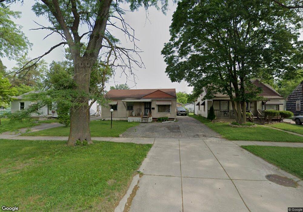
1314 W Pierson Rd Flint, MI 48505
Bel-Aire Woods NeighborhoodEstimated Value: $39,000 - $66,000
3
Beds
2
Baths
881
Sq Ft
$57/Sq Ft
Est. Value
About This Home
This home is located at 1314 W Pierson Rd, Flint, MI 48505 and is currently estimated at $50,450, approximately $57 per square foot. 1314 W Pierson Rd is a home located in Genesee County with nearby schools including Brownell STEM Academy, The New Standard Academy, and Eagle's Nest Academy.
Ownership History
Date
Name
Owned For
Owner Type
Purchase Details
Closed on
Mar 21, 2005
Sold by
Moore Dorothy and Pope Johnnie
Bought by
Threlkeld Kenyatta
Current Estimated Value
Purchase Details
Closed on
May 10, 2004
Sold by
Moore Dorothy
Bought by
Moore Dorothy and Pope Johnnie H
Purchase Details
Closed on
May 1, 2004
Sold by
Pope Johnie H
Bought by
Moore Dorothy
Create a Home Valuation Report for This Property
The Home Valuation Report is an in-depth analysis detailing your home's value as well as a comparison with similar homes in the area
Home Values in the Area
Average Home Value in this Area
Purchase History
We collect this data history from publicly available records. To have your information removed, we recommend requesting removal directly through your county’s website.
| Date | Buyer | Sale Price | Title Company |
|---|---|---|---|
| Threlkeld Kenyatta | -- | None Available | |
| Moore Dorothy | -- | Centennial Title & Abstract | |
| Moore Dorothy | -- | Centennial Title & Abstract |
Source: Public Records
Tax History
| Year | Tax Paid | Tax Assessment Tax Assessment Total Assessment is a certain percentage of the fair market value that is determined by local assessors to be the total taxable value of land and additions on the property. | Land | Improvement |
|---|---|---|---|---|
| 2025 | $812 | $18,400 | $0 | $0 |
| 2024 | $742 | $16,700 | $0 | $0 |
| 2023 | $732 | $15,500 | $0 | $0 |
| 2022 | $0 | $11,300 | $0 | $0 |
| 2021 | $757 | $10,700 | $0 | $0 |
| 2020 | $689 | $8,900 | $0 | $0 |
| 2019 | $1,421 | $9,000 | $0 | $0 |
| 2018 | $1,024 | $10,600 | $0 | $0 |
| 2017 | $867 | $0 | $0 | $0 |
| 2016 | $748 | $0 | $0 | $0 |
| 2015 | -- | $0 | $0 | $0 |
| 2014 | -- | $0 | $0 | $0 |
| 2012 | -- | $14,100 | $0 | $0 |
Source: Public Records
Map
Nearby Homes
- 5215 Susan St
- 5309 Marja St
- 5502 Susan St
- 5413 Fleming Rd
- 5518 Winthrop Blvd
- 1720 Marlowe Dr
- 4816 Glenn Ave
- 1913 Basil Ln
- 5610 Baldwin Blvd
- 5616 Griggs Dr
- 4539 Trumbull Dr
- 4808 Edwards Ave
- 5620 Marlowe Dr
- 5106 Cloverlawn Dr
- 5709 Dupont St
- 2013 Canniff St
- 4306 Berger Dr
- 1709 W Home Ave
- 4911 Birchcrest Dr
- 525 W Pulaski Ave
- 1310 W Pierson Rd
- 1318 W Pierson Rd
- 1402 W Pierson Rd
- 1306 W Pierson Rd
- 1315 Bolan Dr
- 1311 Bolan Dr
- 1319 Bolan Dr
- 1406 W Pierson Rd
- 1302 W Pierson Rd
- 1401 Bolan Dr
- 1307 Bolan Dr
- 1405 Bolan Dr
- 1410 W Pierson Rd
- 1218 W Pierson Rd
- 1317 W Pierson Rd
- 1409 Bolan Dr
- 1313 W Pierson Rd
- 5210 Kermit St
- 1305 Bolan Dr
- 5302 Laurene St
Your Personal Tour Guide
Ask me questions while you tour the home.