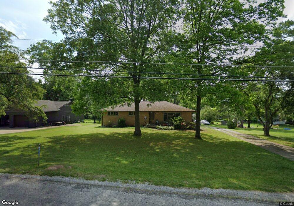
13140 Coal Bank Rd Doylestown, OH 44230
Estimated Value: $268,768 - $359,000
4
Beds
3
Baths
2,284
Sq Ft
$134/Sq Ft
Est. Value
About This Home
This home is located at 13140 Coal Bank Rd, Doylestown, OH 44230 and is currently estimated at $305,192, approximately $133 per square foot. 13140 Coal Bank Rd is a home located in Wayne County with nearby schools including Hazel Harvey Elementary School, Chippewa Intermediate School, and Chippewa Jr./Sr. High School.
Ownership History
Date
Name
Owned For
Owner Type
Purchase Details
Closed on
Jul 30, 2008
Sold by
Milestone Realty Llc
Bought by
Joseph Brian H and Joseph Carla S
Current Estimated Value
Home Financials for this Owner
Home Financials are based on the most recent Mortgage that was taken out on this home.
Original Mortgage
$118,000
Outstanding Balance
$78,090
Interest Rate
6.5%
Mortgage Type
New Conventional
Estimated Equity
$227,102
Purchase Details
Closed on
Apr 29, 2008
Sold by
Springer Macil Grace and Springer Donna Sue
Bought by
Milestone Realty Llc
Purchase Details
Closed on
Jan 1, 1987
Bought by
Springer Macil G
Create a Home Valuation Report for This Property
The Home Valuation Report is an in-depth analysis detailing your home's value as well as a comparison with similar homes in the area
Home Values in the Area
Average Home Value in this Area
Purchase History
| Date | Buyer | Sale Price | Title Company |
|---|---|---|---|
| Joseph Brian H | $148,000 | Title First | |
| Milestone Realty Llc | $57,000 | Title Direct Ltd | |
| Springer Macil G | -- | -- |
Source: Public Records
Mortgage History
| Date | Status | Borrower | Loan Amount |
|---|---|---|---|
| Open | Joseph Brian H | $118,000 |
Source: Public Records
Tax History Compared to Growth
Tax History
| Year | Tax Paid | Tax Assessment Tax Assessment Total Assessment is a certain percentage of the fair market value that is determined by local assessors to be the total taxable value of land and additions on the property. | Land | Improvement |
|---|---|---|---|---|
| 2024 | $2,760 | $79,500 | $17,200 | $62,300 |
| 2023 | $2,760 | $79,230 | $17,200 | $62,030 |
| 2022 | $2,050 | $54,270 | $11,780 | $42,490 |
| 2021 | $2,063 | $54,270 | $11,780 | $42,490 |
| 2020 | $2,077 | $54,270 | $11,780 | $42,490 |
| 2019 | $1,472 | $37,050 | $10,590 | $26,460 |
| 2018 | $1,486 | $37,050 | $10,590 | $26,460 |
| 2017 | $1,474 | $37,050 | $10,590 | $26,460 |
| 2016 | $1,437 | $35,630 | $10,190 | $25,440 |
| 2015 | $1,430 | $35,630 | $10,190 | $25,440 |
| 2014 | $1,256 | $35,630 | $10,190 | $25,440 |
| 2013 | $1,180 | $32,450 | $9,570 | $22,880 |
Source: Public Records
Map
Nearby Homes
- 270 Maple St
- 46 Hidden Pond Dr
- 0 S Portage St
- 325 Catawba Path
- 154 Circle Dr
- 100 Merlot Ct
- 605 Vineyard Way
- 680 Thorn Way
- 620 Thorn Way
- 580 Thorn Way
- 0 Akron Rd Unit 5123781
- 436 N Portage St
- 517 N Portage St
- 340 Gates St
- 500 W Clinton St
- 77 Koehler Ave
- 104 Homan Dr
- 14328 Calaboone Rd
- VL 1067 Homan Dr
- 15500 Freedom Dr
- 13122 Coal Bank Rd
- 426 Coal Bank Rd
- 13127 Coal Bank Rd
- 425 Coal Bank Rd
- 15953 Valley View Rd
- 999 V/L Valley View Rd
- V/L Valleyview Rd
- V/L Valley View
- 13077 Coal Bank Rd
- 189 Valley View Rd
- 13054 Coal Bank Rd
- 13054 Coal Bank Rd
- 383 Maple St
- 15919 Valley View Rd
- 185 Valley View Rd
- 13026 Coal Bank Rd
- 184 Valley View Rd
- 331 Maple St
- 80 Meadow Ridge Trail
- 100 Meadow Ridge Trail