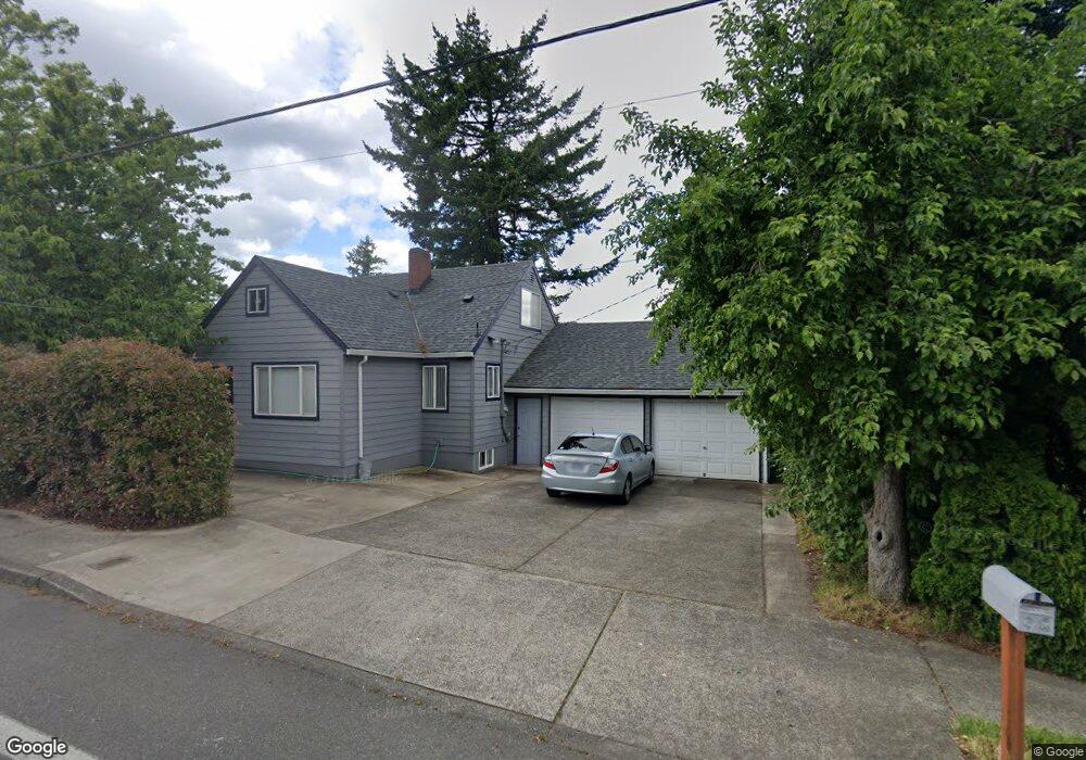
13145 E Burnside St Portland, OR 97233
Hazelwood NeighborhoodEstimated Value: $398,000 - $453,000
3
Beds
1
Bath
1,498
Sq Ft
$285/Sq Ft
Est. Value
About This Home
This home is located at 13145 E Burnside St, Portland, OR 97233 and is currently estimated at $426,679, approximately $284 per square foot. 13145 E Burnside St is a home located in Multnomah County with nearby schools including Menlo Park Elementary School, Floyd Light Middle School, and David Douglas High School.
Ownership History
Date
Name
Owned For
Owner Type
Purchase Details
Closed on
Sep 11, 2006
Sold by
Serkov Paul A
Bought by
Serkov Paul A and Serkov Natalya P
Current Estimated Value
Purchase Details
Closed on
May 18, 1998
Sold by
Serkov Alex
Bought by
Serkov Paul A and Serkov Vera
Home Financials for this Owner
Home Financials are based on the most recent Mortgage that was taken out on this home.
Original Mortgage
$96,750
Outstanding Balance
$18,855
Interest Rate
7.07%
Estimated Equity
$407,824
Create a Home Valuation Report for This Property
The Home Valuation Report is an in-depth analysis detailing your home's value as well as a comparison with similar homes in the area
Home Values in the Area
Average Home Value in this Area
Purchase History
| Date | Buyer | Sale Price | Title Company |
|---|---|---|---|
| Serkov Paul A | -- | Ticor Title Insurance Compan | |
| Serkov Paul A | -- | Fidelity National Title Co |
Source: Public Records
Mortgage History
| Date | Status | Borrower | Loan Amount |
|---|---|---|---|
| Open | Serkov Paul A | $96,750 |
Source: Public Records
Tax History Compared to Growth
Tax History
| Year | Tax Paid | Tax Assessment Tax Assessment Total Assessment is a certain percentage of the fair market value that is determined by local assessors to be the total taxable value of land and additions on the property. | Land | Improvement |
|---|---|---|---|---|
| 2024 | $5,027 | $210,720 | -- | -- |
| 2023 | $4,809 | $204,590 | $0 | $0 |
| 2022 | $4,558 | $198,640 | $0 | $0 |
| 2021 | $4,483 | $192,860 | $0 | $0 |
| 2020 | $4,062 | $187,250 | $0 | $0 |
| 2019 | $3,932 | $181,800 | $0 | $0 |
| 2018 | $3,811 | $176,510 | $0 | $0 |
| 2017 | $3,671 | $171,370 | $0 | $0 |
| 2016 | $3,574 | $166,380 | $0 | $0 |
| 2015 | $3,489 | $161,540 | $0 | $0 |
| 2014 | $3,162 | $156,840 | $0 | $0 |
Source: Public Records
Map
Nearby Homes
- 59 NE 134th Place
- 142 NE 128th Ave
- 13035 SE Stark St
- 12950 NE Glisan St
- 13045 SE Stark St Unit 124
- 13045 SE Stark St
- 13045 SE Stark St Unit 6
- 301 SE 129th Ave
- 15 NE 127th Ave
- 335 SE 129th Ave
- 12827 SE Stark St Unit B4
- 12841 SE Stark St Unit A19
- 12871 SE Stark St Unit A16
- 307 SE 127th Ave
- 13241 SE Washington St
- 601 SE 135th Ave
- 13730 SE Stark St Unit 13752
- 900 NE 131st Place
- 706 SE 135th Ave
- 13050 SE Morrison St
- 13125 E Burnside St
- 16 NE 131st Place
- 13211 E Burnside St
- 8 SE 131st Place
- 32 NE 131st Place
- 17 NE 131st Place
- 10 SE 131st Place
- 13105 E Burnside St
- 13217 E Burnside St Unit 1
- 13217 E Burnside St
- 13215 E Burnside St
- 31 NE 131st Place
- 13210 E Burnside St Unit 13224
- 13202 NE Couch St
- 17 SE 131st Place
- 13046 NE Couch St
- 30 SE 131st Place
- 110 NE 131st Place
- 13226 E Burnside St(not Busy
- 13226 E Burnside St