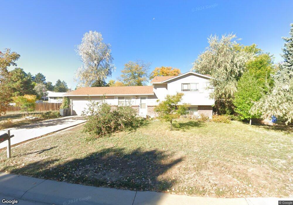
13145 Mercury Dr Lone Tree, CO 80124
Estimated Value: $534,577 - $553,000
4
Beds
2
Baths
1,515
Sq Ft
$359/Sq Ft
Est. Value
About This Home
This home is located at 13145 Mercury Dr, Lone Tree, CO 80124 and is currently estimated at $543,789, approximately $358 per square foot. 13145 Mercury Dr is a home located in Douglas County with nearby schools including Acres Green Elementary School, Cresthill Middle School, and Highlands Ranch High School.
Ownership History
Date
Name
Owned For
Owner Type
Purchase Details
Closed on
Oct 13, 2021
Sold by
Suhanyi Vita L Pantaleo
Bought by
13145 Mercury Llc
Current Estimated Value
Purchase Details
Closed on
May 29, 1998
Sold by
Jack Suhanyi
Bought by
Suhanyi Vita L Pantaleo
Purchase Details
Closed on
Feb 15, 1994
Sold by
Stone Nelson D
Bought by
Suhanyi Jack
Purchase Details
Closed on
Oct 12, 1989
Sold by
Us Dept Housing & Urban Dev
Bought by
Stone Nelson D
Purchase Details
Closed on
Jun 15, 1989
Sold by
Public Trustee
Bought by
Us Dept Housing & Urban Dev
Purchase Details
Closed on
Jul 23, 1985
Sold by
Ramsey Ted B and Ramsey Nancy J
Bought by
Mcknight Ronald A and Mcknight Barbara J
Purchase Details
Closed on
Jul 8, 1983
Sold by
Laughridge Delwin O and Laughridge Marliss R
Bought by
Ramsey Ted B and Ramsey Nancy J
Create a Home Valuation Report for This Property
The Home Valuation Report is an in-depth analysis detailing your home's value as well as a comparison with similar homes in the area
Home Values in the Area
Average Home Value in this Area
Purchase History
| Date | Buyer | Sale Price | Title Company |
|---|---|---|---|
| 13145 Mercury Llc | -- | None Available | |
| Suhanyi Vita L Pantaleo | -- | -- | |
| Suhanyi Jack | $84,200 | Title America | |
| Stone Nelson D | -- | -- | |
| Us Dept Housing & Urban Dev | -- | -- | |
| Mcknight Ronald A | $83,900 | -- | |
| Ramsey Ted B | $81,500 | -- |
Source: Public Records
Tax History
| Year | Tax Paid | Tax Assessment Tax Assessment Total Assessment is a certain percentage of the fair market value that is determined by local assessors to be the total taxable value of land and additions on the property. | Land | Improvement |
|---|---|---|---|---|
| 2025 | $3,148 | $32,770 | $7,510 | $25,260 |
| 2024 | $3,148 | $37,980 | $8,600 | $29,380 |
| 2023 | $3,180 | $37,980 | $8,600 | $29,380 |
| 2022 | $2,406 | $27,020 | $7,300 | $19,720 |
| 2021 | $2,503 | $27,020 | $7,300 | $19,720 |
| 2020 | $2,197 | $24,310 | $6,950 | $17,360 |
| 2019 | $2,205 | $26,300 | $6,950 | $19,350 |
| 2018 | $1,807 | $21,340 | $6,020 | $15,320 |
| 2017 | $1,837 | $21,340 | $6,020 | $15,320 |
| 2016 | $1,665 | $18,950 | $4,580 | $14,370 |
| 2015 | $1,703 | $18,950 | $4,580 | $14,370 |
| 2014 | $1,430 | $14,900 | $3,980 | $10,920 |
Source: Public Records
Map
Nearby Homes
- 8214 Lodgepole Trail
- 8159 Lodgepole Trail
- 357 Saturn Place
- 8049 Sweet Water Rd
- 8046 Lodgepole Trail
- 8860 Kachina Way
- 8822 Fiesta Terrace
- 181 Dianna Dr
- 130 Dianna Dr
- 219 Dianna Dr
- 8666 Ainsdale Ct Unit 12B
- 789 Mercury Cir
- 13226 Canopus Dr
- 8555 Green Island Cir
- 8356 Green Island Cir
- 9345 Erminedale Dr
- 9445 Aspen Hill Cir
- 9464 E Aspen Hill Place
- 8852 Chestnut Hill Ln
- 7057 Chestnut Hill St
- 13157 Mercury Dr
- 13072 Saturn Dr
- 13082 Saturn Dr
- 13148 Mercury Dr
- 13092 Saturn Dr
- 13152 Mercury Dr
- 13144 Mercury Dr
- 13156 Mercury Dr
- 13161 Mercury Dr
- 13140 Mercury Dr
- 13160 Mercury Dr
- 13114 Saturn Dr
- 13136 Mercury Dr
- 13081 Deneb Dr
- 13165 Mercury Dr
- 13164 Mercury Dr
- 13132 Mercury Dr
- 13124 Saturn Dr
- 13127 Mercury Dr
- 13087 Deneb Dr
Your Personal Tour Guide
Ask me questions while you tour the home.