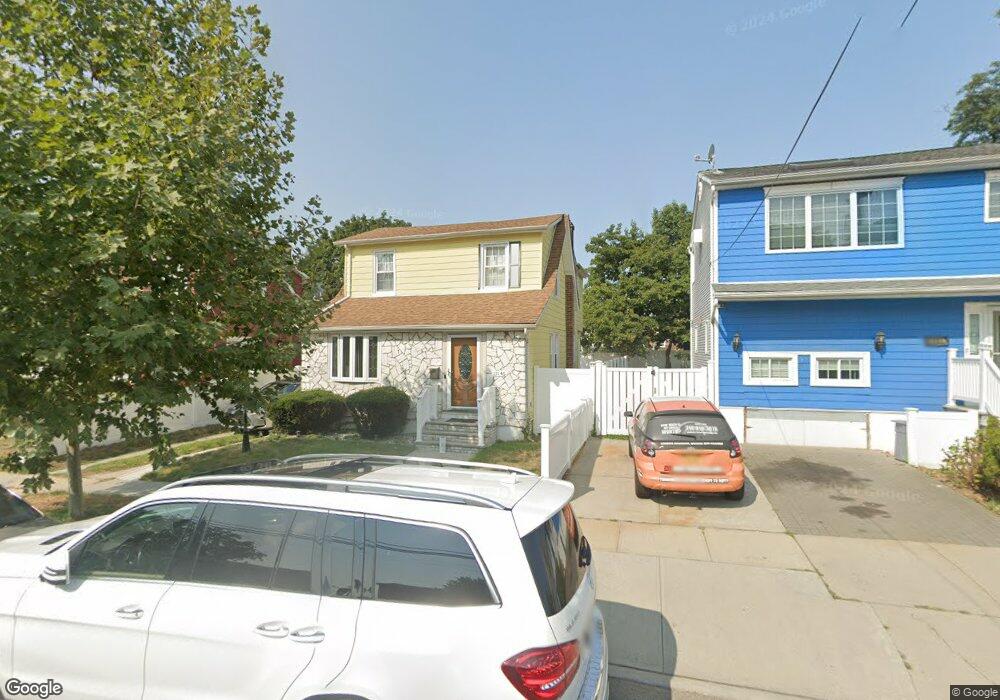
13146 222nd St Springfield Gardens, NY 11413
Laurelton NeighborhoodEstimated Value: $628,000 - $662,000
--
Bed
--
Bath
1,194
Sq Ft
$538/Sq Ft
Est. Value
About This Home
This home is located at 13146 222nd St, Springfield Gardens, NY 11413 and is currently estimated at $642,390, approximately $538 per square foot. 13146 222nd St is a home located in Queens County with nearby schools including P.S. 132 - Ralph Bunche, Is 59 Springfield Gardens, and Merrick Academy Charter School.
Ownership History
Date
Name
Owned For
Owner Type
Purchase Details
Closed on
Dec 24, 1997
Sold by
Burns Robert K and Posa Alison S
Bought by
Felle Joseph F
Current Estimated Value
Home Financials for this Owner
Home Financials are based on the most recent Mortgage that was taken out on this home.
Original Mortgage
$30,400
Interest Rate
7.15%
Create a Home Valuation Report for This Property
The Home Valuation Report is an in-depth analysis detailing your home's value as well as a comparison with similar homes in the area
Home Values in the Area
Average Home Value in this Area
Purchase History
| Date | Buyer | Sale Price | Title Company |
|---|---|---|---|
| Felle Joseph F | $220,000 | First American Title Ins Co |
Source: Public Records
Mortgage History
| Date | Status | Borrower | Loan Amount |
|---|---|---|---|
| Closed | Felle Joseph F | $30,400 |
Source: Public Records
Tax History Compared to Growth
Tax History
| Year | Tax Paid | Tax Assessment Tax Assessment Total Assessment is a certain percentage of the fair market value that is determined by local assessors to be the total taxable value of land and additions on the property. | Land | Improvement |
|---|---|---|---|---|
| 2025 | $5,625 | $28,902 | $7,506 | $21,396 |
| 2024 | $5,625 | $28,006 | $8,571 | $19,435 |
| 2023 | $5,517 | $27,469 | $8,619 | $18,850 |
| 2022 | $5,365 | $35,820 | $11,220 | $24,600 |
| 2021 | $5,372 | $34,440 | $11,220 | $23,220 |
| 2020 | $5,098 | $29,640 | $11,220 | $18,420 |
| 2019 | $4,882 | $27,720 | $11,220 | $16,500 |
| 2018 | $4,666 | $22,891 | $10,622 | $12,269 |
| 2017 | $4,565 | $22,394 | $9,183 | $13,211 |
| 2016 | $4,253 | $22,394 | $9,183 | $13,211 |
| 2015 | $2,548 | $20,071 | $9,846 | $10,225 |
| 2014 | $2,548 | $19,449 | $11,460 | $7,989 |
Source: Public Records
Map
Nearby Homes
- 131-35 222nd St
- 22310 131st Ave
- 131-20 224th St
- 21917 132nd Rd
- 21931 133rd Ave
- 130-55 222nd St
- 130-45 220th St
- 133-15 220th St
- 21924 130th Dr
- 13062 225th St
- 130-43 224th St
- 218-36 133rd Rd
- 22014 130th Ave
- 22014 130th Ave
- 134-15 221st St
- 131-41 226th St Unit 60
- 133-23 225th St
- 134-16 221st St
- 133-22 226th St
- 220-27 134th Rd
- 13150 222nd St
- 13140 222nd St
- 13156 222nd St
- 131-43 221st St
- 13136 222nd St
- 13151 221st St
- 13143 221st St
- 13143 221st St
- 13155 221st St
- 13139 221st St
- 13160 222nd St
- 13160 222nd St
- 131-45 222nd St
- 131-53 222nd St
- 133-29 222 St
- 13132 222nd St
- 131-49 222nd St
- 13135 221st St
- 13161 221st St
- 13153 222nd St