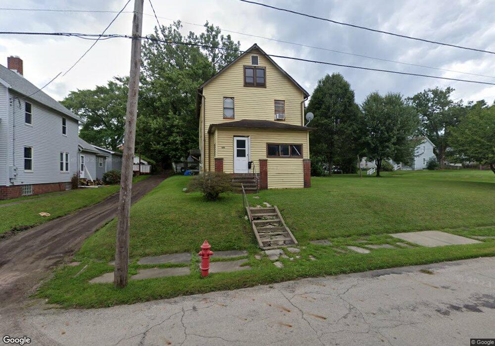
1315 Auld St Alliance, OH 44601
Estimated Value: $51,000 - $78,000
3
Beds
1
Bath
1,198
Sq Ft
$56/Sq Ft
Est. Value
About This Home
This home is located at 1315 Auld St, Alliance, OH 44601 and is currently estimated at $67,283, approximately $56 per square foot. 1315 Auld St is a home located in Stark County with nearby schools including Alliance Elementary School at Rockhill, Alliance Intermediate School at Northside, and Alliance Middle School.
Ownership History
Date
Name
Owned For
Owner Type
Purchase Details
Closed on
Mar 14, 2017
Bought by
Leroy S Bates
Current Estimated Value
Purchase Details
Closed on
Feb 22, 2001
Sold by
Sears Dorothy
Bought by
Bates Leroy S
Home Financials for this Owner
Home Financials are based on the most recent Mortgage that was taken out on this home.
Original Mortgage
$30,974
Interest Rate
6.91%
Mortgage Type
Purchase Money Mortgage
Create a Home Valuation Report for This Property
The Home Valuation Report is an in-depth analysis detailing your home's value as well as a comparison with similar homes in the area
Home Values in the Area
Average Home Value in this Area
Purchase History
| Date | Buyer | Sale Price | Title Company |
|---|---|---|---|
| Leroy S Bates | -- | -- | |
| Bates Leroy S | $11,200 | -- |
Source: Public Records
Mortgage History
| Date | Status | Borrower | Loan Amount |
|---|---|---|---|
| Previous Owner | Bates Leroy S | $30,974 |
Source: Public Records
Tax History Compared to Growth
Tax History
| Year | Tax Paid | Tax Assessment Tax Assessment Total Assessment is a certain percentage of the fair market value that is determined by local assessors to be the total taxable value of land and additions on the property. | Land | Improvement |
|---|---|---|---|---|
| 2025 | -- | $16,450 | $3,360 | $13,090 |
| 2024 | -- | $16,450 | $3,360 | $13,090 |
| 2023 | $540 | $13,440 | $3,430 | $10,010 |
| 2022 | $272 | $13,440 | $3,430 | $10,010 |
| 2021 | $544 | $13,440 | $3,430 | $10,010 |
| 2020 | $499 | $11,520 | $2,980 | $8,540 |
| 2019 | $492 | $11,520 | $2,980 | $8,540 |
| 2018 | $495 | $11,520 | $2,980 | $8,540 |
| 2017 | $666 | $9,770 | $2,490 | $7,280 |
| 2016 | $671 | $9,770 | $2,490 | $7,280 |
| 2015 | $217 | $9,770 | $2,490 | $7,280 |
| 2014 | $265 | $5,680 | $2,280 | $3,400 |
| 2013 | $132 | $5,680 | $2,280 | $3,400 |
Source: Public Records
Map
Nearby Homes
- 1233 Woodland Ave
- 831 Wade Ave
- 814 Milner St
- 1395 S Webb Ave
- 815 Grace St
- 729 Waugh St
- 1044 S Liberty Ave
- 551 South St
- 1005 S Freedom Ave
- 1437 S Linden Ave
- 442 S Liberty Ave
- 452 E Summit St
- 1846 S Freedom Ave
- 390 E College St
- 548 E High St
- 167 11th St
- V/L S Fredeom Ave
- 432 S Linden Ave
- 404 S Linden Ave
- 1475 Chatauqua Ct
- 1329 Auld St
- 1124 Meadow Ave
- 1125 Willow Ave
- 1132 Meadow Ave
- 1131 Willow Ave
- 1140 Meadow Ave
- 1125 Meadow Ave
- 1277 Auld St
- 1401 Auld St
- 1110 Willow Ave
- 1133 Meadow Ave
- 1148 Meadow Ave
- 1139 Meadow Ave
- 1132 Willow Ave
- 1415 Auld St
- 1145 Meadow Ave
- 1148 Willow Ave
- 1124 Clay Ave
- 1312 South St
- 1306 South St