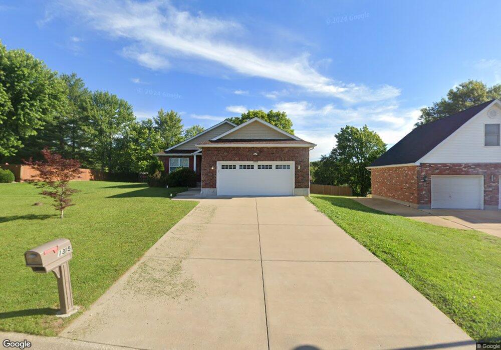
1315 Beulah Dr Festus, MO 63028
Festus/Crystal City NeighborhoodEstimated Value: $301,613 - $371,000
Studio
--
Bath
1,839
Sq Ft
$188/Sq Ft
Est. Value
About This Home
This home is located at 1315 Beulah Dr, Festus, MO 63028 and is currently estimated at $346,403, approximately $188 per square foot. 1315 Beulah Dr is a home with nearby schools including Festus Elementary School, Festus Intermediate School, and Festus Middle School.
Ownership History
Date
Name
Owned For
Owner Type
Purchase Details
Closed on
Nov 11, 2025
Sold by
Bess Gordon E and Bess Peggy S
Bought by
Gordon E Bess And Peggy S Bess Living Trust
Current Estimated Value
Purchase Details
Closed on
Dec 5, 2016
Bought by
Norrick Paden T
Home Financials for this Owner
Home Financials are based on the most recent Mortgage that was taken out on this home.
Original Mortgage
$182,090
Interest Rate
4.08%
Purchase Details
Closed on
Aug 26, 2015
Sold by
Ravenscraft Ellen S and Ellen S Ravenscraft Living Tru
Bought by
Bess Gordon and Bess Peggy
Create a Home Valuation Report for This Property
The Home Valuation Report is an in-depth analysis detailing your home's value as well as a comparison with similar homes in the area
Home Values in the Area
Average Home Value in this Area
Purchase History
| Date | Buyer | Sale Price | Title Company |
|---|---|---|---|
| Gordon E Bess And Peggy S Bess Living Trust | -- | None Listed On Document | |
| Norrick Paden T | -- | -- | |
| Bess Gordon | -- | None Available |
Source: Public Records
Mortgage History
| Date | Status | Borrower | Loan Amount |
|---|---|---|---|
| Previous Owner | Norrick Paden T | $182,090 | |
| Previous Owner | Norrick Paden T | -- |
Source: Public Records
Tax History
| Year | Tax Paid | Tax Assessment Tax Assessment Total Assessment is a certain percentage of the fair market value that is determined by local assessors to be the total taxable value of land and additions on the property. | Land | Improvement |
|---|---|---|---|---|
| 2025 | $2,338 | $45,200 | $4,800 | $40,400 |
| 2024 | $2,338 | $41,300 | $4,800 | $36,500 |
| 2023 | $2,338 | $41,300 | $4,800 | $36,500 |
| 2022 | $2,326 | $41,300 | $4,800 | $36,500 |
| 2021 | $2,238 | $39,700 | $4,800 | $34,900 |
| 2020 | $2,116 | $35,200 | $4,200 | $31,000 |
| 2019 | $2,115 | $35,200 | $4,200 | $31,000 |
| 2018 | $1,908 | $35,200 | $4,200 | $31,000 |
| 2017 | $1,907 | $35,200 | $4,200 | $31,000 |
| 2016 | $866 | $15,900 | $4,000 | $11,900 |
| 2015 | $217 | $4,000 | $4,000 | $0 |
| 2013 | -- | $4,000 | $4,000 | $0 |
Source: Public Records
Map
Nearby Homes
- 707 Jerome Dr
- 1114 N 5th St
- 912 Parc Central Dr
- 1082 Daltons Way
- 1206 N 3rd St
- 807 Huber St
- 202 Sunshine Dr
- 725 Woodrow Ave
- 716 Rosemary Ln
- 530 Cedar Ln
- TBD Cedar Ln
- 0 Tbb Birchwood Overlook-Dogwood Unit MAR24022693
- 1816 Belmont Ct
- 0 Tbb Birchwood Overlook Birchwo Unit MAR24022701
- 17 Ash Ct
- 617 N 6th St
- 1810 Valley View Cir
- 947 S 2nd St
- 1829 Belmont Ct
- 0 Tbb Bichwood Overlook-Sycamore Unit MAR24022712
- 1309 Beulah Dr
- 1420 Alexander Dr
- 1416 Alexander Dr
- 1321 Beulah Dr
- 1316 Beulah Dr
- 1312 Beulah Dr
- 1424 Alexander Dr
- 1412 Alexander Dr
- 1305 Beulah Dr
- 724 Jerome Dr
- 1428 Alexander Dr
- 1408 Alexander Dr
- 725 Stephen Dr
- 725 Jerome Dr
- 1325 Beulah Dr
- 1308 Beulah Dr
- 1404 Alexander Dr
- 720 Jerome Dr
- 1421 Alexander Dr
- 1321 Marie Ct
Your Personal Tour Guide
Ask me questions while you tour the home.