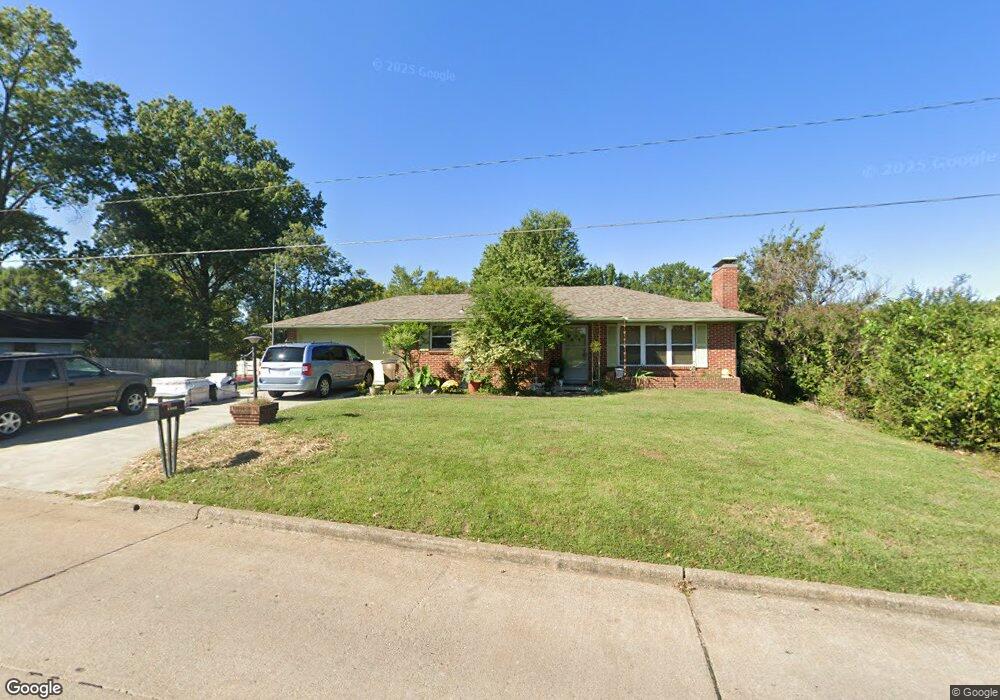
1315 Randol Ave Cape Girardeau, MO 63701
Estimated Value: $191,000 - $199,000
2
Beds
2
Baths
1,156
Sq Ft
$168/Sq Ft
Est. Value
About This Home
This home is located at 1315 Randol Ave, Cape Girardeau, MO 63701 and is currently estimated at $194,558, approximately $168 per square foot. 1315 Randol Ave is a home with nearby schools including Alma Schrader Elementary School, Central Middle School, and Central Junior High School.
Ownership History
Date
Name
Owned For
Owner Type
Purchase Details
Closed on
Jun 27, 2011
Sold by
Potillo Melvin and Potillo Joyce
Bought by
Mouser Eddie L and Mouser Lisa J
Current Estimated Value
Home Financials for this Owner
Home Financials are based on the most recent Mortgage that was taken out on this home.
Original Mortgage
$101,200
Outstanding Balance
$7,655
Interest Rate
4.65%
Mortgage Type
New Conventional
Estimated Equity
$186,903
Create a Home Valuation Report for This Property
The Home Valuation Report is an in-depth analysis detailing your home's value as well as a comparison with similar homes in the area
Home Values in the Area
Average Home Value in this Area
Purchase History
| Date | Buyer | Sale Price | Title Company |
|---|---|---|---|
| Mouser Eddie L | -- | None Available |
Source: Public Records
Mortgage History
| Date | Status | Borrower | Loan Amount |
|---|---|---|---|
| Open | Mouser Eddie L | $101,200 |
Source: Public Records
Tax History Compared to Growth
Tax History
| Year | Tax Paid | Tax Assessment Tax Assessment Total Assessment is a certain percentage of the fair market value that is determined by local assessors to be the total taxable value of land and additions on the property. | Land | Improvement |
|---|---|---|---|---|
| 2025 | $11 | $21,760 | $2,420 | $19,340 |
| 2024 | $11 | $20,730 | $2,310 | $18,420 |
| 2023 | $1,077 | $20,730 | $2,310 | $18,420 |
| 2022 | $993 | $19,100 | $2,130 | $16,970 |
| 2021 | $993 | $19,100 | $2,130 | $16,970 |
| 2020 | $996 | $19,100 | $2,130 | $16,970 |
| 2019 | $994 | $19,100 | $0 | $0 |
| 2018 | $993 | $19,100 | $0 | $0 |
| 2017 | $995 | $19,100 | $0 | $0 |
| 2016 | $991 | $19,100 | $0 | $0 |
| 2015 | $992 | $19,100 | $0 | $0 |
| 2014 | $997 | $19,100 | $0 | $0 |
Source: Public Records
Map
Nearby Homes
- 2449 Janet Dr
- 2550 Marvin St
- 2412 Masters Dr
- 1701 Brookwood Dr
- 1246 Marilyn Dr
- 2323 Brookwood Dr
- 2323 Jean Ann Dr
- 2237 Sherwood Dr
- 1415 N Clark St
- 1107 Dorothy St
- 2629 Hopper Rd
- 1938 Westwood Dr
- 1070 Dorothy St
- 1717 Perryville Rd
- 835 Lochinvar Ln
- 1912 Perryville Rd
- 2416 Terrie Hill Rd
- 3002 Melrose Ave
- 1966 Randol Ave
- 1960 Briarwood Dr