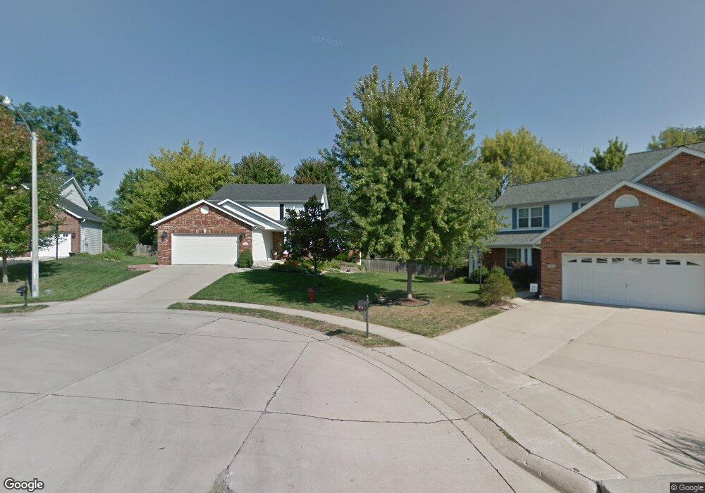
1315 Springbrooke Dr Edwardsville, IL 62025
Estimated Value: $365,000 - $460,431
5
Beds
4
Baths
896
Sq Ft
$475/Sq Ft
Est. Value
About This Home
This home is located at 1315 Springbrooke Dr, Edwardsville, IL 62025 and is currently estimated at $425,858, approximately $475 per square foot. 1315 Springbrooke Dr is a home located in Madison County with nearby schools including LeClaire Elementary School, Columbus Elementary School, and Liberty Middle School.
Ownership History
Date
Name
Owned For
Owner Type
Purchase Details
Closed on
Jun 4, 2004
Sold by
Shepherd Christopher and Shepherd Elizabeth C
Bought by
May Brian and May Areta H
Current Estimated Value
Home Financials for this Owner
Home Financials are based on the most recent Mortgage that was taken out on this home.
Original Mortgage
$163,600
Outstanding Balance
$75,219
Interest Rate
5.12%
Mortgage Type
Unknown
Estimated Equity
$350,639
Create a Home Valuation Report for This Property
The Home Valuation Report is an in-depth analysis detailing your home's value as well as a comparison with similar homes in the area
Home Values in the Area
Average Home Value in this Area
Purchase History
| Date | Buyer | Sale Price | Title Company |
|---|---|---|---|
| May Brian | $204,500 | First American Title Ins Co |
Source: Public Records
Mortgage History
| Date | Status | Borrower | Loan Amount |
|---|---|---|---|
| Open | May Brian | $163,600 |
Source: Public Records
Tax History Compared to Growth
Tax History
| Year | Tax Paid | Tax Assessment Tax Assessment Total Assessment is a certain percentage of the fair market value that is determined by local assessors to be the total taxable value of land and additions on the property. | Land | Improvement |
|---|---|---|---|---|
| 2024 | $10,618 | $154,730 | $27,850 | $126,880 |
| 2023 | $10,618 | $143,580 | $25,840 | $117,740 |
| 2022 | $9,965 | $132,730 | $23,890 | $108,840 |
| 2021 | $8,919 | $125,970 | $22,670 | $103,300 |
| 2020 | $8,635 | $122,080 | $21,970 | $100,110 |
| 2019 | $8,574 | $120,040 | $21,600 | $98,440 |
| 2018 | $8,234 | $112,140 | $20,650 | $91,490 |
| 2017 | $8,012 | $109,770 | $20,210 | $89,560 |
| 2016 | $6,937 | $105,360 | $20,240 | $85,120 |
| 2015 | $6,641 | $97,660 | $18,760 | $78,900 |
| 2014 | $6,641 | $97,660 | $18,760 | $78,900 |
| 2013 | $6,641 | $97,660 | $18,760 | $78,900 |
Source: Public Records
Map
Nearby Homes
- 116 Surrey Ln
- 4 Hadley Ct
- 1120 Franklin Ave
- 424 Circle Dr
- 3478 Manassas Dr
- 18 Shiloh Ct
- 112 Chattanooga Ct
- 500 Monticello Place
- 638 Yale Ave
- 0 Governor's Way Unit 23019948
- Culpepper Plan at Governor's Way
- Scarlett Plan at Governor's Way
- Bella Plan at Governor's Way
- Titan Plan at Governor's Way
- Sunrise Plan at Governor's Way
- Winchester B Plan at Governor's Way
- Alexandria Plan at Governor's Way
- Herndon Plan at Governor's Way
- Bristol Plan at Governor's Way
- Hannah Plan at Governor's Way
- 1314 Springbrooke Dr
- 1318 Springbrooke Dr
- 1312 Springbrooke Dr
- 1402 Stonebrooke Dr
- 1309 Springbrooke Dr
- 1310 Springbrooke Dr
- 1334 Richetta Dr
- 1334 Richetta Dr
- 1400 Stonebrooke Dr
- 1404 Stonebrooke Dr
- 1316 Richetta Dr
- 1307 Springbrooke Dr
- 1344 Richetta Dr
- 1308 Springbrooke Dr
- 1406 Stonebrooke Dr
- 1318 Richetta Dr
- 1401 Stonebrooke Dr
- 1408 Stonebrooke Dr
- 1403 Stonebrooke Dr
- 1306 Springbrooke Dr