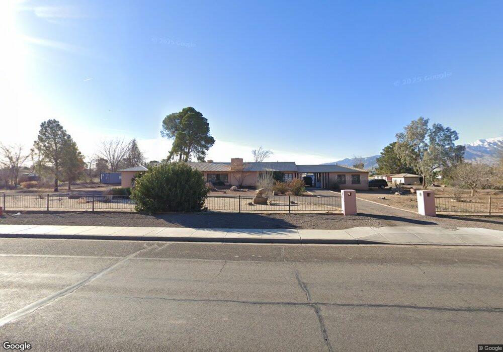
1315 W Relation St Safford, AZ 85546
Estimated Value: $386,229 - $409,000
Studio
--
Bath
2,668
Sq Ft
$150/Sq Ft
Est. Value
About This Home
This home is located at 1315 W Relation St, Safford, AZ 85546 and is currently estimated at $399,307, approximately $149 per square foot. 1315 W Relation St is a home located in Graham County with nearby schools including Ruth Powell Elementary School, Dorothy Stinson School, and Lafe Nelson School.
Ownership History
Date
Name
Owned For
Owner Type
Purchase Details
Closed on
Jul 17, 2025
Sold by
Kenneth P Mckinney Trust and Mckinney Kent
Bought by
Sky Range Trust and Mckinney
Current Estimated Value
Purchase Details
Closed on
Sep 23, 2015
Sold by
Cole Darathy Louise and Louise Cole D
Bought by
Mckinney Kenneth P
Purchase Details
Closed on
May 2, 2006
Sold by
Cole James A and Louise Cole D
Bought by
Cole James A and Louise Cole D
Create a Home Valuation Report for This Property
The Home Valuation Report is an in-depth analysis detailing your home's value as well as a comparison with similar homes in the area
Purchase History
We collect this data history from publicly available records. To have your information removed, we recommend requesting removal directly through your county’s website.
| Date | Buyer | Sale Price | Title Company |
|---|---|---|---|
| Sky Range Trust | -- | None Listed On Document | |
| Mckinney Kenneth P | $200,000 | Safford Title Agency Inc | |
| Cole James A | -- | None Available |
Source: Public Records
Tax History
| Year | Tax Paid | Tax Assessment Tax Assessment Total Assessment is a certain percentage of the fair market value that is determined by local assessors to be the total taxable value of land and additions on the property. | Land | Improvement |
|---|---|---|---|---|
| 2027 | $2,006 | -- | -- | -- |
| 2026 | $1,666 | -- | -- | -- |
| 2025 | $1,666 | $29,998 | $3,604 | $26,394 |
| 2024 | $1,730 | $28,027 | $3,604 | $24,423 |
| 2023 | $1,730 | $23,690 | $3,322 | $20,368 |
| 2022 | $1,686 | $20,806 | $3,322 | $17,484 |
| 2021 | $1,894 | $0 | $0 | $0 |
| 2020 | $1,825 | $0 | $0 | $0 |
| 2019 | $1,925 | $0 | $0 | $0 |
| 2018 | $1,832 | $0 | $0 | $0 |
| 2017 | $1,634 | $0 | $0 | $0 |
| 2016 | $1,811 | $0 | $0 | $0 |
| 2015 | $1,372 | $0 | $0 | $0 |
Source: Public Records
Map
Nearby Homes
- 1007 W Rose Ln
- 1610 S Camilla Cir
- 828 W Navajo Ln
- 1350 W 19th St
- 1711 S Fargo Dr
- 1385 S Meadow Ln
- 1582 W Stone Willow Way
- 1564 W Stone Willow Way
- 1227 S 7th Ave
- 1808 S 8th Ave
- 1470 W Cobblestone Dr
- 5052 S 20th Ave
- 1630 W Cobblestone Dr
- 0 S 20th Ave Unit no
- 1204 S Central Ave Unit A
- 1104 S Central Ave
- 1017 S 5th Ave
- 211 W 15th St
- 1879 W Peppertree Dr Unit B7
- 1879 W Peppertree Dr Unit C12
- 1319 W Relation St
- 1221 W Relation St
- 1264 W Relation St
- 1206 W Relation St
- 1321 W Relation St
- 1220 W Relation St
- 1407 S 12th Ave
- 1409 S 12th Ave
- 1411 S 12th Ave
- 1323 W Relation St
- 1200 W Relation St
- 1403 S 14th Ave
- 1107 W Relation St
- 1413 S 12th Ave
- 1202 W Relation St
- 1502 S 12th Ave
- 1407 S 14th Ave
- 1120 W Relation St
- 0 14th Ave Unit 22424073
- TBD 14th Ave
Your Personal Tour Guide
Ask me questions while you tour the home.