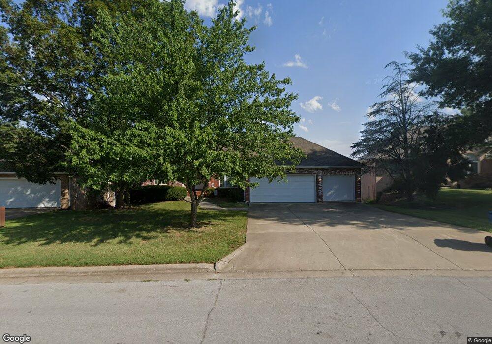
1315 W Swallow St Springfield, MO 65810
Southwest Springfield NeighborhoodEstimated Value: $439,723 - $487,000
4
Beds
3
Baths
3,606
Sq Ft
$129/Sq Ft
Est. Value
About This Home
This home is located at 1315 W Swallow St, Springfield, MO 65810 and is currently estimated at $465,181, approximately $129 per square foot. 1315 W Swallow St is a home located in Greene County with nearby schools including Gray Elementary School, Wilson's Creek Intermediate School, and Cherokee Middle School.
Ownership History
Date
Name
Owned For
Owner Type
Purchase Details
Closed on
Jan 29, 2021
Sold by
Willard Cathryn Lynne
Bought by
Willard Cathryn Lynne and Cathryn Lynne Willard Living T
Current Estimated Value
Purchase Details
Closed on
Apr 13, 2015
Sold by
Bussey Lewis E
Bought by
Willard Cathryn Lynne
Purchase Details
Closed on
Aug 12, 2013
Sold by
Bussey Lewis E
Bought by
Bussey Lewis E and Virginia C Bussey Trust Fbo Linda B Will
Create a Home Valuation Report for This Property
The Home Valuation Report is an in-depth analysis detailing your home's value as well as a comparison with similar homes in the area
Home Values in the Area
Average Home Value in this Area
Purchase History
| Date | Buyer | Sale Price | Title Company |
|---|---|---|---|
| Willard Cathryn Lynne | -- | None Available | |
| Willard Cathryn Lynne | -- | None Available | |
| Bussey Lewis E | -- | None Available |
Source: Public Records
Tax History
| Year | Tax Paid | Tax Assessment Tax Assessment Total Assessment is a certain percentage of the fair market value that is determined by local assessors to be the total taxable value of land and additions on the property. | Land | Improvement |
|---|---|---|---|---|
| 2025 | $3,399 | $68,230 | $7,130 | $61,100 |
| 2024 | $3,263 | $60,820 | $5,610 | $55,210 |
| 2023 | $3,245 | $60,820 | $5,610 | $55,210 |
| 2022 | $3,048 | $55,810 | $5,610 | $50,200 |
| 2021 | $3,048 | $55,810 | $5,610 | $50,200 |
| 2020 | $2,992 | $52,390 | $5,610 | $46,780 |
| 2019 | $2,908 | $52,390 | $5,610 | $46,780 |
| 2018 | $2,596 | $46,800 | $5,610 | $41,190 |
| 2017 | $2,570 | $45,190 | $5,610 | $39,580 |
| 2016 | $2,477 | $45,190 | $5,610 | $39,580 |
| 2015 | $2,454 | $45,190 | $5,610 | $39,580 |
| 2014 | $2,411 | $44,070 | $5,610 | $38,460 |
Source: Public Records
Map
Nearby Homes
- 1922 W Woodhaven St Unit Lot 42
- 1924 W Woodhaven St Unit Lot 43
- 1914 W Woodhaven St Unit Lot 38
- 1910 W Woodhaven St Unit Lot 36
- 1912 W Woodhaven St Unit Lot 37
- 4782 S Turnberry Ave
- 1233 W Highland St
- 744 W Lasalle St
- 1658 W Riverside St
- 4441 S Lafontaine Ave
- 3860 S Parklane Ave
- 4530 S Shady Lane Ct
- 2065 W Buena Vista St
- 2021 W Kingsley St
- 2175 W Glen Gary Ct
- 4825 S Sydney Ave
- 4907 S Buckingham Ln
- 796 W Sherwood Dr
- 2177 W Glen Gary Ct
- 4916 S Buckingham Ln
- 1321 W Swallow St
- 1309 W Swallow St
- 1329 W Swallow St
- 1301 W Swallow St
- 1318 W Swallow St
- 1310 W Swallow St
- 4329 S Newton Ave
- 1231 W Swallow St
- 4326 S Newton Ave
- 1236 W Swallow St
- 4334 S Newton Ave
- 4337 S Newton Ave
- 1228 W Swallow St
- 1223 W Swallow St
- 1235 W Cardinal St
- 1241 W Cardinal St
- 1220 W Swallow St
- 4346 S Newton Ave
- 4343 S Newton Ave
- 1430 W Lark St
Your Personal Tour Guide
Ask me questions while you tour the home.