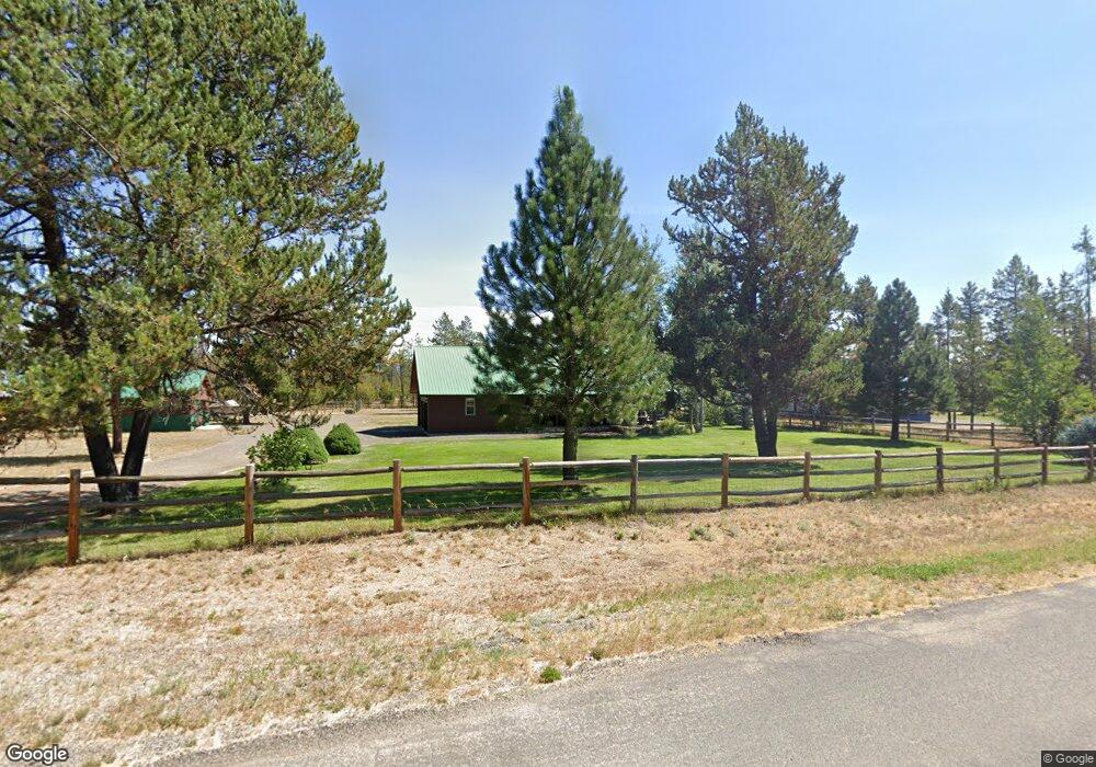
13152 Gail-Alan Rd McCall, ID 83638
Estimated Value: $460,000 - $502,000
3
Beds
2
Baths
1,182
Sq Ft
$407/Sq Ft
Est. Value
About This Home
This home is located at 13152 Gail-Alan Rd, McCall, ID 83638 and is currently estimated at $481,000, approximately $406 per square foot. 13152 Gail-Alan Rd is a home with nearby schools including Donnelly Elementary School and McCall-Donnelly High School.
Ownership History
Date
Name
Owned For
Owner Type
Purchase Details
Closed on
Aug 20, 2018
Sold by
Hubbard Susan Noel and Hubbard Scott Calvin
Bought by
Hubbard Cabin Llc
Current Estimated Value
Home Financials for this Owner
Home Financials are based on the most recent Mortgage that was taken out on this home.
Original Mortgage
$65,000
Outstanding Balance
$56,450
Interest Rate
4.5%
Mortgage Type
New Conventional
Estimated Equity
$424,550
Purchase Details
Closed on
Apr 28, 2014
Sold by
Hubbard Delores A
Bought by
Hubbard Cabin Llc
Create a Home Valuation Report for This Property
The Home Valuation Report is an in-depth analysis detailing your home's value as well as a comparison with similar homes in the area
Home Values in the Area
Average Home Value in this Area
Purchase History
| Date | Buyer | Sale Price | Title Company |
|---|---|---|---|
| Hubbard Cabin Llc | -- | Accommodation | |
| Hubbard Susan Noel | -- | Pioneer Title Canyon Caldwel | |
| Hubbard Cabin Llc | -- | None Available |
Source: Public Records
Mortgage History
| Date | Status | Borrower | Loan Amount |
|---|---|---|---|
| Open | Hubbard Susan Noel | $65,000 |
Source: Public Records
Tax History Compared to Growth
Tax History
| Year | Tax Paid | Tax Assessment Tax Assessment Total Assessment is a certain percentage of the fair market value that is determined by local assessors to be the total taxable value of land and additions on the property. | Land | Improvement |
|---|---|---|---|---|
| 2025 | $1,379 | $541,277 | $217,223 | $324,054 |
| 2023 | $1,379 | $554,613 | $226,403 | $328,210 |
| 2022 | $1,534 | $515,256 | $206,649 | $308,607 |
| 2021 | $1,572 | $340,940 | $77,030 | $263,910 |
| 2020 | $1,685 | $309,705 | $81,730 | $227,975 |
| 2019 | $1,341 | $223,434 | $41,730 | $181,704 |
| 2018 | $1,399 | $220,409 | $52,595 | $167,814 |
| 2017 | $1,545 | $222,830 | $57,647 | $165,183 |
| 2016 | $1,625 | $231,904 | $52,057 | $179,847 |
| 2015 | $1,401 | $190,255 | $0 | $0 |
| 2013 | -- | $175,687 | $0 | $0 |
Source: Public Records
Map
Nearby Homes
- Lot 6 Hideout Dr Unit 6
- Lot 4 Hideout Dr Unit 4
- 13111 Cameron Dr
- 24 Mangum Dr Unit # 1 Unit 1
- 22 Charters Dr
- 32 Mangum Cir Unit 3
- 32 Mangum Cir
- 24 Mangum Cir Unit 1
- 35 1 Mangum Cir
- 20 #5 W Mangum Cir Unit 5
- 35 Mangum Cir Unit 1
- 20 Mangum Cir Unit 8
- 34 Mangum Cir Unit 8
- 12960 Dawn Dr
- 16 Buckskin Dr
- 126 Forest Place
- 120 Forest Place
- 1816 Schultz
- 1816 Schultz Unit 15
- 106 Forest Place
- 13154 Gail-Alan Rd
- 13155 Gail Alan Unit 8
- 13155 Gail Alan
- 13158 Gail Alan
- 13153 Gestrin Rd
- 13149 Gestrin Rd
- 13149 Gestrin Rd Unit 2
- 13153 Gail-Alan Unit 9
- 13153 Gail-Alan
- 13143 Gail Alan
- 13158 Gail-Alan Rd
- 13171 Gail-Alan Rd Unit 19
- 13171 Gail-Alan Rd
- 13169 Gail-Alan Rd Unit 20
- 13169 Gail-Alan Rd
- 13153 Gestrin Rd
- 13153 Gestrin Rd Unit 4
- 13150 Norwood Rd
- 13150 Norwood Rd Unit 2
- 13148 Norwood Unit 1