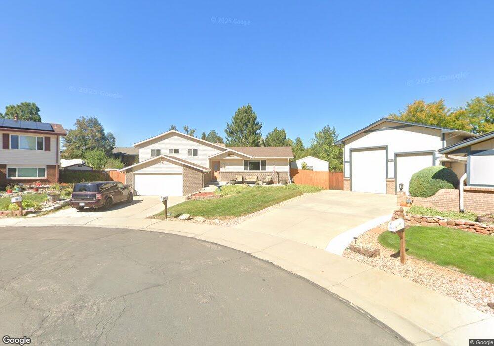
13153 Saint Paul Cir Thornton, CO 80241
Estimated Value: $527,000 - $590,000
4
Beds
3
Baths
2,248
Sq Ft
$245/Sq Ft
Est. Value
About This Home
This home is located at 13153 Saint Paul Cir, Thornton, CO 80241 and is currently estimated at $549,898, approximately $244 per square foot. 13153 Saint Paul Cir is a home located in Adams County with nearby schools including Tarver Elementary School, Century Middle School, and Horizon High School.
Ownership History
Date
Name
Owned For
Owner Type
Purchase Details
Closed on
Apr 28, 2015
Sold by
Yolo Llc
Bought by
Byrne Sean M and Byrne Tiffany M
Current Estimated Value
Home Financials for this Owner
Home Financials are based on the most recent Mortgage that was taken out on this home.
Original Mortgage
$331,987
Outstanding Balance
$256,307
Interest Rate
3.74%
Mortgage Type
VA
Estimated Equity
$293,592
Purchase Details
Closed on
Dec 4, 2014
Sold by
Cowell Bruce C and Cowell Robin
Bought by
Yolo Llc
Purchase Details
Closed on
Mar 17, 1995
Sold by
Hatch Kenneth M and Hatch Tamara L
Bought by
Cowell Bruce A and Cowell Robin
Home Financials for this Owner
Home Financials are based on the most recent Mortgage that was taken out on this home.
Original Mortgage
$123,400
Interest Rate
8.87%
Purchase Details
Closed on
Mar 17, 1992
Create a Home Valuation Report for This Property
The Home Valuation Report is an in-depth analysis detailing your home's value as well as a comparison with similar homes in the area
Home Values in the Area
Average Home Value in this Area
Purchase History
| Date | Buyer | Sale Price | Title Company |
|---|---|---|---|
| Byrne Sean M | $325,000 | First American Title Ins Co | |
| Yolo Llc | -- | None Available | |
| Cowell Bruce A | $129,900 | -- | |
| -- | $95,000 | -- |
Source: Public Records
Mortgage History
| Date | Status | Borrower | Loan Amount |
|---|---|---|---|
| Open | Byrne Sean M | $331,987 | |
| Previous Owner | Cowell Bruce A | $123,400 |
Source: Public Records
Tax History Compared to Growth
Tax History
| Year | Tax Paid | Tax Assessment Tax Assessment Total Assessment is a certain percentage of the fair market value that is determined by local assessors to be the total taxable value of land and additions on the property. | Land | Improvement |
|---|---|---|---|---|
| 2024 | $3,676 | $33,560 | $6,560 | $27,000 |
| 2023 | $3,639 | $39,240 | $6,770 | $32,470 |
| 2022 | $2,887 | $26,210 | $6,460 | $19,750 |
| 2021 | $2,984 | $26,210 | $6,460 | $19,750 |
| 2020 | $2,912 | $26,100 | $6,650 | $19,450 |
| 2019 | $2,918 | $26,100 | $6,650 | $19,450 |
| 2018 | $2,865 | $24,900 | $7,490 | $17,410 |
| 2017 | $2,605 | $24,900 | $7,490 | $17,410 |
| 2016 | $1,934 | $18,000 | $3,660 | $14,340 |
| 2015 | $1,932 | $18,000 | $3,660 | $14,340 |
| 2014 | -- | $16,070 | $3,420 | $12,650 |
Source: Public Records
Map
Nearby Homes
- 2691 E 132nd Ave
- 2788 E 132nd Cir
- 2746 E 132nd Place
- 3825 Dyanna Dr
- 13540 Detroit St
- 13080 Harrison Dr
- 13064 Harrison Dr
- 13068 Harrison Dr
- 13004 Harrison Dr
- 3850 E 128th Way
- 4061 E 133rd Cir
- 3802 E 127th Ln
- 12811 Josephine Ct
- 2275 E 129th Ave
- 12672 Madison Ct
- 12711 Colorado Blvd Unit 914
- 12711 Colorado Blvd Unit 617F
- 13022 Bellaire St
- 2420 E 127th Ave
- 2552 E 126th Way
- 13157 Saint Paul Cir
- 13147 Saint Paul Cir
- 13178 Milwaukee Ct
- 13174 Milwaukee Ct
- 13143 Saint Paul Cir
- 13164 Milwaukee St
- 13159 Saint Paul Dr
- 13137 Saint Paul Dr
- 13154 Milwaukee St
- 13184 Milwaukee Ct
- 13168 Milwaukee St
- 13161 Saint Paul Dr
- 13152 Saint Paul Dr
- 13142 Saint Paul Dr
- 13144 Milwaukee St
- 13188 Milwaukee Ct
- 13133 Saint Paul Dr
- 13154 Saint Paul Dr
- 13163 Saint Paul Dr
- 13132 Saint Paul Dr